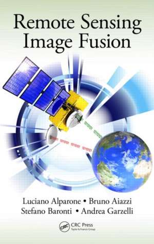
Remote Sensing Image Fusion: Signal and Image Processing of Earth Observations
Autor Luciano Alparone, Bruno Aiazzi, Stefano Baronti, Andrea Garzellien Limba Engleză Hardback – 6 mar 2015
The book brings a new perspective to a multidisciplinary research field that is becoming increasingly articulate and comprehensive. It fosters signal/image processing methodologies toward the goal of information extraction, either by humans or by machines, from remotely sensed images. The authors explain how relatively simple processing methods tailored to the specific features of the images may be winning in terms of reliable performance over more complex algorithms based on mathematical theories and models unconstrained from the physical behaviors of the instruments.
Ultimately, the book covers the births and developments of three generations of RS image fusion. Established textbooks are mainly concerned with the earliest generation of methods. This book focuses on second generation methods you can use now and new trends that may become third generation methods. Only the lessons learned with second generation methods will be capable of fostering the excellence among the myriad of methods that are proposed almost every day by the scientific literature.
| Toate formatele și edițiile | Preț | Express |
|---|---|---|
| Paperback (1) | 338.33 lei 43-57 zile | |
| CRC Press – 12 dec 2019 | 338.33 lei 43-57 zile | |
| Hardback (1) | 770.33 lei 43-57 zile | |
| CRC Press – 6 mar 2015 | 770.33 lei 43-57 zile |
Preț: 770.33 lei
Preț vechi: 1106.36 lei
-30% Nou
Puncte Express: 1155
Preț estimativ în valută:
147.40€ • 154.29$ • 122.69£
147.40€ • 154.29$ • 122.69£
Carte tipărită la comandă
Livrare economică 31 martie-14 aprilie
Preluare comenzi: 021 569.72.76
Specificații
ISBN-13: 9781466587496
ISBN-10: 1466587490
Pagini: 342
Ilustrații: 54 black & white illustrations, 48 colour illustrations, 28 black & white tables
Dimensiuni: 156 x 234 x 23 mm
Greutate: 0.79 kg
Ediția:1
Editura: CRC Press
Colecția CRC Press
Seria Signal and Image Processing of Earth Observations
Locul publicării:Boca Raton, United States
Public țintă
Academic and Professional Practice & DevelopmentCuprins
Introduction. Sensors and Image Data Products. Quality Assessment. Image Resembling and Registration. Pan-Sharpening of Multi-Spectral Image Data. Pan-Sharpening of hyper-Spectral Image Data. Aliasing and Misregistration Effects in Pan-Sharpening. Integration of Images from Heterogeneous Sensors. New Trends.
Notă biografică
Luciano Alparone received the Laurea degree (with honors) in electronic engineering from the University of Florence, Florence, Italy, in 1985 and the Ph.D. degree from the Italian Ministry of Education in 1990. During the spring of 2000 and summer of 2001, he was a Visiting Researcher at the Tampere International Centre for Signal Processing, Tampere, Finland. Since 2002, he has been an Associate Professor with the Images and Communications Laboratory, Department of Electronics and Telecommunications, University of Florence, where he currently holds the courses of Telecommunication Systems and Remote Sensing for Environmental Monitoring. He participated in several research projects funded by the Italian Ministry of University (MIUR), the Italian Space Agency (ASI), the French Space Agency (CNES), and the European Space Agency (ESA). Recently, he has been the Principal Investigator of a project funded by ASI on the processing of Cosmo-SkyMed SAR data. His research interests are data compression for remote sensing applications, multiresolution image analysis and processing, multisensor data fusion, analysis, and processing of SAR images. He has authored or coauthored over 60 papers in peer-reviewed journals and a total of 300 publications. Dr. Alparone was a corecipient of the 2004 Geoscience and Remote Sensing Letters Prize Paper Award for the study on "A global quality measurement of pansharpened multispectral imagery."
Bruno Aiazzi received the Laurea degree in electronic engineering from the University of Florence, Florence, Italy, in 1991. Since 2001, he has been a Researcher with the Institute of Applied Physics "Nello Carrara" (IFAC-CNR), which is located in the CNR Area di Ricerca di Firenze, Florence. He is currently Senior Researcher in the IFAC-CNR Institute. He has been working in several international research projects funded by the main European space agencies (ASI, ESA, CNES) on remote sensing topics: image quality definition and measurement, with applications to advanced hyperspectral sensors, adaptive methods for lossless and near-lossless data compression in satellite scenarios, multispectral and hyperspectral pansharpening algorithms, automatic estimation of multitemporal changes, and theoretical definition of statistic-based features for classification purposes. He is the coauthor of more than 30 papers published in international peer-reviewed journals, and a total of almost 200 publications. He is the recipient of the IEEE Geoscience and Remote Sensing Society Certificate of Appreciation as the winner of the 2006 Data Fusion Contest, Fusion on Multispectral and Panchromatic Images. He is an IEEE member.
Stefano Baronti is Senior Researcher at the Institute of Applied Physics "Nello Carrara" (IFAC) of the National Research Council (CNR) of Italy. He was born in Florence, Italy, in 1954. He received the Laurea degree in Electronic Engineering from the University of Florence, in 1980 and joined CNR in 1985, as a Researcher of IFAC, where he is currently responsible for the research unit Systems, techniques, processing and analysis of multidimensional multiresolution remote sensing data. He has been involved in several projects funded by the Italian, French, and European Space Agencies. His research interests include computer vision applications, image compression, processing of optical and microwave remote sensing SAR images, and fusion and quality assessment of remote sensing data. He is the coauthor of more than 270 papers published in international peer-reviewed journals, proceedings of international conferences and book chapters. He is a member of the IEEE Geoscience and Remote Sensing Society (GRSS) and of the IEEE Signal Processing Society and participates in the GRSS Technical Committee on Data Fusion. He is the recipient of the IEEE GRSS 2004 Letter Prize Paper Award and the IEEE Geoscience and Remote Sensing Society Certificate of Appreciation as the winner of the 2006 Data Fusion Contest, Fusion on Multispectral and Panchromatic Images.
Andrea Garzelli is Associate Professor of Telecommunications at the Department of Information Engineering of the University of Siena where he currently teaches the undergraduate and postgraduate courses on "Digital Signal Processing". He obtained the "Laurea" degree (summa cum laude) in Electronic Engineering and the Ph.D. degree in Computer Science and Telecommunication Engineering from the University of Florence, Italy, in 1991 and 1995, respectively. From 1995 to 2001 he has been Assistant Professor at the Department of Information Engineering of the University of Siena. He has been Program Coordinator of both graduate and Master degrees in Telecommunication Engineering at the University of Siena from 2002 to 2009. His research interests are in signal and image analysis, processing, and communication: nonlinear filtering, analysis of SAR images, and image classification and fusion for optical and SAR remote sensing applications. He is author of more than 150 scientific publications, including peer-reviewed journals, book chapters and conference proceedings. Dr. Garzelli is a Member of the IEEE Geoscience and Remote Sensing Society - Data Fusion Committee. He is the 2004 recipient, with his co-authors, of the IEEE Geoscience and Remote Sensing Society Letters Prize Paper Award for the paper "A Global Quality Measurement of Pan-Sharpened Multispectral Imagery". On January 2006, he has been elected Senior Member of the IEEE. He has been the invited speaker at the "Image and Signal Processing for Remote Sensing" Conference at SPIE Remote Sensing 2011 giving a talk on "Image sharpening: solutions and implementation issues."
Recenzii
"… a very impressive piece of work. … should become the bedside book for anyone interested in image fusion for remote sensing, from the graduate student, the PhD candidate or the researcher to the engineer or the enduser addressing any application based on remote sensing data and in need for an improved resolution."
—Jocelyn Chanussot, Grenoble Institute of Technology
"… the first comprehensive book to be published on this important topic. The authors are leaders in the field and have been on top of this important subject for the last two decades. The book is highly recommended."
—Prof. Jón Atli Benediktsson, Faculty of Electrical and Computer Engineering, University of Iceland, IEEE Fellow, SPIE Fellow, 2011-2012 President IEEE Geoscience and Remote Sensing Society, 2003-2008 Editor-in-Chief, IEEE Trans. on Geoscience and Remote Sensing
Descriere
A synthesis of more than ten years of experience, this book covers methods specifically designed for remote sensing imagery. The authors supply a comprehensive classification system and rigorous mathematical description of advanced and state-of-the-art methods for pansharpening of multispectral images, fusion of hyperspectral and panchromatic images, and fusion of data from heterogeneous sensors such as optical and synthetic aperture radar (SAR) images and integration of thermal and visible/near-infrared images. They also explore new trends of signal/image processing, such as compressive sensing and sparse signal representations.
