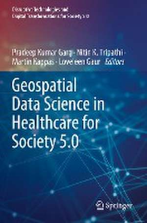
Geospatial Data Science in Healthcare for Society 5.0: Disruptive Technologies and Digital Transformations for Society 5.0
Editat de Pradeep Kumar Garg, Nitin K. Tripathi, Martin Kappas, Loveleen Gauren Limba Engleză Paperback – 12 mar 2023
| Toate formatele și edițiile | Preț | Express |
|---|---|---|
| Paperback (1) | 736.25 lei 38-45 zile | |
| Springer Nature Singapore – 12 mar 2023 | 736.25 lei 38-45 zile | |
| Hardback (1) | 802.26 lei 17-24 zile | +68.85 lei 7-13 zile |
| Springer Nature Singapore – 11 mar 2022 | 802.26 lei 17-24 zile | +68.85 lei 7-13 zile |
Preț: 736.25 lei
Preț vechi: 968.75 lei
-24% Nou
Puncte Express: 1104
Preț estimativ în valută:
140.88€ • 147.09$ • 116.60£
140.88€ • 147.09$ • 116.60£
Carte tipărită la comandă
Livrare economică 31 martie-07 aprilie
Preluare comenzi: 021 569.72.76
Specificații
ISBN-13: 9789811694783
ISBN-10: 9811694788
Pagini: 318
Ilustrații: VIII, 318 p. 116 illus., 73 illus. in color.
Dimensiuni: 155 x 235 mm
Ediția:1st ed. 2022
Editura: Springer Nature Singapore
Colecția Springer
Seria Disruptive Technologies and Digital Transformations for Society 5.0
Locul publicării:Singapore, Singapore
ISBN-10: 9811694788
Pagini: 318
Ilustrații: VIII, 318 p. 116 illus., 73 illus. in color.
Dimensiuni: 155 x 235 mm
Ediția:1st ed. 2022
Editura: Springer Nature Singapore
Colecția Springer
Seria Disruptive Technologies and Digital Transformations for Society 5.0
Locul publicării:Singapore, Singapore
Cuprins
Potential of Geospatial Data in Healthcare for Society 5.0.- Geospatial Health Data Analytics for Society 5.0.- Relevance of spatio-temporal data visualisation techniques in healthcare system.- GIS and Remote Sensing for public health.- Infectious diseases and their tracking in GIS
Notă biografică
Pradeep Kumar Garg is currently a professor in the Department of Civil Engineering, Indian Institute of Technology Roorkee. Dr. Garg received his B.E. and M.E. degrees in civil engineering from the University of Roorkee, in 1980 and 1982, respectively. He obtained his Ph.D. in remote sensing from the University of Bristol, UK. His areas of interest include satellite image analysis, land-use mapping, land surveying, digital image processing, GPS survey, and GIS. Dr. Garg has over 110 journals and over 150 conference publications to his credit. He has supervised 27 Ph.D. thesis and over 80 master theses, as well as written many textbooks on Geospatial Data and Technology.
Nitin K. Tripathi is a Professor of Remote Sensing (RS) and Geographical Information Systems (GIS) at the Asian Institute of Technology, Thailand. Dr. Tripathi has over 32 years of teaching and research experience. Dr. Tripathi obtained his B.Tech. degree in 1984 from NIT Warangal, India, and M.Tech. and a Ph.D. degree in Remote Sensing from IIT Kanpur. Dr. Tripathi has 214 publications including 02 books and 12 book chapters to his credit. He is an acclaimed researcher in the remote sensing and GIS applications field. He has supervised 47 doctoral and 156 master’s thesis where the majority of the research topics are focused on the applications of GIS and RS in climate change impacts on water resources, agriculture and health, location-based information services and also employing AI and Machine Learning for predictive modeling.
Martin Kappas is a university professor of Geography and the head of the Cartography, GIS, and Remote Sensing Section of the Georg-August University of Göttingen. His remote sensing laboratoryis a full member of the European Association of Remote Sensing Laboratories (EARSeL) and takes part as an active member of Competence Network for Research to Combat Desertification (DesertNET). He is a member of the Göttingen International Health Network (GIHN). His research interest is landscape evaluation using geoinformatics techniques and field spectrometry. His research theme is the application of remote sensing and GIS to study land-cover/land-use change and dynamics. He has published over 150 peer-reviewed publications and several scientific books and textbooks such as Global Health. A Challenge for Interdisciplinary Research by Kappas, M., Gross, U., Kelleher, D. (eds., 2012).
Loveleen Gaur is the Professor and Program Director (Artificial Intelligence and Business Intelligence and Data Analytics), Amity University, India. She is a senior IEEE member and Series Editor with CRCand Wiley. Prof. Gaur has significantly contributed to enhancing scientific understanding by participating in over three hundred scientific conferences, symposia, and seminars by chairing technical sessions and delivering plenary and invited talks. She has a specialization in artificial intelligence, machine learning, data analytics, and business intelligence. She has chaired various positions in International Conferences of repute and is a reviewer with top-rated journals of IEEE, SCI, and ABDC Journals. She has been honored with prestigious National and International awards. She is also actively involved in various reputed projects of the Government of India and abroad.
Textul de pe ultima copertă
The book introduces a variety of latest techniques designed to represent, enhance, and empower multi-disciplinary approaches of geographic information system (GIS), artificial intelligence (AI), deep learning (DL), machine learning, and cloud computing research in healthcare. It provides a unique compendium of the current and emerging use of geospatial data for healthcare and reflects the diversity, complexity, and depth and breadth of this multi-disciplinary area. This book addresses various aspects of how smart healthcare devices can be used to detect and analyze diseases. Further, it describes various tools and techniques to evaluate the efficacy, suitability, and efficiency of geospatial data for health-related applications. It features illustrative case studies, including future applications and healthcare challenges. This book is beneficial for computer science and engineering students and researchers, medical professionals, and anyone interested in using geospatial data in healthcare. It is also intended for experts, offering them a valuable retrospective and a global vision for the future, as well as for non-experts who are curious to learn about this important subject. The book presents an effort to draw how we can build health-related applications using geospatial big data and their subsequent analysis.
Caracteristici
Provides an overview of basic concepts of geospatial data and its integration with other technologies Contains the most recent research analysis in the domain of computer vision and software engineering Presents health-related applications using geospatial big data and their subsequent analysis
