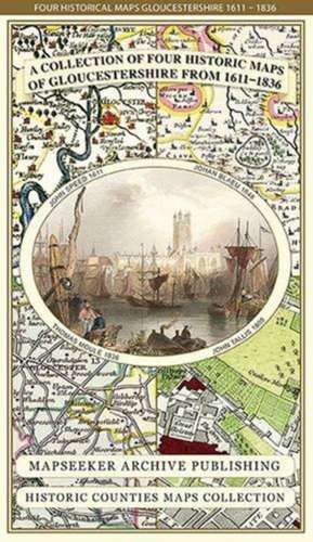
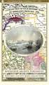
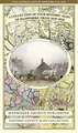
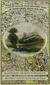
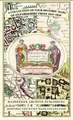
Gloucestershire 1611 - 1836 - Fold Up Map that features a collection of Four Historic Maps, John Speed's County Map 1611, Johan Blaeu's County Map of 1648, Thomas Moules County Map of 1836 and a Plan of Gloucester 1805 by Cole and Roper. The maps also feature three historic views of Gloucester from the 1840's.: Historic Counties Maps Collection
Autor Mapseeker Publishing Ltd.en Limba Engleză Sheet map – 28 aug 2014
Preț: 132.30 lei
Nou
Puncte Express: 198
Preț estimativ în valută:
25.32€ • 26.40$ • 21.04£
25.32€ • 26.40$ • 21.04£
Disponibil
Livrare economică 27 februarie-13 martie
Livrare express 13-19 februarie pentru 14.20 lei
Preluare comenzi: 021 569.72.76
Specificații
ISBN-13: 9781844918287
ISBN-10: 1844918289
Pagini: 1
Dimensiuni: 228 x 139 x 32 mm
Greutate: 0.1 kg
Editura: Historical Images Ltd
Colecția Historic Counties Maps Collection
Seria Historic Counties Maps Collection
ISBN-10: 1844918289
Pagini: 1
Dimensiuni: 228 x 139 x 32 mm
Greutate: 0.1 kg
Editura: Historical Images Ltd
Colecția Historic Counties Maps Collection
Seria Historic Counties Maps Collection