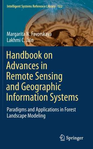
Handbook on Advances in Remote Sensing and Geographic Information Systems: Paradigms and Applications in Forest Landscape Modeling: Intelligent Systems Reference Library, cartea 122
Autor Margarita N. Favorskaya, Lakhmi C. Jainen Limba Engleză Hardback – 6 mar 2017
Given the scope of its coverage, the book offers a valuable resource for students, researchers, practitioners, and educators interested in remote sensing and geographic information systems and applications.
| Toate formatele și edițiile | Preț | Express |
|---|---|---|
| Paperback (1) | 1164.70 lei 6-8 săpt. | |
| Springer International Publishing – 18 iul 2018 | 1164.70 lei 6-8 săpt. | |
| Hardback (1) | 1171.14 lei 6-8 săpt. | |
| Springer International Publishing – 6 mar 2017 | 1171.14 lei 6-8 săpt. |
Din seria Intelligent Systems Reference Library
- 20%
 Preț: 1050.59 lei
 - 20%
 Preț: 1157.60 lei
 - 20%
 Preț: 648.44 lei
 - 20%
 Preț: 650.08 lei
 - 20%
 Preț: 1005.64 lei
 - 5%
 Preț: 968.90 lei
 - 20%
 Preț: 1052.67 lei
 - 20%
 Preț: 1171.46 lei
 - 20%
 Preț: 1164.84 lei
 - 20%
 Preț: 815.84 lei
 - 20%
 Preț: 989.96 lei
 - 20%
 Preț: 1063.41 lei
 - 20%
 Preț: 925.45 lei
 - 20%
 Preț: 504.38 lei
 - 18%
 Preț: 1113.26 lei
 - 20%
 Preț: 1920.04 lei
 - 20%
 Preț: 990.62 lei
 - 20%
 Preț: 651.57 lei
 - 20%
 Preț: 645.97 lei
 - 20%
 Preț: 660.16 lei
 - 20%
 Preț: 647.13 lei
 - 20%
 Preț: 654.05 lei
 - 20%
 Preț: 649.93 lei
 - 20%
 Preț: 648.11 lei
 - 20%
 Preț: 657.99 lei
 - 20%
 Preț: 656.84 lei
 - 20%
 Preț: 1624.04 lei
 - 20%
 Preț: 642.98 lei
 - 20%
 Preț: 649.60 lei
 - 20%
 Preț: 651.23 lei
 - 20%
 Preț: 653.06 lei
 - 20%
 Preț: 1002.99 lei
 - 20%
 Preț: 645.14 lei
 - 20%
 Preț: 658.33 lei
 - 20%
 Preț: 644.98 lei
 - 20%
 Preț: 646.62 lei
Preț: 1171.14 lei
Preț vechi: 1463.92 lei
-20% Nou
Puncte Express: 1757
Preț estimativ în valută:
224.11€ • 239.64$ • 186.85£
224.11€ • 239.64$ • 186.85£
Carte tipărită la comandă
Livrare economică 17 aprilie-01 mai
Preluare comenzi: 021 569.72.76
Specificații
ISBN-13: 9783319523064
ISBN-10: 3319523066
Pagini: 415
Ilustrații: XIX, 415 p. 109 illus.
Dimensiuni: 155 x 235 x 24 mm
Greutate: 0.79 kg
Ediția:1st ed. 2017
Editura: Springer International Publishing
Colecția Springer
Seria Intelligent Systems Reference Library
Locul publicării:Cham, Switzerland
ISBN-10: 3319523066
Pagini: 415
Ilustrații: XIX, 415 p. 109 illus.
Dimensiuni: 155 x 235 x 24 mm
Greutate: 0.79 kg
Ediția:1st ed. 2017
Editura: Springer International Publishing
Colecția Springer
Seria Intelligent Systems Reference Library
Locul publicării:Cham, Switzerland
Cuprins
Innovations in Remote Sensing of Forests.- Overview of LiDAR Technologies and Equipment for Land Cover Scanning.- Software Tools for Terrain and Forest Modelling.- Data Fusion for Evaluation of Woodland Parameters.- Tree Modelling in Virtual Reality Environment.- Realistic Tree Modelling.- Digital Modelling of Terrain Surface.- Texturing of Landscape Scenes.- Large Scene Rendering.- Scene Rendering under Meteorological Impacts.- Lighting and Shadows Rendering in Natural Scenes.- Modelling of Forest Ecosystems.
Textul de pe ultima copertă
This book presents the latest advances in remote-sensing and geographic information systems and applications. It is divided into four parts, focusing on Airborne Light Detection and Ranging (LiDAR) and Optical Measurements of Forests; Individual Tree Modelling; Landscape Scene Modelling; and Forest Eco-system Modelling.
Given the scope of its coverage, the book offers a valuable resource for students, researchers, practitioners, and educators interested in remote sensing and geographic information systems and applications.
Given the scope of its coverage, the book offers a valuable resource for students, researchers, practitioners, and educators interested in remote sensing and geographic information systems and applications.
Caracteristici
Presents recent research in remote-sensing and geographic information systems Features detailed computer-aided methods of modelling, intelligent data fusion technologies, rendering technologies, and evaluation methodologies Presents innovative methods for use with terrain and vegetation Includes supplementary material: sn.pub/extras
