Historical Land Use/Land Cover Classification Using Remote Sensing: A Case Study of the Euphrates River Basin in Syria: SpringerBriefs in Geography
Autor Wafi Al-Faresen Limba Engleză Paperback – 24 iul 2013
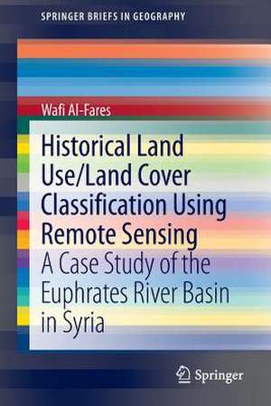
The kernel of this study was whether, how and to what extent applying the various remotely sensed data that were used here, would be an effective approach to classify the historical and current land use/land cover, to monitor the dynamics of land use/land cover during the last four decades, to map the development of the irrigation areas, and to classify the major strategic winter- and summer-irrigated agricultural crops in the study area of the Euphrates River Basin.
Din seria SpringerBriefs in Geography
-
 Preț: 377.18 lei
 -
 Preț: 380.25 lei
 -
 Preț: 380.63 lei
 -
 Preț: 411.32 lei
 -
 Preț: 379.09 lei
 -
 Preț: 381.98 lei
 -
 Preț: 381.98 lei
 -
 Preț: 376.22 lei
 -
 Preț: 314.59 lei
 -
 Preț: 340.12 lei
 - 15%
 Preț: 469.09 lei
 -
 Preț: 376.22 lei
 -
 Preț: 345.52 lei
 -
 Preț: 377.35 lei
 -
 Preț: 376.22 lei
 -
 Preț: 347.31 lei
 -
 Preț: 411.93 lei
 -
 Preț: 377.35 lei
 -
 Preț: 378.92 lei
 -
 Preț: 350.65 lei
 -
 Preț: 377.73 lei
 -
 Preț: 379.09 lei
 -
 Preț: 376.80 lei
 -
 Preț: 376.80 lei
 -
 Preț: 347.74 lei
 -
 Preț: 376.22 lei
 -
 Preț: 378.54 lei
 -
 Preț: 338.70 lei
 -
 Preț: 414.21 lei
 -
 Preț: 379.68 lei
 -
 Preț: 378.34 lei
 -
 Preț: 342.20 lei
 -
 Preț: 377.57 lei
 -
 Preț: 343.83 lei
 -
 Preț: 377.35 lei
 -
 Preț: 350.81 lei
 -
 Preț: 378.92 lei
 -
 Preț: 353.36 lei
 -
 Preț: 375.62 lei
 -
 Preț: 149.55 lei
 -
 Preț: 378.12 lei
 -
 Preț: 376.43 lei
 -
 Preț: 347.31 lei
 -
 Preț: 413.63 lei
 -
 Preț: 376.43 lei
 -
 Preț: 344.52 lei
 -
 Preț: 378.71 lei
 -
 Preț: 378.12 lei
 -
 Preț: 447.24 lei
Preț: 384.86 lei
Nou
Puncte Express: 577
Preț estimativ în valută:
73.64€ • 76.89$ • 60.95£
73.64€ • 76.89$ • 60.95£
Carte tipărită la comandă
Livrare economică 05-19 aprilie
Preluare comenzi: 021 569.72.76
Specificații
ISBN-13: 9783319006239
ISBN-10: 3319006231
Pagini: 224
Ilustrații: XVIII, 204 p. 96 illus., 86 illus. in color.
Dimensiuni: 155 x 235 x 20 mm
Greutate: 0.34 kg
Ediția:2013
Editura: Springer International Publishing
Colecția Springer
Seria SpringerBriefs in Geography
Locul publicării:Cham, Switzerland
ISBN-10: 3319006231
Pagini: 224
Ilustrații: XVIII, 204 p. 96 illus., 86 illus. in color.
Dimensiuni: 155 x 235 x 20 mm
Greutate: 0.34 kg
Ediția:2013
Editura: Springer International Publishing
Colecția Springer
Seria SpringerBriefs in Geography
Locul publicării:Cham, Switzerland
Public țintă
ResearchCuprins
Theoretical background and literature review / state of the art.- Overview of study area.- Data and tools.- Research methodology.- Results, analysis and discussions.- Summary, concluding remarks and recommendations.
Textul de pe ultima copertă
Although the development of remote sensing techniques focuses greatly on construction of new sensors with higher spatial and spectral resolution, it is advisable to also use data of older sensors (especially, the LANDSAT-mission) when the historical mapping of land use/land cover and monitoring of their dynamics are needed. Using data from LANDSAT missions as well as from Terra (ASTER) Sensors, the authors shows in his book maps of historical land cover changes with a focus on agricultural irrigation projects.
The kernel of this study was whether, how and to what extent applying the various remotely sensed data that were used here, would be an effective approach to classify the historical and current land use/land cover, to monitor the dynamics of land use/land cover during the last four decades, to map the development of the irrigation areas, and to classify the major strategic winter- and summer-irrigated agricultural crops in the study area of the Euphrates River Basin.
The kernel of this study was whether, how and to what extent applying the various remotely sensed data that were used here, would be an effective approach to classify the historical and current land use/land cover, to monitor the dynamics of land use/land cover during the last four decades, to map the development of the irrigation areas, and to classify the major strategic winter- and summer-irrigated agricultural crops in the study area of the Euphrates River Basin.
Caracteristici
Presents an experimental case study with a step-by-step methodology and clear and simple illustrations and tables Deals with a politically important area (Syria and Euphrates-River-Basin) Important scientific advance: work regarding covered period, geographical location and the used data is currently underrepresented in the literature Includes supplementary material: sn.pub/extras
