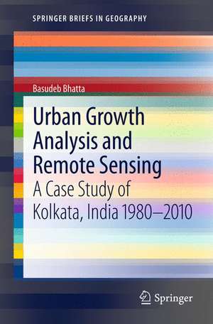
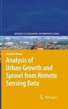
Urban Growth Analysis and Remote Sensing: A Case Study of Kolkata, India 1980–2010: SpringerBriefs in Geography
Autor Basudeb Bhattaen Limba Engleză Paperback – 22 iun 2012
Din seria SpringerBriefs in Geography
-
 Preț: 411.32 lei
 -
 Preț: 377.18 lei
 -
 Preț: 380.63 lei
 -
 Preț: 381.98 lei
 -
 Preț: 379.09 lei
 -
 Preț: 380.25 lei
 -
 Preț: 142.81 lei
 -
 Preț: 381.98 lei
 -
 Preț: 314.59 lei
 -
 Preț: 340.12 lei
 -
 Preț: 376.22 lei
 - 15%
 Preț: 469.09 lei
 -
 Preț: 376.22 lei
 -
 Preț: 345.52 lei
 -
 Preț: 377.35 lei
 -
 Preț: 376.22 lei
 -
 Preț: 347.31 lei
 -
 Preț: 411.93 lei
 -
 Preț: 377.35 lei
 -
 Preț: 378.92 lei
 -
 Preț: 350.65 lei
 -
 Preț: 377.73 lei
 -
 Preț: 379.09 lei
 -
 Preț: 376.80 lei
 -
 Preț: 376.80 lei
 -
 Preț: 347.74 lei
 -
 Preț: 376.22 lei
 -
 Preț: 378.54 lei
 -
 Preț: 338.70 lei
 -
 Preț: 379.68 lei
 -
 Preț: 378.34 lei
 -
 Preț: 384.86 lei
 -
 Preț: 342.20 lei
 -
 Preț: 377.57 lei
 -
 Preț: 343.83 lei
 -
 Preț: 377.35 lei
 -
 Preț: 350.81 lei
 -
 Preț: 378.92 lei
 -
 Preț: 353.36 lei
 -
 Preț: 375.62 lei
 -
 Preț: 149.55 lei
 -
 Preț: 378.12 lei
 -
 Preț: 376.43 lei
 -
 Preț: 347.31 lei
 -
 Preț: 413.63 lei
 -
 Preț: 376.43 lei
 -
 Preț: 344.52 lei
 -
 Preț: 378.71 lei
 -
 Preț: 447.24 lei
Preț: 378.12 lei
Nou
Puncte Express: 567
Preț estimativ în valută:
72.37€ • 74.58$ • 61.10£
72.37€ • 74.58$ • 61.10£
Carte tipărită la comandă
Livrare economică 04-18 martie
Preluare comenzi: 021 569.72.76
Specificații
ISBN-13: 9789400746978
ISBN-10: 9400746970
Pagini: 125
Ilustrații: XIII, 103 p. 23 illus., 13 illus. in color.
Dimensiuni: 155 x 235 x 20 mm
Greutate: 0.18 kg
Ediția:2012
Editura: SPRINGER NETHERLANDS
Colecția Springer
Seria SpringerBriefs in Geography
Locul publicării:Dordrecht, Netherlands
ISBN-10: 9400746970
Pagini: 125
Ilustrații: XIII, 103 p. 23 illus., 13 illus. in color.
Dimensiuni: 155 x 235 x 20 mm
Greutate: 0.18 kg
Ediția:2012
Editura: SPRINGER NETHERLANDS
Colecția Springer
Seria SpringerBriefs in Geography
Locul publicării:Dordrecht, Netherlands
Public țintă
ResearchCuprins
Introduction.-
-Background.-
-Significance.-
-Objectives.-
-Research Questions.-
-Methodological Overview.-
Review of Literature.-
-Urban Growth and Sprawl.-
-Physical Patterns and Forms of Urban Growth and Sprawl.-
-Temporal Process of Urban Growth and Sprawl.-
-Remote Sensing for the Analysis of Urban Growth and Sprawl.-
-Measurement and Analysis of Urban Growth and Sprawl.-
-Administrative versus Natural Boundary for the Analysis.-
-Determining the Natural Boundary of the City.-
-Subdivision of Natural City Extent.
-Similar Studies in India.-
-Similar Studies on Kolkata.-
-Scope of the Research.-
Methodology.-
-Data.-
-Software Used.-
-Image Registration.-
-Encoding Hardcopy Map.-
-Encoding Vector Maps.-
-Image Classification.-
-Assessment of Classification Accuracy.-
-Subsetting of Remote Sensing Data.-
-Determining the Natural Boundary of the City.-
-Subdivision of Natural City Extent.-
-Calculating the Built-up Area.-
-Generation of KMC Boundary.-
-Analysis Based on Administrative Boundary.-
-Analysis Based on Natural Boundary.-
-City of Kolkata.-
Result and Discussion.-
-Classified Imagery and Change Map.-
-Results from Analysis—Based on Administrative Boundary.-
-Results from Analysis—Based on Natural Boundary.-
-Comparison of Sprawl Analyses.-
-Degree of Freedom and Goodness.-
-Boundary of the city.-
-Application of the Results.-
-Limitations of the Research.-
Conclusions.-
-Conclusions.-
-Scope of Future Research.
Notă biografică
Basudeb Bhatta has a Ph.D. in Engineering, a M.Sc. in Remote Sensing and Geographic Information Systems, a B.Sc. in Geoinformatics and a Diploma in Mechanical Engineering. He is currently Course Coordinator in the Computer Aided Design Centre of Jadavpur University, Kolkata. He has more than 15 years of industrial, teaching and research experience in remote sensing, GNSS, and GIS. He has authored many research papers and articles in various journals and magazines. He has also authored several textbooks on Remote Sensing, GIS, GNSS, and CAD. He has been involved in a large number of courses on Remote Sensing and GIS to promote Geoinformatics technology. In the recent years he has been conducting dynamic research on applications of Geoinformatics in urban geographic studies.
Textul de pe ultima copertă
This book documents research conducted on the analysis of urban growth and sprawl by using remote sensing data and GIS techniques. The research was conducted between 1980-2010 in the city of Kolkata, India. The aim of the research was to use metrics that were less demanding in terms of data and computation than normal metrics. However, it has been found that most of them were inferior in capturing insights of urban sprawl. For this book, some of these metrics have therefore been modified and new ones are proposed. The research focuses on problems associated with the analysis of urban growth by using remote sensing data from a technological perspective.
Caracteristici
Takes a unique look at the urban growth and sprawl of Kolkata, India, by using temporal satellite imageswith 10 year intervals, starting with 1980 Helpful in providing local authorities to establish and evaluate development goals in terms of social and other infrastructure equipments considering the threats of urban sprawl in achieving sustainable development The book shows the potentials of remote sensing and Geographic Information Systems (GIS) for the analysis of urban growth and sprawl in spatio-temporal scales Includes supplementary material: sn.pub/extras Includes supplementary material: sn.pub/extras
