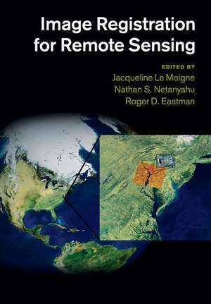
Image Registration for Remote Sensing
Editat de Jacqueline Le Moigne, Nathan S. Netanyahu, Roger D. Eastmanen Limba Engleză Paperback – 28 feb 2018
Image registration employs digital image processing in order to bring two or more digital images into precise alignment for analysis and comparison. Accurate registration algorithms are essential for creating mosaics of satellite images and tracking changes on the planet's surface over time. Bringing together invited contributions from thirty-six distinguished researchers, the book presents a detailed overview of current research and practice in the application of image registration to remote sensing imagery. Chapters cover the problem definition, theoretical issues in accuracy and efficiency, fundamental algorithms, and real-world case studies of image registration software applied to imagery from operational satellite systems. This book provides a comprehensive and practical overview for Earth and space scientists, presents image processing researchers with a summary of current research, and can be used for specialised graduate courses.
| Toate formatele și edițiile | Preț | Express |
|---|---|---|
| Paperback (1) | 448.35 lei 6-8 săpt. | |
| Cambridge University Press – 28 feb 2018 | 448.35 lei 6-8 săpt. | |
| Hardback (1) | 1147.89 lei 6-8 săpt. | |
| Cambridge University Press – 23 mar 2011 | 1147.89 lei 6-8 săpt. |
Preț: 448.35 lei
Preț vechi: 503.77 lei
-11% Nou
85.79€ • 90.05$ • 71.21£
Carte tipărită la comandă
Livrare economică 10-24 aprilie
Specificații
ISBN-10: 1108445756
Pagini: 514
Ilustrații: 139 b/w illus. 23 colour illus. 37 tables
Dimensiuni: 170 x 244 x 24 mm
Greutate: 0.81 kg
Editura: Cambridge University Press
Colecția Cambridge University Press
Locul publicării:Cambridge, United Kingdom
Cuprins
Foreword Jon A. Benediktsson; Part I. The Importance of Image Registration for Remote Sensing: 1. Introduction Jacqueline Le Moigne, Nathan S. Netanyahu and Roger D. Eastman; 2. Influence of image registration on validation efforts Bin Tan and Curtis E. Woodcock; 3. Survey of image registration methods Roger D. Eastman, Nathan S. Netanyahu and Jacqueline Le Moigne; Part II. Similarity Metrics for Image Registration: 4. Fast correlation and phase correlation Harold S. Stone; 5. Matched filtering techniques Qin-Sheng Chen; 6. Image registration using mutual information Arlene A. Cole-Rhodes and Pramod K. Varshney; Part III. Feature Matching and Strategies for Image Registration: 7. Registration of multiview images A. Ardeshir Goshtasby; 8. New approaches to robust, point-based image registration David M. Mount, Nathan S. Netanyahu and San Ratanasanya; 9. Condition theory for image registration and post-registration error estimation Charles S. Kenney, B. S. Manjunath, Marco Zuliani and Kaushal Solanki; 10. Feature-based image to image registration Venu M. Govindu and Rama Chellappa; 11. On the use of wavelets for image registration Jacqueline Le Moigne, Ilya Zavorin and Harold S. Stone; 12. Gradient descent approaches to image registration Arlene A. Cole-Rhodes and Roger D. Eastman; 13. Bounding the performance of image registration Min Xu and Parmod K. Varshney; Part IV. Applications and Operational Systems: 14. Multi-temporal and multi-sensor image registration Jacqueline Le Moigne, Arlene A. Cole-Rhodes, Roger D. Eastman, Nathan S. Netanyahu, Harold S. Stone, Ilya Zavorin and Jeffrey T. Morisette; 15. Georegistration of meteorological images James L. Carr; 16. Challenges, solutions, and applications of accurate multi-angle image registration: lessons learned from MISR Veljko M. Jovanovic, David J. Diner and Roger Davies; 17. Automated AVHRR image navigation William J. Emery, R. Ian Crocker and Daniel G. Baldwin; 18. Landsat image geocorrection and registration James C. Storey; 19. Automatic and precise orthorectification of SPOT images Simon Baillarin, Aurélie Bouillon and Marc Bernard; 20. Geometry of the VEGETATION sensor Sylvia Sylvander; 21. Accurate MODIS global geolocation through automated ground control image matching Robert E. Wolfe and Masahiro Nishihama; 22. SeaWIFS operational geolocation assessment system Frederick S. Patt; Part V. Conclusion: 23. Concluding remarks Jacqueline Le Moigne, Nathan S. Netanyahu and Roger D. Eastman; Glossary; Index.
Recenzii
'This is an important reference book for all remote-sensing professionals as well as for advanced level geophysical data processing personnel in academia and in industry.' Wooil M. Moon, The Leading Edge
Descriere
Demonstrates the application of image registration for creating mosaics of satellite images and tracking temporal changes at the Earth's surface.
