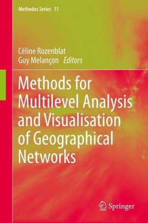
Methods for Multilevel Analysis and Visualisation of Geographical Networks: Methodos Series, cartea 11
Editat de Céline Rozenblat, Guy Melanconen Limba Engleză Hardback – 18 iun 2013
| Toate formatele și edițiile | Preț | Express |
|---|---|---|
| Paperback (1) | 637.46 lei 6-8 săpt. | |
| SPRINGER NETHERLANDS – 16 iul 2015 | 637.46 lei 6-8 săpt. | |
| Hardback (1) | 643.65 lei 6-8 săpt. | |
| SPRINGER NETHERLANDS – 18 iun 2013 | 643.65 lei 6-8 săpt. |
Din seria Methodos Series
-
 Preț: 281.46 lei
 - 18%
 Preț: 950.52 lei
 - 18%
 Preț: 946.72 lei
 - 18%
 Preț: 1118.13 lei
 -
 Preț: 426.56 lei
 - 20%
 Preț: 563.66 lei
 - 18%
 Preț: 1006.72 lei
 -
 Preț: 354.54 lei
 -
 Preț: 350.72 lei
 - 18%
 Preț: 780.37 lei
 - 15%
 Preț: 646.62 lei
 - 15%
 Preț: 646.94 lei
 - 15%
 Preț: 645.79 lei
 - 18%
 Preț: 894.03 lei
 - 15%
 Preț: 638.11 lei
 - 18%
 Preț: 1668.36 lei
 - 15%
 Preț: 638.24 lei
 - 24%
 Preț: 786.71 lei
 -
 Preț: 98.73 lei
Preț: 643.65 lei
Preț vechi: 757.24 lei
-15% Nou
Puncte Express: 965
Preț estimativ în valută:
123.17€ • 129.18$ • 102.53£
123.17€ • 129.18$ • 102.53£
Carte tipărită la comandă
Livrare economică 01-15 aprilie
Preluare comenzi: 021 569.72.76
Specificații
ISBN-13: 9789400766761
ISBN-10: 9400766769
Pagini: 200
Ilustrații: X, 223 p. 105 illus.
Dimensiuni: 155 x 235 x 20 mm
Greutate: 0.51 kg
Ediția:2013
Editura: SPRINGER NETHERLANDS
Colecția Springer
Seria Methodos Series
Locul publicării:Dordrecht, Netherlands
ISBN-10: 9400766769
Pagini: 200
Ilustrații: X, 223 p. 105 illus.
Dimensiuni: 155 x 235 x 20 mm
Greutate: 0.51 kg
Ediția:2013
Editura: SPRINGER NETHERLANDS
Colecția Springer
Seria Methodos Series
Locul publicării:Dordrecht, Netherlands
Public țintă
ResearchCuprins
Preface: Denise Pumain.- Introduction: Céline Rozenblat, Guy Mélançon.- I: Concepts and visualizations of multilevel spatial networks.- 1: Céline Rozenblat, Guy Mélançon: A small world perspective on Urban Systems.- 2: Jean-François Gleyze: Topological clustering for geographical networks.- 3: Alain L'Hostis : Theoretical models of Time-space: the role of transport networks in the shrinking and shrivelling of geographical space.- II: Tools for networks analysis: 4.- Guy Mélancon, Celine Rozenblat: Structural analysis of networks.- 5: Antoine Lambert, Romain Bourqui, David Auber: Graph Visualization for Geography.- 6: Pierre-Yves Koenig : Exploring hierarchies using the DAGMap.- III: Empirical studies of spatial multilevel networks: 7: César Ducruet: Port in a world maritime system: a multi-level analysis.- 8: Céline Rozenblat, Guy Mélançon, Romain Bourqui, David Auber : Comparing multi-level clustering methods on weighted graphs: the case of worldwide air passengers traffic 2000-2004.- 9: Charles Bohan, Bérengère Gautier: Multilevel analysis of Corporations Networks: a comparison between agro-food and automobile strategies for urban development.- 10: Marie-Noëlle Comin: The Capture and diffusion of knowledge Spillovers: the influence of the position of Cities in a network.- 11: Patrice Tissandier, Tien Phan-Quang, Daniel Archambault: Defining polycentric Urban Areas through commuting cohesion in France.- Conclusion: Céline Rozenblat, Guy Mélançon.
Textul de pe ultima copertă
This leading-edge study focuses on the latest techniques in analysing and representing the complex, multi-layered data now available to geographers studying urban zones and their populations. The volume tracks the successful results of the SPANGEO Project, which was set up in 2005 to standardize, and share, the syncretic, multinational mapping techniques already developed by geographers and computer scientists. SPANGEO sought new and responsive ways of visualising urban geographical and social data that reflected the fine-grained detail of the inputs. It allowed for visual representation of the large and complex networks and flows which are such an integral feature of the dynamism of urban geography. SPANGEO developed through the ‘visual analytics loop’ in which geographers collaborated with computer scientists by feeding data into the design of visualisations that in turn spawned the urge to incorporate more varied data into the visualisation. This volume covers all the relevant aspects, from conceptual principles to the tools of network analysis and the actual results flowing from their deployment. Detailed case studies set out in this volume include spatial multi-level analyses of flows in airports and sea ports, as well as the fascinating scientific networks in European cities. The volume shows how the primary concern of geography—the interaction of society with physical space—has been revivified by the complexities of new cartographical and statistical methodologies, which allow for highly detailed mapping and far more powerful computer analysis of spatial relationships.
Caracteristici
Covers brand new methods and concepts in geography and spatial planning Includes revealing visualizations of graphs Includes detailed methods suitable for non-mathematicians and the public?


