Optical and SAR Remote Sensing of Urban Areas: A Practical Guide: Springer Geography
Autor Courage Kamusokoen Limba Engleză Paperback – 4 dec 2022
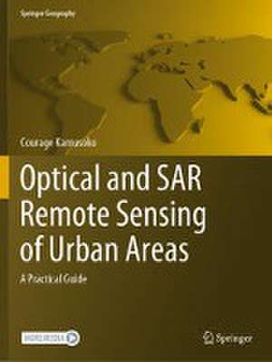
This book introduces remotely sensed image processing for urban areas using optical and synthetic aperture radar (SAR) data and assists students, researchers, and remote sensing practitioners who are interested in land cover mapping using such data. There are many introductory and advanced books on optical and SAR remote sensing image processing, but most of them do not serve as good practical guides. However, this book is designed as a practical guide and a hands-on workbook, where users can explore data and methods to improve their land cover mapping skills for urban areas. Although there are many freely available earth observation data, the focus is on land cover mapping using Sentinel-1 C-band SAR and Sentinel-2 data. All remotely sensed image processing and classification procedures are based on open-source software applications such QGIS and R as well as cloud-based platforms such as Google Earth Engine (GEE).
The book is organized into six chapters. Chapter 1 introduces geospatial machine learning, and Chapter 2 covers exploratory image analysis and transformation. Chapters 3 and 4 focus on mapping urban land cover using multi-seasonal Sentinel-2 imagery and multi-seasonal Sentinel-1 imagery, respectively. Chapter 5 discusses mapping urban land cover using multi-seasonal Sentinel-1 and Sentinel-2 imagery as well as other derived data such as spectral and texture indices. Chapter 6 concludes the book with land cover classification accuracy assessment.
The book is organized into six chapters. Chapter 1 introduces geospatial machine learning, and Chapter 2 covers exploratory image analysis and transformation. Chapters 3 and 4 focus on mapping urban land cover using multi-seasonal Sentinel-2 imagery and multi-seasonal Sentinel-1 imagery, respectively. Chapter 5 discusses mapping urban land cover using multi-seasonal Sentinel-1 and Sentinel-2 imagery as well as other derived data such as spectral and texture indices. Chapter 6 concludes the book with land cover classification accuracy assessment.
| Toate formatele și edițiile | Preț | Express |
|---|---|---|
| Paperback (1) | 451.48 lei 6-8 săpt. | |
| Springer Nature Singapore – 4 dec 2022 | 451.48 lei 6-8 săpt. | |
| Hardback (1) | 533.88 lei 3-5 săpt. | |
| Springer Nature Singapore – 3 dec 2021 | 533.88 lei 3-5 săpt. |
Din seria Springer Geography
- 18%
 Preț: 961.55 lei
 - 15%
 Preț: 665.01 lei
 - 18%
 Preț: 792.72 lei
 - 20%
 Preț: 564.76 lei
 - 15%
 Preț: 533.88 lei
 - 18%
 Preț: 1224.36 lei
 - 18%
 Preț: 949.73 lei
 - 18%
 Preț: 1115.46 lei
 - 18%
 Preț: 1115.46 lei
 - 18%
 Preț: 730.35 lei
 -
 Preț: 441.36 lei
 - 18%
 Preț: 1004.19 lei
 - 18%
 Preț: 949.55 lei
 - 15%
 Preț: 644.30 lei
 -
 Preț: 398.74 lei
 - 18%
 Preț: 955.25 lei
 - 18%
 Preț: 787.15 lei
 - 18%
 Preț: 1003.38 lei
 - 18%
 Preț: 897.14 lei
 - 18%
 Preț: 1117.03 lei
 - 18%
 Preț: 1120.18 lei
 - 18%
 Preț: 1128.08 lei
 - 18%
 Preț: 726.37 lei
 - 18%
 Preț: 964.54 lei
 - 15%
 Preț: 647.40 lei
 - 15%
 Preț: 646.62 lei
 - 15%
 Preț: 640.71 lei
 - 18%
 Preț: 2154.04 lei
 - 15%
 Preț: 648.05 lei
 - 24%
 Preț: 1118.07 lei
 -
 Preț: 391.61 lei
 - 18%
 Preț: 961.55 lei
 - 18%
 Preț: 948.16 lei
 - 18%
 Preț: 1563.24 lei
 - 15%
 Preț: 647.27 lei
 - 24%
 Preț: 857.90 lei
 - 24%
 Preț: 1139.69 lei
 - 5%
 Preț: 1116.73 lei
 - 20%
 Preț: 551.31 lei
 - 15%
 Preț: 637.13 lei
 - 15%
 Preț: 642.03 lei
 - 18%
 Preț: 940.39 lei
 -
 Preț: 395.09 lei
 -
 Preț: 365.45 lei
 - 18%
 Preț: 960.13 lei
 - 24%
 Preț: 642.99 lei
Preț: 451.48 lei
Nou
Puncte Express: 677
Preț estimativ în valută:
86.39€ • 90.38$ • 71.77£
86.39€ • 90.38$ • 71.77£
Carte tipărită la comandă
Livrare economică 02-16 aprilie
Preluare comenzi: 021 569.72.76
Specificații
ISBN-13: 9789811651519
ISBN-10: 9811651515
Pagini: 119
Ilustrații: XI, 119 p. 103 illus., 90 illus. in color.
Dimensiuni: 210 x 279 mm
Greutate: 0.35 kg
Ediția:1st ed. 2022
Editura: Springer Nature Singapore
Colecția Springer
Seria Springer Geography
Locul publicării:Singapore, Singapore
ISBN-10: 9811651515
Pagini: 119
Ilustrații: XI, 119 p. 103 illus., 90 illus. in color.
Dimensiuni: 210 x 279 mm
Greutate: 0.35 kg
Ediția:1st ed. 2022
Editura: Springer Nature Singapore
Colecția Springer
Seria Springer Geography
Locul publicării:Singapore, Singapore
Cuprins
- Geospatial Machine Learning in Urban Areas: Challenges and Prospects.- Exploratory Analysis and Transformation for Remotely-Sensed Imagery.- Mapping Urban Land Cover using Multi-seasonal Sentinel-2 Imagery, Spectral and Texture Indices.- Mapping Urban Land Cover using Multi-seasonal Sentinel-1 Imagery and Texture Indices.- Improving Urban Land Cover Mapping.- Land Cover Classification Accuracy Assessment.- Appendix.
Notă biografică
Courage Kamusoko is an independent geospatial consultant based in Japan. His expertise includes land use and cover change modeling, and the design and implementation of geospatial database management systems. His primary research involves analyses of remotely sensed images, land use and cover modeling, and machine learning. In addition to his focus on geospatial research and consultancy, he has dedicated his time to teaching practical machine learning for geospatial analysis and modeling. Recently, he published the book Remote Sensing Image Classification in R (Springer).
Textul de pe ultima copertă
This book introduces remotely sensed image processing for urban areas using optical and synthetic aperture radar (SAR) data and assists students, researchers, and remote sensing practitioners who are interested in land cover mapping using such data. There are many introductory and advanced books on optical and SAR remote sensing image processing, but most of them do not serve as good practical guides. However, this book is designed as a practical guide and a hands-on workbook, where users can explore data and methods to improve their land cover mapping skills for urban areas. Although there are many freely available earth observation data, the focus is on land cover mapping using Sentinel-1 C-band SAR and Sentinel-2 data. All remotely sensed image processing and classification procedures are based on open-source software applications such QGIS and R as well as cloud-based platforms such as Google Earth Engine (GEE).
The book is organized into six chapters. Chapter 1 introduces geospatial machine learning, and Chapter 2 covers exploratory image analysis and transformation. Chapters 3 and 4 focus on mapping urban land cover using multi-seasonal Sentinel-2 imagery and multi-seasonal Sentinel-1 imagery, respectively. Chapter 5 discusses mapping urban land cover using multi-seasonal Sentinel-1 and Sentinel-2 imagery as well as other derived data such as spectral and texture indices. Chapter 6 concludes the book with land cover classification accuracy assessment.
Caracteristici
Is designed to be a workbook for students, researchers, and practitioners Includes step-by-step reference tutorials for processing optical and SAR data Uses free and open source software such as QGIS and R
