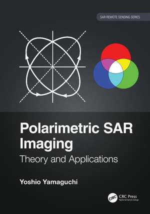
Polarimetric SAR Imaging: Theory and Applications: SAR Remote Sensing
Autor Yoshio Yamaguchien Limba Engleză Hardback – 19 aug 2020
Features:
- Provides cutting-edge polarimetric applications for earth observation with full color images.
- Includes detailed descriptions of theory, equations, expansions, and flowcharts, and numerous real examples.
- Explains concepts, data analysis, and applications in simple and clear language aimed at an intuitive comprehension.
- Provides specific and unique examples of PolSAR images derived from actual space and airborne systems (ALOS/ALOS2, PiSAR-x/L)
- Covers the wide range of the radar polarimetry, especially the decomposition of the polarimetry data, an original method developed by the author using the Japanese polarimetric SAR data
| Toate formatele și edițiile | Preț | Express |
|---|---|---|
| Paperback (1) | 359.75 lei 6-8 săpt. | |
| CRC Press – 31 mai 2023 | 359.75 lei 6-8 săpt. | |
| Hardback (1) | 826.86 lei 6-8 săpt. | |
| CRC Press – 19 aug 2020 | 826.86 lei 6-8 săpt. |
Preț: 826.86 lei
Preț vechi: 1106.88 lei
-25% Nou
Puncte Express: 1240
Preț estimativ în valută:
158.22€ • 169.19$ • 131.92£
158.22€ • 169.19$ • 131.92£
Carte tipărită la comandă
Livrare economică 17 aprilie-01 mai
Preluare comenzi: 021 569.72.76
Specificații
ISBN-13: 9780367478315
ISBN-10: 0367478315
Pagini: 350
Ilustrații: 36 Tables, color; 317 Illustrations, color
Dimensiuni: 178 x 254 x 25 mm
Greutate: 0.84 kg
Ediția:1
Editura: CRC Press
Colecția CRC Press
Seria SAR Remote Sensing
ISBN-10: 0367478315
Pagini: 350
Ilustrații: 36 Tables, color; 317 Illustrations, color
Dimensiuni: 178 x 254 x 25 mm
Greutate: 0.84 kg
Ediția:1
Editura: CRC Press
Colecția CRC Press
Seria SAR Remote Sensing
Public țintă
Academic, Postgraduate, Professional, and Professional Practice & DevelopmentCuprins
Introduction. Wave Polarimetry. Scattering Polarimetry. Polarization Matrices. H/A/ Polarimetric Decomposition. Compound Scattering Matrix. Scattering Mechanisms and Modeling. Scattering Power Decomposition. Correlation and Similarity. Polarimetric Synthetic Aperture Radar. Material Constant. Interpretation of PolSAR Images. Surface Scattering. Double Bounce Scattering. Volume Scattering.
Descriere
Radar polarimetry has been used for the precise monitoring of the Earth surface. This book explains the basic polarimetry concept and its diverse applications. Fully color-coded images make it easy to understand and recognize polarization by color. This original method will help students and radar experts understand and use radar polarimetry.


