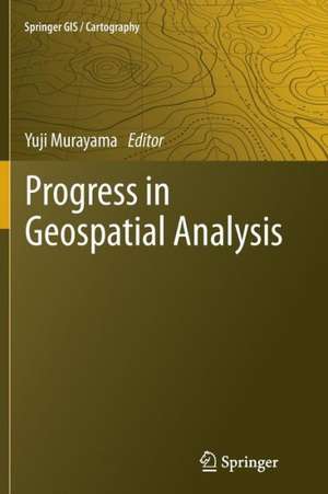
Progress in Geospatial Analysis
Editat de Yuji Murayamaen Limba Engleză Paperback – 9 aug 2014
| Toate formatele și edițiile | Preț | Express |
|---|---|---|
| Paperback (1) | 640.71 lei 6-8 săpt. | |
| Springer – 9 aug 2014 | 640.71 lei 6-8 săpt. | |
| Hardback (1) | 651.51 lei 6-8 săpt. | |
| Springer – 7 iul 2012 | 651.51 lei 6-8 săpt. |
Preț: 640.71 lei
Preț vechi: 753.77 lei
-15% Nou
Puncte Express: 961
Preț estimativ în valută:
122.60€ • 131.10$ • 102.22£
122.60€ • 131.10$ • 102.22£
Carte tipărită la comandă
Livrare economică 18 aprilie-02 mai
Preluare comenzi: 021 569.72.76
Specificații
ISBN-13: 9784431547440
ISBN-10: 4431547444
Pagini: 304
Ilustrații: XII, 292 p.
Dimensiuni: 155 x 235 x 16 mm
Greutate: 0.43 kg
Ediția:2012
Editura: Springer
Colecția Springer
Locul publicării:Tokyo, Japan
ISBN-10: 4431547444
Pagini: 304
Ilustrații: XII, 292 p.
Dimensiuni: 155 x 235 x 16 mm
Greutate: 0.43 kg
Ediția:2012
Editura: Springer
Colecția Springer
Locul publicării:Tokyo, Japan
Public țintă
ResearchCuprins
From the Contents: Part I Geospatial Data Acquisition and Processing.- Multispectral Classification of Remote Sensing Data for Geospatial Analysis.- Part II Geospatial Theories and Methods.- Fuzzy Set Theory in Geospatial Analysis.- Spatial Prominence and Spatial Weights Matrix in Geospatial Analysis.- Geographically Weighted Regression in Geospatial Analysis.- Weight of Evidence in Geospatial Analysis.- Markov-Cellular Automata in Geospatial Analysis.- Multilayer Perceptron Neural Networks in Geospatial Analysis.- Part III Applications in Geospatial Analysis.- Urban Growth Modeling Using Bayesian Probability Function.- Land Suitability Assessment Using a Fuzzy Multi-Criteria Evaluation.- Neighborhood Interaction in Urban Land-Use Changes Using Cellular Automata-Based.
Notă biografică
Yuji Murayama, Professor, Division of Spatial Information Science, Graduate School of Life and Environmental Sciences, University of Tsukuba, Japan. Email: mura@geoenv.tsukuba.ac.jp,
Web: http://giswin.geo.tsukuba.ac.jp/sis/en/faculty.html.
Books published: Murayama, Y. and Thapa, R. B. eds. (2011). Spatial Analysis and Modeling in Geographical Transformation Process: GIS-based Application. Dordrecht: Springer, 300p. Kamusoko, C., Mundia, C. N. and Murayama, Y. eds. (2011). Recent Advances in Remote Sensing and GIS in Sub-Sahara Africa. New York: Nova publishers. Murayama, Y. and Du, G. eds. (2005). Cities in Global Perspective: Diversity and Transition. Tokyo: College of Tourism, Rikkyo University with IGU Commission, 626p. Murayama, Y. (2000). Japanese Urban System. Dordrecht: Kluwer Publishers, 271p. Murayama, Y. (1991). Spatial Structure of Traffic Flows. Tokyo: Kokon-Shoin, 311p.
Textul de pe ultima copertă
This book examines current trends and developments in the methods and applications of geospatial analysis and highlights future development prospects. It provides a comprehensive discussion of remote sensing- and geographical information system (GIS)-based data processing techniques, current practices, theories, models, and applications of geospatial analysis. Data acquisition and processing techniques such as remote sensing image selections, classifications, accuracy assessments, models of GIS data, and spatial modeling processes are the focus of the first part of the book. In the second part, theories and methods related to fuzzy sets, spatial weights and prominence, geographically weighted regression, weight of evidence, Markov-cellular automata, artificial neural network, agent-based simulation, multi-criteria evaluation, analytic hierarchy process, and a GIS network model are included. Part three presents selected best practices in geospatial analysis. The chapters, all by expert authors, are arranged so that readers who are new to the field will gain an overview and important insights. Those readers who are already practitioners will gain from the advanced and updated materials and state-of-the-art developments in geospatial analysis.
Caracteristici
Provides a thorough overview on the world of geospatial analysis including remote sensing and GIS Contains three parts, including geospatial theories and their applications Not only for the practitioners in the field, but is dedicated for the beginners as well
