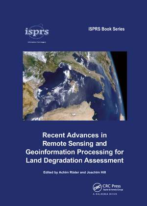
Recent Advances in Remote Sensing and Geoinformation Processing for Land Degradation Assessment
Editat de Achim Roeder, Joachim Hillen Limba Engleză Paperback – 18 oct 2019
| Toate formatele și edițiile | Preț | Express |
|---|---|---|
| Paperback (1) | 379.55 lei 6-8 săpt. | |
| CRC Press – 18 oct 2019 | 379.55 lei 6-8 săpt. | |
| Hardback (1) | 996.30 lei 6-8 săpt. | |
| CRC Press – 23 apr 2009 | 996.30 lei 6-8 săpt. |
Preț: 379.55 lei
Preț vechi: 505.09 lei
-25% Nou
Puncte Express: 569
Preț estimativ în valută:
72.62€ • 76.23$ • 60.28£
72.62€ • 76.23$ • 60.28£
Carte tipărită la comandă
Livrare economică 10-24 aprilie
Preluare comenzi: 021 569.72.76
Specificații
ISBN-13: 9780367385750
ISBN-10: 0367385759
Pagini: 418
Dimensiuni: 174 x 246 mm
Greutate: 0.95 kg
Ediția:1
Editura: CRC Press
Colecția CRC Press
ISBN-10: 0367385759
Pagini: 418
Dimensiuni: 174 x 246 mm
Greutate: 0.95 kg
Ediția:1
Editura: CRC Press
Colecția CRC Press
Public țintă
Academic and Professional Practice & DevelopmentCuprins
Remote sensing and geoinformation processing in land degradation assessment-an introduction Part 1 Setting the scene: principles in remote sensing and spatial scene modelling for land degradation, Coupled human-environment system approaches to desertification: Linking people to pixels. Remote sensing based assessment of biophysical indicators for land degradation and desertification. Integrated environmental modelling to characterise processes of land degradation and desertification for policy support. Estimating area-averaged surface fluxes over contrasted agricultural patchwork in a semi-arid region Part 2 The global perspective: strategies for large area mapping. Potential of long time series of FAPAR products for assessing and monitoring land surface changes: Examples in Europe and the Sahel. Inter-comparison of MEDOKADS and NOAA/NASA pathfinder AVHRR land NDVI time series. Change detection in Syria's rangelands using long-term AVHRR data (1982-2004). 'Hot spot' assessment of land cover change in the CWANA region using AVHRR satellite imagery. Fuzzy integration of satellite data for detecting environmental anomalies across Africa. The spatial uncertainty of desiccation in the West African Sahel and its implications for land degradation. Ongoing desertification processes in the sahelian belt of West Africa: An evidence from the rain-use efficiency Part 3 Taking a closer look: biophysical indicators of vegetation and soils. Vegetation cover and biomass along climatic gradients: The synergy of remote sensing and field studies in two Eastern Mediterranean sites. Modelling species distributions with high resolution remote sensing data to delineate patterns of plant diversity in the Sahel zone of Burkina Faso. Retrieving rangeland vegetation characteristics through constrained inverse reflectance modelling of earth observation satellite imagery. Using reflectance spectroscopy and Landsat data to assess soil inorganic carbon in the Judean Desert (Israel). Simulating Mu
Notă biografică
Achim Röder is a senior scientist and lecturer with the Remote Sensing Department, University of Trier, and has been involved in research on desertification and land degradation for more than 10 years. His present research focuses on the characterization of landscape trends using time series analysis, and the derivation of biophysical indicators under consideration of scaling effects and transitions. Joachim Hill has been head of the Remote Sensing Department, University of Trier, since 1994. His research focuses on the application of hyper- and multispectral remote sensing techniques to derive biophysical vegetation parameters and their assimilation in ecosystem models, and on mapping and monitoring land degradation phenomena in dryland ecosystems.
Descriere
With a specific focus on desertification and land degradation, this volume covers the assessment of related biophysical indicators, as well as complementary qualitive information at different spatial and temporal scales.
