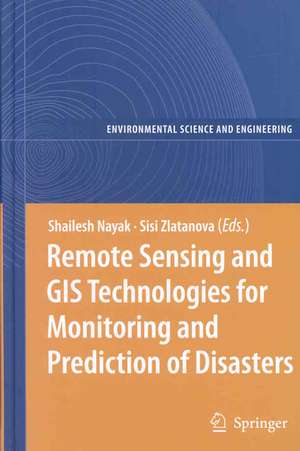
Remote Sensing and GIS Technologies for Monitoring and Prediction of Disasters: Environmental Science and Engineering
Editat de Shailesh Nayak, Sisi Zlatanovaen Limba Engleză Hardback – 25 iul 2008
This book focuses on a wider utilisation of remote sensing in disaster management. The discussed aspects comprise data access/delivery to the users, information extraction and analysis, management of data and its integration with other data sources (airborne and terrestrial imagery, GIS data, etc.), data standardization, organisational and legal aspects of sharing remote sensing information.
| Toate formatele și edițiile | Preț | Express |
|---|---|---|
| Paperback (1) | 943.88 lei 43-57 zile | |
| Springer Berlin, Heidelberg – 22 noi 2010 | 943.88 lei 43-57 zile | |
| Hardback (1) | 951.29 lei 43-57 zile | |
| Springer Berlin, Heidelberg – 25 iul 2008 | 951.29 lei 43-57 zile |
Din seria Environmental Science and Engineering
- 18%
 Preț: 1238.42 lei
 - 18%
 Preț: 2166.68 lei
 - 18%
 Preț: 1420.88 lei
 - 18%
 Preț: 914.20 lei
 - 18%
 Preț: 1225.94 lei
 - 18%
 Preț: 1118.13 lei
 - 18%
 Preț: 1402.74 lei
 - 18%
 Preț: 3419.93 lei
 - 18%
 Preț: 1223.55 lei
 - 18%
 Preț: 1008.91 lei
 - 18%
 Preț: 1234.46 lei
 - 18%
 Preț: 1409.82 lei
 - 18%
 Preț: 736.64 lei
 - 18%
 Preț: 949.73 lei
 - 18%
 Preț: 1287.47 lei
 - 18%
 Preț: 2116.64 lei
 - 18%
 Preț: 1231.95 lei
 - 15%
 Preț: 641.71 lei
 - 23%
 Preț: 1129.31 lei
 - 18%
 Preț: 1237.93 lei
 - 18%
 Preț: 956.18 lei
 - 24%
 Preț: 1057.93 lei
 - 24%
 Preț: 1079.06 lei
 - 18%
 Preț: 953.03 lei
 - 18%
 Preț: 1233.06 lei
 - 15%
 Preț: 666.73 lei
 - 18%
 Preț: 1222.31 lei
 - 18%
 Preț: 1242.35 lei
 - 18%
 Preț: 1232.89 lei
 - 18%
 Preț: 1823.56 lei
 - 18%
 Preț: 1228.96 lei
 - 18%
 Preț: 1221.69 lei
 - 18%
 Preț: 945.79 lei
 - 18%
 Preț: 1008.28 lei
 - 24%
 Preț: 795.49 lei
 - 18%
 Preț: 1246.47 lei
 - 18%
 Preț: 1239.85 lei
 - 18%
 Preț: 957.62 lei
 - 18%
 Preț: 1244.89 lei
 - 15%
 Preț: 640.55 lei
 - 18%
 Preț: 950.33 lei
 - 18%
 Preț: 1824.01 lei
 - 15%
 Preț: 639.59 lei
 - 18%
 Preț: 947.50 lei
 - 18%
 Preț: 1229.73 lei
Preț: 951.29 lei
Preț vechi: 1160.10 lei
-18% Nou
Puncte Express: 1427
Preț estimativ în valută:
182.03€ • 190.53$ • 151.51£
182.03€ • 190.53$ • 151.51£
Carte tipărită la comandă
Livrare economică 31 martie-14 aprilie
Preluare comenzi: 021 569.72.76
Specificații
ISBN-13: 9783540792581
ISBN-10: 3540792589
Pagini: 284
Ilustrații: X, 272 p. 96 illus.
Dimensiuni: 155 x 235 x 20 mm
Greutate: 0.61 kg
Ediția:2008
Editura: Springer Berlin, Heidelberg
Colecția Springer
Seriile Environmental Science and Engineering, Environmental Science
Locul publicării:Berlin, Heidelberg, Germany
ISBN-10: 3540792589
Pagini: 284
Ilustrații: X, 272 p. 96 illus.
Dimensiuni: 155 x 235 x 20 mm
Greutate: 0.61 kg
Ediția:2008
Editura: Springer Berlin, Heidelberg
Colecția Springer
Seriile Environmental Science and Engineering, Environmental Science
Locul publicării:Berlin, Heidelberg, Germany
Public țintă
ResearchCuprins
Use of Geo-Information technology in large disasters.- Geoinformation-Based Response to the 27 May Indonesia Earthquake – an Initial Assessment.- The Application of Geo-Technologies after Hurricane Katrina.- Application of Remote Sensing for Damage Assessment of Coastal Ecosystems in India due to the December 2004 Tsunami.- Increasing the Use of Geospatial Technologies for Emergency Response and Disaster Rehabilitation in Developing Countries.- Remote Sensing Technology for Disaster Monitoring.- Adopting Multisensor Remote Sensing Datasets and Coupled Models for Disaster Management.- Nearshore Coastal Processes Between Karwar and Bhatal, Central West Coast of India: Implications for Pollution Dispersion.- Landslide Hazard Zonation in Darjeeling Himalayas: a Case Study on Integration of IRS and SRTM Data.- Monitoring and Interpretation of Urban Land Subsidence Using Radar Interferometric Time Series and Multi-Source GIS Database.- Extending the Functionality of the Consumer-Grade GPS for More Efficient GIS and Mapping Applications.- System Architectures for Access of Geo-Information.- Interoperable Access Control for Geo Web Services in Disaster Management.- Spatial Data Infrastructure for Emergency Response in Netherlands.- Geocollaboration in Hazard, Risk and Response: Practical Experience with Real-Time Geocollaboration at Québec Civil Security.- On-line Street Network Analysis for Flood Evacuation Planning.- Multi-user tangible interfaces for effective decision-making in disaster management.
Recenzii
From the reviews:
“The book has brought together a wide variety of remote sensing and GIS applications and their integrations with other techniques for disaster management and emergency response handling. Inclusion of practical examples drawn from case studies makes it easier for the reader to understand the theoretical concepts. … a basic guide for the beginners who are interested in gaining technical expertise in the field of remote sensing and GIS applications for disaster management and emergency response handling.” (Ranjani Wasantha Kulawardhana, International Journal of Digital Earth, Vol. 4 (6), November, 2011)
“The book has brought together a wide variety of remote sensing and GIS applications and their integrations with other techniques for disaster management and emergency response handling. Inclusion of practical examples drawn from case studies makes it easier for the reader to understand the theoretical concepts. … a basic guide for the beginners who are interested in gaining technical expertise in the field of remote sensing and GIS applications for disaster management and emergency response handling.” (Ranjani Wasantha Kulawardhana, International Journal of Digital Earth, Vol. 4 (6), November, 2011)
Caracteristici
The book deals with a wider utilisation of remote sensing in disaster management Includes supplementary material: sn.pub/extras
