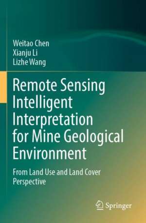
Remote Sensing Intelligent Interpretation for Mine Geological Environment: From Land Use and Land Cover Perspective
Autor Weitao Chen, Xianju Li, Lizhe Wangen Limba Engleză Paperback – 20 aug 2023
This book examines the theory and methods of remote sensing intelligent interpretation based on deep learning. Based on geological and environmental effects on mines, this book constructs a set of systematic mine remote sensing datasets focusing on the multi-level task with the system of “target detection→scene classification→semantic segmentation."
Taking China’s Hubei Province as an example, this book focuses on the following four aspects: 1. Development of a multiscale remote sensing dataset of the mining area, including mine target remote sensing dataset, mine (including non-mine areas) remote sensing scene dataset, and semantic segmentation remote sensing dataset of mining land cover. The three datasets are the basis of intelligent interpretation based on deep learning. 2. Research on mine target remote sensing detection method based on deep learning. 3. Research on remote sensing scene classification method of mine and non-mine areas based on deep learning. 4. Research on the fine-scale classification method of mining land cover based on semantic segmentation.
The book is a valuable reference both for scholars, practitioners and as well as graduate students who are interested in mining environment research.
| Toate formatele și edițiile | Preț | Express |
|---|---|---|
| Paperback (1) | 881.61 lei 38-44 zile | |
| Springer Nature Singapore – 20 aug 2023 | 881.61 lei 38-44 zile | |
| Hardback (1) | 1105.66 lei 22-36 zile | |
| Springer Nature Singapore – 19 aug 2022 | 1105.66 lei 22-36 zile |
Preț: 881.61 lei
Preț vechi: 1160.02 lei
-24% Nou
Puncte Express: 1322
Preț estimativ în valută:
168.84€ • 173.96$ • 141.44£
168.84€ • 173.96$ • 141.44£
Carte tipărită la comandă
Livrare economică 19-25 februarie
Preluare comenzi: 021 569.72.76
Specificații
ISBN-13: 9789811937415
ISBN-10: 9811937419
Pagini: 246
Ilustrații: XII, 246 p. 110 illus., 89 illus. in color.
Dimensiuni: 155 x 235 mm
Ediția:1st ed. 2022
Editura: Springer Nature Singapore
Colecția Springer
Locul publicării:Singapore, Singapore
ISBN-10: 9811937419
Pagini: 246
Ilustrații: XII, 246 p. 110 illus., 89 illus. in color.
Dimensiuni: 155 x 235 mm
Ediția:1st ed. 2022
Editura: Springer Nature Singapore
Colecția Springer
Locul publicării:Singapore, Singapore
Cuprins
Preface.-Mine geological environment: An overview.-Multimodal remote sensing science and technology.-Deep learning technology for remote sensing intelligent interpretation.-Remote sensing interpretation signs of mine land occupation type.- Mine remote sensing dataset construction for multi-level tasks.- Mine target detection by remote sensing and deep learning.- Mine remote sensing scene classification by deep learning.- Mine land occupation classification based on machine learning and remote sensing images.- Mine land occupation classification based on deep learning and remote sensing images.- Concluding remarks.
Notă biografică
Dr. Weitao Chen (Member, IEEE) is a professor at the School of Computer Science, China Univ. of Geosciences (CUG). He received B.E. from Jiaozuo Institute of Technology in 2003, M.E from in 2006 and Doctor from China Univ. of Geosciences in 2012. He has published more than 30 peer-reviewed technical papers in international journals. His main research interests include machine learning and remote sensing of environment. Prof. Chen is a member of IEEE and served as a reviewer of several international journals. He was awarded the land and resources science and Technology Progress Award (second prize in 2019), and the science and technology Award (second prize) of China command and control society (second prize in 2020). He was awarded "cradle plan" talent project of China University of Geosciences and the "Chenguang plan" talent project of Youth Science and technology in Wuhan, Hubei Province
Dr. Xianju Li received the B.S., M.S., and Ph.D. degrees from China University of Geoscience, Wuhan, China, in 2009, 2012, and 2016, respectively. Since 2016, he has been an associate professor in the School of Computer Science, China University of Geosciences. He has published more than 10 peer-reviewed technical papers in international journals. His main research fields include remote sensing image processing and analysis, computer vision, and machine learning. He was awarded the land and resources science and Technology Progress Award (second prize in 2019).
Textul de pe ultima copertă
This book examines the theory and methods of remote sensing intelligent interpretation based on deep learning. Based on geological and environmental effects on mines, this book constructs a set of systematic mine remote sensing datasets focusing on the multi-level task with the system of “target detection→scene classification→semantic segmentation."
Taking China’s Hubei Province as an example, this book focuses on the following four aspects: 1. Development of a multiscale remote sensing dataset of the mining area, including mine target remote sensing dataset, mine (including non-mine areas) remote sensing scene dataset, and semantic segmentation remote sensing dataset of mining land cover. The three datasets are the basis of intelligent interpretation based on deep learning. 2. Research on mine target remote sensing detection method based on deep learning. 3. Research on remote sensing scene classification method of mine and non-mine areas based on deep learning. 4. Research on the fine-scale classification method of mining land cover based on semantic segmentation.
The book is a valuable reference both for scholars, practitioners and as well as graduate students who are interested in mining environment research.
Caracteristici
Combines interdisciplinary expertise RS and AI to improve the automatic interpretation of mine geological environment Constructs a systematic mine remote sensing dataset focusing on the multi-level task Introduces deep learning technology for mine-targeted remote sensing detection and scene classification of mine
