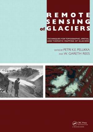
Remote Sensing of Glaciers: Techniques for Topographic, Spatial and Thematic Mapping of Glaciers
Editat de Petri Pellikka, W. Gareth Reesen Limba Engleză Hardback – 16 dec 2009
This book is of interest to specialists and students working in the field of remote sensing, glaciology, physical geography, geology and climate change.
| Toate formatele și edițiile | Preț | Express |
|---|---|---|
| Paperback (1) | 370.25 lei 43-57 zile | |
| CRC Press – 15 oct 2019 | 370.25 lei 43-57 zile | |
| Hardback (1) | 993.85 lei 43-57 zile | |
| CRC Press – 16 dec 2009 | 993.85 lei 43-57 zile |
Preț: 993.85 lei
Preț vechi: 1332.92 lei
-25% Nou
Puncte Express: 1491
Preț estimativ în valută:
190.17€ • 199.09$ • 157.36£
190.17€ • 199.09$ • 157.36£
Carte tipărită la comandă
Livrare economică 07-21 aprilie
Preluare comenzi: 021 569.72.76
Specificații
ISBN-13: 9780415401661
ISBN-10: 0415401666
Pagini: 356
Ilustrații: 32 colour illustrations
Dimensiuni: 174 x 246 x 23 mm
Greutate: 0.84 kg
Ediția:1
Editura: CRC Press
Colecția CRC Press
ISBN-10: 0415401666
Pagini: 356
Ilustrații: 32 colour illustrations
Dimensiuni: 174 x 246 x 23 mm
Greutate: 0.84 kg
Ediția:1
Editura: CRC Press
Colecția CRC Press
Public țintă
Professional Practice & DevelopmentNotă biografică
Petri Pellikka obtained his B.Sc. and M.Sc. degrees at the University of Helsinki, Finland, specializing in Physical geography and Development geography. He carried out his Ph.D. studies at the University of Munich, Germany and at the University of Oulu, Finland, on airborne video camera sensor calibration and its application in studies of forest phenology in the German Alps. Dr. Pellikka has been a professor of geoinformatics at the Faculty of Science of the University of Helsinki since 2002. He leads the GeoInformatics Research Group of 10 researchers and Ph.D. students at the Department of Geosciences and Geography. His current research activities are on remote sensing of forest, land cover and land use changes in East Africa, particularly Kenya. He has published over 110 scientific papers and over 40 popular articles.
Gareth Rees studied Natural Sciences as an undergraduate, specialising in Physics, and Radio Astronomy for his PhD, at the University of Cambridge. Since 1985 he has been a member of the academic staff at the Scott Polar Research Institute (SPRI), specialising in the application of spaceborne and airborne remote sensing techniques to the investigation of polar environments. He directs the Polar Landscape and Remote Sensing Group at SPRI. The work of this group includes field-based investigation of glaciers and ice caps in Svalbard and Iceland and laboratory-based studies of snow and terrestrial ice in other parts of the world including Siberia and the Caucasus Mountains. The group also has a major research focus on the dynamics of high-latitude vegetation (tundra and the northern part of the boreal forest) and its response to global climate change, and Dr Rees is the co-director of a core project of the International Polar Year that is investigating the Arctic treeline region. Dr Rees conducts frequent fieldwork in Svalbard and in northern Russia. He has published seven books and over 70 scientific
Gareth Rees studied Natural Sciences as an undergraduate, specialising in Physics, and Radio Astronomy for his PhD, at the University of Cambridge. Since 1985 he has been a member of the academic staff at the Scott Polar Research Institute (SPRI), specialising in the application of spaceborne and airborne remote sensing techniques to the investigation of polar environments. He directs the Polar Landscape and Remote Sensing Group at SPRI. The work of this group includes field-based investigation of glaciers and ice caps in Svalbard and Iceland and laboratory-based studies of snow and terrestrial ice in other parts of the world including Siberia and the Caucasus Mountains. The group also has a major research focus on the dynamics of high-latitude vegetation (tundra and the northern part of the boreal forest) and its response to global climate change, and Dr Rees is the co-director of a core project of the International Polar Year that is investigating the Arctic treeline region. Dr Rees conducts frequent fieldwork in Svalbard and in northern Russia. He has published seven books and over 70 scientific
Cuprins
Foreword, Acknowledgments, Author biography, Preface: Remote sensing of glaciers – glaciological research using remote sensing, Abbreviations, 1 Principles of remote sensing, 2 The formation and dynamics of glaciers, 3 Glacier parameters monitored using remote sensing, 4 The early history of remote sensing of glaciers, 5 Physics of glacier remote sensing, 6 Terrestrial photogrammetry in glacier studies, 7 Aerial photogrammetry in glacier studies, 8 Optical remote sensing of glacier extent, 9 SAR imaging of glaciers, 10 Airborne laser scanning in glacier studies, 11 Ground-penetrating radar in glaciological applications, 12 Detection and visualization of glacier area changes, 13 Detection of distortions in digital elevation models: simultaneous data acquisition at Hintereisferner glacier, 14 Accuracy aspects in topographical change detection of glacier surface, 15 The role of remote sensing in worldwide glacier monitoring, 16 Conclusions, Copyrights for figures, Authors, Reviewers, Subject index, Colour plates
Descriere
Bringing together experts in the field of remote sensing of glaciers, this book covers topics ranging from early terrestrial photogrammetry to the latest airborne laser and satellite radar methods for investigating glacier change. Providing important background information on instruments and techniques of measurement, the book discusses the mass balance and flow of glaciers and physical principles that underlie remote sensing at various wavelengths. This volume presents a focused view of glacier measurement and monitoring, making it an important contribution to investigations of glacier mass balance.
