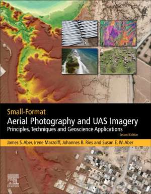
Small-Format Aerial Photography and UAS Imagery: Principles, Techniques and Geoscience Applications
Autor James S. Aber, Irene Marzolff, Johannes Ries, Susan Elizabeth Ward Aberen Limba Engleză Paperback – 17 sep 2019
This new edition includes small unmanned aerial systems (UAS) and discusses changes in legal practices across the globe. In addition, the book presents the history of SFAP, providing background and context for new developments.
- Provides background and context for new developments in SFAP
- Covers the legal implications for small format aerial systems in different countries
- Discusses unmanned aerial systems (drones) and their applications
- Features new case studies for different applications, including vineyard monitoring and impacts of wind energy
Preț: 592.79 lei
Preț vechi: 823.31 lei
-28% Nou
Puncte Express: 889
Preț estimativ în valută:
113.43€ • 118.83$ • 94.01£
113.43€ • 118.83$ • 94.01£
Carte tipărită la comandă
Livrare economică 02-16 aprilie
Preluare comenzi: 021 569.72.76
Specificații
ISBN-13: 9780128129425
ISBN-10: 0128129425
Pagini: 394
Dimensiuni: 216 x 276 mm
Greutate: 0.91 kg
Ediția:2
Editura: ELSEVIER SCIENCE
ISBN-10: 0128129425
Pagini: 394
Dimensiuni: 216 x 276 mm
Greutate: 0.91 kg
Ediția:2
Editura: ELSEVIER SCIENCE
V-ar putea interesa
-
 Map Librarianship: A Guide to Geoliteracy, Map and GIS Resources and ServicesSusan Elizabeth Ward Aber-8%Preț: 342.95 lei372.77 lei
 -
 GIS in Land and Property ManagementMartin P. Ralphs-18%Preț: 1452.51 lei1771.35 lei
 -
 Spatial Data QualityWenzhong Shi-18%Preț: 1117.07 lei1362.29 lei
 -
 Foundations of Geographic Information ScienceMatt Duckham-31%Preț: 682.20 lei990.60 lei
 -
 -18%Preț: 1169.45 lei1426.15 lei
 -
 GlaciotectonismJames S. Aber-9%Preț: 880.08 lei967.12 lei
 -
 Radar Remote Sensing of Planetary SurfacesBruce A. CampbellPreț: 442.82 lei
 -
 The Remote Sensing Data BookGareth Rees-19%Preț: 694.04 lei856.84 lei
 -
 Multidimensional Geographic Information ScienceJonathan Raper-24%Preț: 412.67 lei546.24 lei
 -
 -26%Preț: 351.88 lei476.61 lei
 -
 -29%Preț: 483.58 lei679.39 lei
 -
 -22%Preț: 416.87 lei533.55 lei
 -
 Remote Sensing of Drought: Innovative Monitoring ApproachesBrian D. Wardlow-18%Preț: 1555.41 lei1896.84 lei
 -
 -23%Preț: 1014.88 lei1318.02 lei
 -
 Optical Remote Sensing of Land Surface: Techniques and MethodsNicolas Baghdadi-23%Preț: 613.24 lei798.29 lei
 -
 Land Surface Remote Sensing in Agriculture and ForestNicolas Baghdadi-28%Preț: 672.50 lei936.40 lei
 -
 Microwave Remote Sensing of Land Surfaces: Techniques and MethodsNicolas Baghdadi-9%Preț: 616.69 lei677.68 lei
 -
 Land Surface Remote Sensing in Urban and Coastal AreasNicolas Baghdadi-38%Preț: 613.66 lei993.23 lei
 -
 -15%Preț: 642.36 lei755.72 lei
 -
 -18%Preț: 1162.33 lei1417.47 lei
 -
 Aerosol Remote SensingJacqueline Lenoble-18%Preț: 1217.72 lei1485.03 lei
 -
 Preț: 390.84 lei
Public țintă
graduate students, researchers and professionals in the areas of: Natural Resource management, environmental management, ecology, agricultural science, environmental science, energy, urban planning, physical geography, remote sensing, geology, geomorphologyCuprins
Part I. History and principles1. Introduction to small-format aerial photography 2. Basic principles of SFAP 3. Photogrammetry4. Lighting and atmospheric conditions5. Photographic composition
Part II. SFAP techniques6. Cameras for SFAP7. Manned and tethered platforms and mounts8. Unmanned aerial systems (UAS – drones) 9. SFAP survey planning and implementation10. Legal issues11. Image interpretation12. Image processing and analysis
Part III. Case studies13. Gully erosion monitoring14. Wetland environments15. Architecture, archaeology, and cemeteries 16. Recreational property17. Vegetation and soils18. Wind energy 19. Vineyards 20. Geomorphology21. Emergence of SFAP