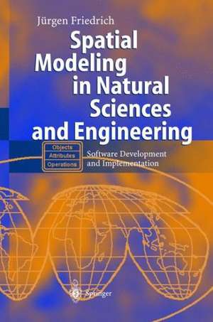
Spatial Modeling in Natural Sciences and Engineering: Software Development and Implementation
Autor Jürgen Friedrichen Limba Engleză Paperback – 10 noi 2012
| Toate formatele și edițiile | Preț | Express |
|---|---|---|
| Paperback (1) | 646.80 lei 6-8 săpt. | |
| Springer Berlin, Heidelberg – 10 noi 2012 | 646.80 lei 6-8 săpt. | |
| Hardback (1) | 655.85 lei 6-8 săpt. | |
| Springer Berlin, Heidelberg – 9 feb 2004 | 655.85 lei 6-8 săpt. |
Preț: 646.80 lei
Preț vechi: 808.50 lei
-20% Nou
Puncte Express: 970
Preț estimativ în valută:
123.78€ • 134.41$ • 103.98£
123.78€ • 134.41$ • 103.98£
Carte tipărită la comandă
Livrare economică 22 aprilie-06 mai
Preluare comenzi: 021 569.72.76
Specificații
ISBN-13: 9783642623363
ISBN-10: 3642623360
Pagini: 324
Ilustrații: XV, 305 p. 36 illus. in color.
Dimensiuni: 155 x 235 x 17 mm
Greutate: 0.45 kg
Ediția:Softcover reprint of the original 1st ed. 2004
Editura: Springer Berlin, Heidelberg
Colecția Springer
Locul publicării:Berlin, Heidelberg, Germany
ISBN-10: 3642623360
Pagini: 324
Ilustrații: XV, 305 p. 36 illus. in color.
Dimensiuni: 155 x 235 x 17 mm
Greutate: 0.45 kg
Ediția:Softcover reprint of the original 1st ed. 2004
Editura: Springer Berlin, Heidelberg
Colecția Springer
Locul publicării:Berlin, Heidelberg, Germany
Public țintă
ResearchCuprins
I: Object-Oriented Methodology.- 1. Introduction.- 2. Overview of Different Object-Oriented Approaches.- 3. Fundamentals of Object-Oriented Models.- II: Building Models with Objects and Patterns.- 4. Dynamic Matrix Processor in Visual Basic.- 5. 2D Dynamic Data Plotter in Visual Basic.- 6. 3D Data Visualizer in Visual Basic.- 7. Interactive Window Shell for Exe-Files in Visual Basic.- 8. Image Digitizer with a Database in Visual Basic.- 9. City Map Java Applet with a Road Finder.- 10. Parallel Computing of Satellite Orbits using Java Threads.- List of Abbreviations.- List of Figures.- List of Tables.
Recenzii
From the reviews:
"This is one of the first books trying to introduce object-oriented theory and practise especially for spatial sciences. … The examples may be used as starting point for own implementation because they are well described … . Thus, I would recommend it for higher level graduate and postgraduate students as well as practitioners in the field of surveying, geodesy, cartography, photogrammetry … . For these readers it will give a deeper insight into object-oriented concepts … . will help beginners to do the first successful steps in object-orientation." (Ralf Bill, Photogrammetrie-Fernerkundung-Geoinformation, Issue 6, 2004)
"This is a well-presented book, with a clear structure and writing style, which is easy to follow. … the author’s objective has been achieved, as the book takes the reader smoothly from basic concepts behind object-oriented methodology to the building of models with objects and patterns, concluding with applied examples. … the book is suitable for undergraduate students of Spatial Sciences and Engineering disciplines … . would also be suitable for teaching units within distance-based graduate programmes in spatial sciences or engineering." (G. Metternicht, The Photogrammetric Record, Vol. 20 (109), March, 2005)
Caracteristici
Fills a market niche because the covered topics (building spatial models and software engineering) are rarely taught at universities but urgently needed by many engineers Uses a practical step-by-step learning method with complete small, medium-sized and extendable applications Takes a learning-by-doing and problem-oriented approach Includes supplementary material: sn.pub/extras
