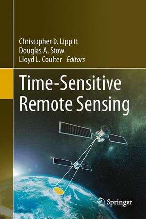
Time-Sensitive Remote Sensing
Editat de Christopher D. Lippitt, Douglas A. Stow, Lloyd L. Coulteren Limba Engleză Hardback – 2 iun 2015
| Toate formatele și edițiile | Preț | Express |
|---|---|---|
| Paperback (1) | 636.30 lei 6-8 săpt. | |
| Springer – 12 oct 2016 | 636.30 lei 6-8 săpt. | |
| Hardback (1) | 642.51 lei 6-8 săpt. | |
| Springer – 2 iun 2015 | 642.51 lei 6-8 săpt. |
Preț: 642.51 lei
Preț vechi: 755.88 lei
-15% Nou
Puncte Express: 964
Preț estimativ în valută:
122.94€ • 128.11$ • 101.80£
122.94€ • 128.11$ • 101.80£
Carte tipărită la comandă
Livrare economică 03-17 aprilie
Preluare comenzi: 021 569.72.76
Specificații
ISBN-13: 9781493926015
ISBN-10: 1493926012
Pagini: 130
Ilustrații: XIII, 198 p. 68 illus., 64 illus. in color.
Dimensiuni: 155 x 235 x 17 mm
Greutate: 0.48 kg
Ediția:2015
Editura: Springer
Colecția Springer
Locul publicării:New York, NY, United States
ISBN-10: 1493926012
Pagini: 130
Ilustrații: XIII, 198 p. 68 illus., 64 illus. in color.
Dimensiuni: 155 x 235 x 17 mm
Greutate: 0.48 kg
Ediția:2015
Editura: Springer
Colecția Springer
Locul publicării:New York, NY, United States
Public țintă
Professional/practitionerCuprins
Remote Sensing Theory and Time-Sensitive Information.- Time Sensitive Remote Sensing Systems for Post-Hazard Damage Assessment.- Repeat Station Imaging for Rapid Airborne Change Detection.- Rapid Fire Detection, Characterization and Reporting From VIIRS Data.- Application of Mobile Data Capture with Imagery Support.- The International Charter ‘Space and Major Disasters’.- The Federal Ocean Spill Team for Emergency Response Remote Sensing, FOSTERRS: Enabling remote sensing technology for marine disaster response.- LANCE, NASA's Land Atmosphere Near real-time Capability for EOS.- A Comprehensive Analysis of Building Damage in the 2010 Haiti Earthquake using High-Resolution Imagery and Crowdsourcing.- Near-Real Time Delivery of MODIS-based Information on Forest Disturbances.- The Use Of NASA LANCE Imagery And Data For Near Real-Time Applications.- Use Of Satellite Image Derived Products For Early Warning And Monitoring Of The Impact Of Drought On Food Security In Africa.
Textul de pe ultima copertă
This book documents the state of the art in the use of remote sensing to address time-sensitive information requirements. Specifically, it brings together a group of authors who are both researchers and practitioners, who work toward or are currently using remote sensing to address time-sensitive information requirements with the goal of advancing the effective use of remote sensing to supply time-sensitive information. The book addresses the theoretical implications of time-sensitivity on the remote sensing process, assessments or descriptions of methods for expediting the delivery and improving the quality of information derived from remote sensing, and describes and analyzes time-sensitive remote sensing applications, with an emphasis on lessons learned. This book is intended for remote sensing scientists, practitioners (e.g., emergency responders or administrators of emergency response agencies), and students, but will also be of use to those seeking to understand the potential of remote sensing to address a range of pressing issues, particularly natural and anthropogenic hazard response.
Caracteristici
Only concise collection of literature on the use of remote sensing for rapid response Special attention paid to natural and anthropogenic hazards which are increasing in frequency and severity, and which remote sensing has a critical role to play Puts in perspective the significant technical and administrative hurdles to overcome if the potential of remote sensing as rapid response tool is to be realized Covers geospatial hazard response which has been recognized by the two largest remote sensing and geospatial technology groups, ISPRS and ASPRS, as a critical initiative Includes supplementary material: sn.pub/extras
