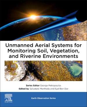
Unmanned Aerial Systems for Monitoring Soil, Vegetation, and Riverine Environments: Earth Observation
Editat de Salvatore Manfreda, Ben Dor Eyalen Limba Engleză Paperback – 23 ian 2023
- Includes a summary of technical UAS issues allowing readers to focus on how the exact technology fits their scientific question
- Provides specific applications enabling readers to understand the benefits and threats within the field
- Includes a comprehensive literature review in each chapter, allowing readers to know the key players and research in the field
Preț: 741.35 lei
Preț vechi: 969.61 lei
-24% Nou
Puncte Express: 1112
Preț estimativ în valută:
141.85€ • 148.11$ • 117.40£
141.85€ • 148.11$ • 117.40£
Carte tipărită la comandă
Livrare economică 28 martie-11 aprilie
Livrare express 27 februarie-05 martie pentru 89.74 lei
Preluare comenzi: 021 569.72.76
Specificații
ISBN-13: 9780323852838
ISBN-10: 0323852831
Pagini: 346
Ilustrații: Approx. 260 illustrations (260 in full color)
Dimensiuni: 191 x 235 x 22 mm
Greutate: 0.6 kg
Editura: ELSEVIER SCIENCE
Seria Earth Observation
ISBN-10: 0323852831
Pagini: 346
Ilustrații: Approx. 260 illustrations (260 in full color)
Dimensiuni: 191 x 235 x 22 mm
Greutate: 0.6 kg
Editura: ELSEVIER SCIENCE
Seria Earth Observation
Public țintă
Primary: Environmental Science and remote sensing education, including ( but not limited to) soil, water, and vegetationSecondary: They will find in one book most of the required steps to apply UAS technology for their present and future needs with regards to efficient monitoring and analysis of environment.
Cuprins
Introduction
Section 1 - General introduction on the use of UAS for environmental monitoring
• Remote sensing of the environment using unmanned aerial systems
• Protocols for UAS-based observation
• Using structure-from-motion workflows for 3D mapping and remote sensing
Section 2 - Vegetation monitoring
• Vegetation mapping and monitoring by unmanned aerial systems (UAS)—current state and perspectives
• Monitoring agricultural ecosystems
Section 3 - Soil Mapping
• Mapping soil properties for unmanned aerial system based environmental monitoring
• Soil moisture monitoring using unmanned aerial system
Section 4 - River Monitoring
• Geometric correction and stabilization of images collected by UASs in river monitoring
• River flow monitoring with unmanned aerial system
• Monitoring river channel dynamics by Unmanned Aerial Systems
Section 5 - Tools and datasets
• Tools and datasets for unmanned aerial system applications


