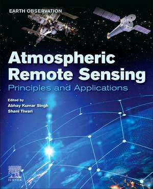
Atmospheric Remote Sensing: Principles and Applications: Earth Observation
Editat de Abhay Kumar Singh, Shani Tiwarien Limba Engleză Paperback – 9 noi 2022
This book is a valuable reference for students, researchers and professionals working in atmospheric science, remote sensing, and related disciplines.
- Covers the fundamentals of remote sensing as applied to atmospheric science
- Includes methods and applications of remote sensing technologies for atmospheric science and related disciplines in earth science
- Includes full color photographs and figures that visually represent concepts discussed in the book
Preț: 722.57 lei
Preț vechi: 942.05 lei
-23% Nou
Puncte Express: 1084
Preț estimativ în valută:
138.28€ • 150.15$ • 116.16£
138.28€ • 150.15$ • 116.16£
Carte tipărită la comandă
Livrare economică 15-29 aprilie
Preluare comenzi: 021 569.72.76
Specificații
ISBN-13: 9780323992626
ISBN-10: 0323992625
Pagini: 480
Dimensiuni: 191 x 235 x 32 mm
Greutate: 0.82 kg
Editura: ELSEVIER SCIENCE
Seria Earth Observation
ISBN-10: 0323992625
Pagini: 480
Dimensiuni: 191 x 235 x 32 mm
Greutate: 0.82 kg
Editura: ELSEVIER SCIENCE
Seria Earth Observation
V-ar putea interesa
-
 -9%Preț: 583.87 lei641.62 lei
 -
 -24%Preț: 669.90 lei877.34 lei
 -
 -22%Preț: 798.11 lei1029.70 lei
 -
 Engaged Research for Community Resilience to Climate ChangeShannon Van Zandt-27%Preț: 570.09 lei783.72 lei
 -
 Conceptual Boundary Layer Meteorology: The Air Near HereApril L. Hiscox-24%Preț: 572.27 lei748.83 lei
 -
 Extreme Weather ForecastingMarina Astitha-24%Preț: 687.56 lei900.27 lei
 -
 Biogenic Volatile Organic Compounds and Climate ChangeFederico Brilli-24%Preț: 688.20 lei900.68 lei
 -
 -23%Preț: 749.71 lei974.95 lei
 -
 -12%Preț: 180.36 lei205.84 lei
 -
 Water Scarcity, Contamination and ManagementAshwani Kumar Tiwari-23%Preț: 812.19 lei1057.62 lei
 -
 Future Forests: Mitigation and Adaptation to Climate ChangeSteven G. McNulty-23%Preț: 720.86 lei940.96 lei
 -
 -23%Preț: 747.40 lei973.47 lei
 -
 -14%Preț: 1012.16 lei1176.92 lei
 -
 Numerical Methods for Atmospheric and Oceanic SciencesA. Chandrasekar-8%Preț: 395.58 lei429.98 lei
 -
 Thermodynamics, Kinetics, and Microphysics of CloudsVitaly I. Khvorostyanov-14%Preț: 779.45 lei906.33 lei
 -
 Gravity: Newtonian, Post-Newtonian, RelativisticEric Poisson-11%Preț: 593.97 lei667.39 lei
 -
 Zonal Jets: Phenomenology, Genesis, and PhysicsBoris Galperin-14%Preț: 1137.87 lei1323.11 lei
 -
 Applied Thermodynamics for MeteorologistsSam Miller-11%Preț: 448.93 lei504.41 lei
 -
 Particle Dark Matter: Observations, Models and SearchesGianfranco Bertone-11%Preț: 552.05 lei620.28 lei
 -
 Turbulence in the AtmosphereJohn C. WyngaardPreț: 358.66 lei
 -
 Internal Gravity WavesBruce R. SutherlandPreț: 395.54 lei
 -
 -14%Preț: 1154.45 lei1342.38 lei
 -
 An Introduction to Planetary AtmospheresAgustin Sanchez-Lavega-18%Preț: 801.39 lei977.31 lei
 -
 -19%Preț: 543.82 lei671.38 lei
 -
 Atmospheric Radiation A Primer with Illustrative SolutionsJA Coakley Jr.Preț: 452.82 lei
 -
 R IN FINANCE AND ECONOMICSAbhay Kumar Singh & David E Allen-19%Preț: 375.80 lei463.94 lei
Cuprins
Section 1: Principles of atmospheric remote sensing
1. Satellite Remote Sensing Aerosol Optical Depth (AOD) Retrievals: accuracy assessment, limitations, and usage recommendations over Asia
2. Earth Observation Satellites (EOS) for global sustainability: Potentials and boundaries
3. Remote Sensing and its implication to air pollution studies
4. Global Navigation Satellite System and its Application in Remote Sensing of Atmosphere
5. Estimation of Ionospheric Total Electron Content (TEC) from GNSS observations
6. Impact of water vapor on atmospheric correction of satellite images
Section 2: Application of atmospheric remote sensing
7. Identification of fires over the Indian region from space
8. Identification of different aerosol types observed at a semi-arid location in southern peninsular India retrieved from the CALIPSO
9. Remote sensing of clouds: challenges and way forward
10. Study of Aerosol – Cloud Interaction over Indian region using satellite remote sensing
11. Aerosol loading over the Northern Indian ocean using spaceborne measurement
12. Balloon – based remote sensing of Atmosphere
13. Vertical distribution of atmospheric brown clouds using LiDAR remote sensing over Indian region
14. Application of Remote Sensing to study forest fires over the Himalayan region
15. Study of the atmospheric and ionospheric phenomenon using GPS based remote sensing technique
16. Low-latitude lower ionosphere remote sensing using very low frequency (VLF) waves
17. Remote Sensing of Ionosphere, Plasmasphere, and Magnetosphere by VLF Wave
18. Remote Sensing of Ionospheric Irregularities
19. Application of atmospheric remote sensing in disaster management
20. Characteristics of tropical cyclones through remote sensing observations and techniques
21. Significance of Remote sensing in Tropical Cyclone prediction and disaster management: Indian perspective
22. Study of dust storm characteristics over Indo – Gangetic Basin through satellite remote sensing
23. Geomorphological mapping of glacial and periglacial landforms using Remote Sensing: Examples from semi-arid and sub-humid Himalayan valleys
24. Classification of Remotely sensed Formosat-2 Haridwar data using Deep Learning Artificial Neural Network and Convolutional Neural Network
25. Remote sensing-based study of landslide hazard zonation in Namchi and its surrounding area of Sikkim, India