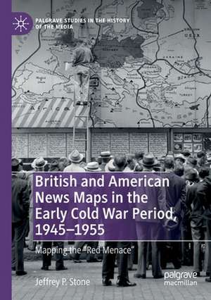
British and American News Maps in the Early Cold War Period, 1945–1955: Mapping the "Red Menace": Palgrave Studies in the History of the Media
Autor Jeffrey P. Stoneen Limba Engleză Paperback – 14 aug 2020
| Toate formatele și edițiile | Preț | Express |
|---|---|---|
| Paperback (1) | 449.90 lei 6-8 săpt. | |
| Springer International Publishing – 14 aug 2020 | 449.90 lei 6-8 săpt. | |
| Hardback (1) | 589.14 lei 6-8 săpt. | |
| Springer International Publishing – 21 iun 2019 | 589.14 lei 6-8 săpt. |
Din seria Palgrave Studies in the History of the Media
- 18%
 Preț: 787.91 lei
 - 15%
 Preț: 696.35 lei
 - 15%
 Preț: 646.11 lei
 -
 Preț: 211.47 lei
 -
 Preț: 393.90 lei
 - 15%
 Preț: 585.26 lei
 - 15%
 Preț: 584.43 lei
 - 15%
 Preț: 700.61 lei
 - 18%
 Preț: 894.03 lei
 -
 Preț: 384.48 lei
 - 18%
 Preț: 738.06 lei
 -
 Preț: 385.84 lei
 -
 Preț: 391.61 lei
 -
 Preț: 389.70 lei
 -
 Preț: 385.47 lei
 - 15%
 Preț: 584.10 lei
 - 15%
 Preț: 587.72 lei
 - 18%
 Preț: 895.27 lei
 - 15%
 Preț: 589.33 lei
 - 18%
 Preț: 732.84 lei
 -
 Preț: 391.61 lei
 -
 Preț: 391.79 lei
 - 15%
 Preț: 641.53 lei
 - 15%
 Preț: 531.59 lei
 - 15%
 Preț: 645.14 lei
 - 15%
 Preț: 585.08 lei
 - 15%
 Preț: 640.88 lei
 - 15%
 Preț: 586.38 lei
 -
 Preț: 388.72 lei
 -
 Preț: 381.59 lei
 -
 Preț: 386.22 lei
 -
 Preț: 392.21 lei
 -
 Preț: 395.47 lei
 -
 Preț: 387.20 lei
 - 15%
 Preț: 583.93 lei
 -
 Preț: 485.99 lei
 - 15%
 Preț: 582.80 lei
 -
 Preț: 392.60 lei
 -
 Preț: 391.61 lei
 - 15%
 Preț: 698.15 lei
 - 18%
 Preț: 791.57 lei
Preț: 449.90 lei
Nou
Puncte Express: 675
Preț estimativ în valută:
86.09€ • 89.88$ • 71.25£
86.09€ • 89.88$ • 71.25£
Carte tipărită la comandă
Livrare economică 04-18 aprilie
Preluare comenzi: 021 569.72.76
Specificații
ISBN-13: 9783030154707
ISBN-10: 303015470X
Pagini: 236
Ilustrații: XVI, 236 p. 38 illus., 19 illus. in color.
Dimensiuni: 148 x 210 mm
Greutate: 0.31 kg
Ediția:1st ed. 2019
Editura: Springer International Publishing
Colecția Palgrave Macmillan
Seria Palgrave Studies in the History of the Media
Locul publicării:Cham, Switzerland
Cuprins
1. Cold War-era News Maps in Historical Context.- 2. Trends in British and American News Maps by the End of World War II.- 3. Air Age Maps, the Shrinking Globe, and Anglo-American Relations.- 4. American Spheres, British Zones, and the "Special Relationship".- 5. Cold War Germany in News Maps.- 6. Conclusions.
Notă biografică
Jeffrey P. Stone is Lecturer in history at Hill College and lives in Fort Worth, Texas, USA. His research specializes in the history of cartography, American foreign policy, and international cultural history, and his dissertation won the 2008 Wolfskill Prize. He has published articles in numerous academic journals, including Kansas History, The Portolan, and Geschichte Transnational, and entries in The Encyclopedia of Transatlantic Relations and The History of Cartography series.
Textul de pe ultima copertă
During the early years of the Cold War, England and the United States both found themselves reassessing their relationship with their former ally the Soviet Union, and the status of their own “special relationship” was far from certain. As Jeffrey P. Stone argues, maps from British and American news journals from this period became a valuable tool for relating the new realities of the Cold War to millions of readers. These maps were vehicles for political ideology, revealing both obvious and subtle differences in how each country viewed global geopolitics at the onset of the Cold War. Richly illustrated with news maps, cartographic advertisements, and cartoons from the era, this book reveals the idiomatic political, cultural, and material differences contributing to these divergent cartographic visions of the Cold War world.
Caracteristici
Offers a pioneering study of Cold War news journal cartography Compares cartographic depictions of the early Cold War world from British and American news media Appeals to scholars and students of Anglo-American relations, the Cold War, media history, the history of cartography, and American and British foreign policy
