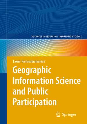
Geographic Information Science and Public Participation: Advances in Geographic Information Science
Autor Laxmi Ramasubramanianen Limba Engleză Paperback – mar 2012
| Toate formatele și edițiile | Preț | Express |
|---|---|---|
| Paperback (1) | 635.15 lei 43-57 zile | |
| Springer Berlin, Heidelberg – mar 2012 | 635.15 lei 43-57 zile | |
| Hardback (1) | 638.43 lei 43-57 zile | |
| Springer Berlin, Heidelberg – 4 feb 2010 | 638.43 lei 43-57 zile |
Din seria Advances in Geographic Information Science
- 18%
 Preț: 1110.72 lei
 - 24%
 Preț: 669.64 lei
 - 24%
 Preț: 606.73 lei
 - 15%
 Preț: 637.46 lei
 - 18%
 Preț: 899.21 lei
 - 18%
 Preț: 1388.68 lei
 - 18%
 Preț: 948.92 lei
 - 15%
 Preț: 635.96 lei
 - 18%
 Preț: 944.67 lei
 - 18%
 Preț: 954.31 lei
 - 15%
 Preț: 641.71 lei
 - 15%
 Preț: 646.11 lei
 - 18%
 Preț: 1118.75 lei
 - 15%
 Preț: 648.56 lei
 - 18%
 Preț: 1230.84 lei
 - 18%
 Preț: 948.29 lei
 - 18%
 Preț: 1123.19 lei
 - 18%
 Preț: 948.47 lei
 - 18%
 Preț: 956.69 lei
 - 18%
 Preț: 941.82 lei
 - 15%
 Preț: 635.80 lei
 - 18%
 Preț: 761.72 lei
 - 18%
 Preț: 894.03 lei
Preț: 635.15 lei
Preț vechi: 747.23 lei
-15% Nou
Puncte Express: 953
Preț estimativ în valută:
121.54€ • 127.21$ • 101.16£
121.54€ • 127.21$ • 101.16£
Carte tipărită la comandă
Livrare economică 31 martie-14 aprilie
Preluare comenzi: 021 569.72.76
Specificații
ISBN-13: 9783642262142
ISBN-10: 3642262147
Pagini: 188
Ilustrații: XIV, 163 p.
Dimensiuni: 155 x 235 x 10 mm
Greutate: 0.27 kg
Ediția:2008
Editura: Springer Berlin, Heidelberg
Colecția Springer
Seria Advances in Geographic Information Science
Locul publicării:Berlin, Heidelberg, Germany
ISBN-10: 3642262147
Pagini: 188
Ilustrații: XIV, 163 p.
Dimensiuni: 155 x 235 x 10 mm
Greutate: 0.27 kg
Ediția:2008
Editura: Springer Berlin, Heidelberg
Colecția Springer
Seria Advances in Geographic Information Science
Locul publicării:Berlin, Heidelberg, Germany
Public țintă
Professional/practitionerCuprins
Participatory Planning: Why Does It matter?.- Dilemmas in Contemporary Planning.- The Digital Revolution.- Dilemmas in Contemporary Planning.- PPGIS: State of the Practice.- Three Narratives.- Politics and Participation in Boston’s South End.- Planning to Preserve Community Character in Oak Park, Illinois.- Chicagoland’s Search for Common Ground.- Evaluation.- The Future of PPGIS.- PPGIS as Critical Reflective Practice.- Where to, from Here?.
Recenzii
From the reviews:
“Geographic Information Systems and Public Participation is one of eight books in the Springer series Advances in Geographic Information Science. … Ramasubramanian provides readers with several relevant building frameworks and food for thought, especially in the fields of public engagement, planning, and GIS development. It also offers ample sources for further reading … .” (Cindy Regalado, Environmental and Planning B: Planning and Design, Vol. 39 (2), 2012)
“Geographic Information Systems and Public Participation is one of eight books in the Springer series Advances in Geographic Information Science. … Ramasubramanian provides readers with several relevant building frameworks and food for thought, especially in the fields of public engagement, planning, and GIS development. It also offers ample sources for further reading … .” (Cindy Regalado, Environmental and Planning B: Planning and Design, Vol. 39 (2), 2012)
Notă biografică
Dr. Laxmi Ramasubramanian is an Associate Professor in the Department of Urban Affairs and Planning at Hunter College and a member of the Doctoral Faculty in the Earth and Environmental Science Program at the City University of New York Graduate Center. She has consulted, lectured, researched, and published worldwide.
Textul de pe ultima copertă
This book argues that many positive planning and policy outcomes can result when GIS experts and community organizers work together to address problems affecting our neighborhoods and cities. This book is written by an author who, in addition to being an academic, has worked for twenty years in the grassroots, designing and implementing a wide range of community-oriented GIS activities. The book is both an account of personal experiences, as well as an academic reflection of professional practice. The case studies are drawn from multiple scales and represent stake holders covering a wide swath of actors. For practitioners, the book will help to place their own experiences into a historical and socio-political context and will provide guidance for their work. For students, it looks behind the scenes of glossy PPGIS reports usually found in the literature. For policymakers, it highlights the pathways to facilitate social change through consensus building. This book provides clarity about terminologies and definitions. It provides practical guidelines for policymakers seeking to implement consensus-building approaches that are supported by GIS and other digital tools.
Caracteristici
First book focusing directly on these topics Provides a theoretical framework that links planning, GIS, and community development Includes case studies that provide examples of planning processes at the local, regional, and national scales Contains critical discussions about the future of participatory processes that use technologies Includes supplementary material: sn.pub/extras


