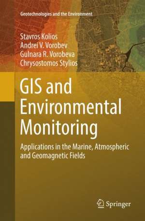
GIS and Environmental Monitoring: Applications in the Marine, Atmospheric and Geomagnetic Fields: Geotechnologies and the Environment, cartea 20
Autor Stavros Kolios, Andrei V. Vorobev, Gulnara R. Vorobeva, Chrysostomos Styliosen Limba Engleză Paperback – aug 2018
This book constitutes a notable contribution to investigate and present the capabilities of Geographic Information Systems (GIS) and their applicability and usefulness in environmental-related applications and sciences. The focus is on the design, creation, development and operation of integrated Web-based GIS applications for weather, marine and atmospheric environments, and the Earth's magnetic field. More specifically, the aim of this book is to present characteristic applications of GIS to environmental monitoring including GIS solutions for eco-mapping sea and port-related parameters, climate changes, and geomagnetic field.
In the first part of the book, the description of every application includes the user requirements, the design and development stages performed and the presentation of the final outcome, its capabilities and services. The Web-based applications are developed through different innovative approaches, such as cloud GIS and Google Apps for GIS, justifying the merit of WebGIS in the world of the environmental applications. The second part of the book provides an overview of geomagnetic field parameters and reveals the potential of using GIS for modeling and analyzing of the Earth's magnetic (geomagnetic) field and its parameters. Here, the authors present the recently introduced phenomenon called “geomagnetic pseudostorm”, which is modeled and further analyzed here with GIS technology and tools.
This book appeals to those interested in various areas where spatial information becomes of paramount relevance (e.g. social and economic research and mapping, environmental and climate research, decision support systems, public services, and especially for geomagnetic field variations and for the design of warning systems for natural disasters). It presents modern methods and approaches to visualize and analyze spatial information using innovative techniques, procedures, and tools of WebGIS technology. In this book, the readers find a valuable companion in their efforts to design and develop their own WebGIS applications, as it includes useful examples of developing (Web)GIS applications regarding the monitoring of marine and atmospheric environments, as well as applications that deal with meteorological issues and the Earth’s magnetic field along with solar activity (space weather information).This book can also serve as a useful reference source for graduates, researchers and professionals related to the areas indicated above.
| Toate formatele și edițiile | Preț | Express |
|---|---|---|
| Paperback (1) | 728.31 lei 38-44 zile | |
| Springer International Publishing – aug 2018 | 728.31 lei 38-44 zile | |
| Hardback (1) | 945.79 lei 3-5 săpt. | |
| Springer International Publishing – 22 iun 2017 | 945.79 lei 3-5 săpt. |
Din seria Geotechnologies and the Environment
- 15%
 Preț: 649.71 lei
 - 18%
 Preț: 1408.89 lei
 - 18%
 Preț: 1007.49 lei
 - 18%
 Preț: 945.79 lei
 - 20%
 Preț: 566.51 lei
 - 18%
 Preț: 952.09 lei
 - 18%
 Preț: 948.92 lei
 - 15%
 Preț: 652.31 lei
 - 18%
 Preț: 951.77 lei
 - 15%
 Preț: 639.25 lei
 - 15%
 Preț: 652.17 lei
 - 24%
 Preț: 746.98 lei
 - 24%
 Preț: 778.71 lei
 - 18%
 Preț: 952.72 lei
 - 18%
 Preț: 968.34 lei
 - 24%
 Preț: 790.73 lei
 - 18%
 Preț: 995.63 lei
 - 18%
 Preț: 886.92 lei
 - 5%
 Preț: 1106.69 lei
 - 18%
 Preț: 1215.04 lei
 - 15%
 Preț: 636.12 lei
 - 18%
 Preț: 967.08 lei
 - 15%
 Preț: 530.42 lei
Preț: 728.31 lei
Preț vechi: 958.30 lei
-24% Nou
Puncte Express: 1092
Preț estimativ în valută:
139.41€ • 151.48$ • 117.18£
139.41€ • 151.48$ • 117.18£
Carte tipărită la comandă
Livrare economică 17-23 aprilie
Preluare comenzi: 021 569.72.76
Specificații
ISBN-13: 9783319850580
ISBN-10: 331985058X
Pagini: 174
Ilustrații: XI, 174 p. 98 illus., 66 illus. in color.
Dimensiuni: 155 x 235 mm
Greutate: 0.32 kg
Ediția:Softcover reprint of the original 1st ed. 2017
Editura: Springer International Publishing
Colecția Springer
Seria Geotechnologies and the Environment
Locul publicării:Cham, Switzerland
Cuprins
From the Contents: Geographic Information Systems (GIS).- Brief history.- Overview of GIS definition and tasks.- WebGIS.- WebGIS definition.- WebGIS applications in Environmental monitoring.- WebGIS applications in E-Government.- WebGIS applications in GeoSciences and especially in presenting geomagnetic fields.- Modeling and analysis of geomagnetic filed and variations using WebGIS.- Earth magnetism origin.
Textul de pe ultima copertă
This book constitutes a notable contribution to investigate and present the capabilities of Geographic Information Systems (GIS) and their applicability and usefulness in environmental-related applications and sciences. The focus is on the design, creation, development and operation of integrated Web-based GIS applications for weather, marine and atmospheric environments, and Earth's magnetic field. More specifically, the aim of this book is to present characteristic applications of GIS to environmental monitoring including GIS solutions for eco-mapping sea and port-related parameters, climate changes, and geomagnetic field.
In the first part of the book, the description of every application includes the user requirements, the design and development stages performed and the presentation of the final outcome, its capabilities and services. The Web-based applications are developed through different innovative approaches, such as cloud GIS and Google Apps for GIS, justifying the merit of WebGIS in the world of the environmental applications. The second part of the book provides an overview of geomagnetic field parameters and reveals the potential of using GIS for modeling and analyzing of the Earth's magnetic (geomagnetic) field and its parameters. Here, the authors present the recently introduced phenomenon called “geomagnetic pseudostorm”, which is modeled and further analyzed here with GIS technology and tools.
This book appeals to those interested in various areas where spatial information becomes of paramount relevance (e.g. social and economic research and mapping, environmental and climate research, decision support systems, public services, and especially for geomagnetic field variations and for the design of warning systems for natural disasters). It presents modern methods and approaches to visualize and analyze spatial information using innovative techniques, procedures, and tools of WebGIS technology.In this book, the readers find a valuable companion in their efforts to design and develop their own WebGIS applications, as it includes useful examples of developing (Web)GIS applications regarding the monitoring of marine and atmospheric environments, as well as applications that deal with meteorological issues and the Earth’s magnetic field along with solar activity (space weather information).This book can also serve as a useful reference source for graduates, researchers and professionals related to the areas indicated above.
Caracteristici
Presentation of the state-of-the-art GIS software and tools Discusses a range of GIS applications in the GeoSciences Special attention given to environmental monitoring and applications
