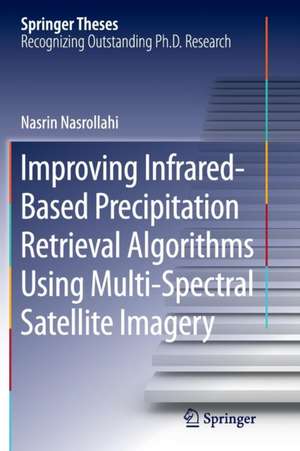
Improving Infrared-Based Precipitation Retrieval Algorithms Using Multi-Spectral Satellite Imagery: Springer Theses
Autor Nasrin Nasrollahien Limba Engleză Paperback – 10 sep 2016
Using satellite data to estimate precipitation from space overcomes the limitation of ground-based observations in terms of availability over remote areas and oceans as well as spatial coverage. However, the accuracy of satellite-based estimates still need to be improved.
The approach introduced in this thesis takes advantage of the recent NASA satellites in observing clouds and precipitation. In addition, machine-learning techniques are also employed to make the best use of remotely-sensed "big data." The results provide a significant improvement in detecting non-precipitating areas and reducing false identification of precipitation.
| Toate formatele și edițiile | Preț | Express |
|---|---|---|
| Paperback (1) | 630.43 lei 6-8 săpt. | |
| Springer International Publishing – 10 sep 2016 | 630.43 lei 6-8 săpt. | |
| Hardback (1) | 636.45 lei 6-8 săpt. | |
| Springer International Publishing – 27 noi 2014 | 636.45 lei 6-8 săpt. |
Din seria Springer Theses
- 18%
 Preț: 997.88 lei
 -
 Preț: 389.88 lei
 - 15%
 Preț: 646.94 lei
 - 18%
 Preț: 943.43 lei
 -
 Preț: 399.29 lei
 - 18%
 Preț: 944.99 lei
 - 15%
 Preț: 636.80 lei
 - 18%
 Preț: 941.05 lei
 - 15%
 Preț: 643.16 lei
 - 15%
 Preț: 642.68 lei
 - 18%
 Preț: 1103.62 lei
 - 20%
 Preț: 558.82 lei
 - 18%
 Preț: 1112.30 lei
 - 18%
 Preț: 944.19 lei
 - 18%
 Preț: 1109.92 lei
 - 18%
 Preț: 1217.27 lei
 - 15%
 Preț: 640.06 lei
 - 15%
 Preț: 636.45 lei
 - 15%
 Preț: 640.06 lei
 - 15%
 Preț: 640.88 lei
 -
 Preț: 389.70 lei
 - 20%
 Preț: 563.89 lei
 -
 Preț: 393.35 lei
 - 15%
 Preț: 637.93 lei
 - 15%
 Preț: 641.85 lei
 - 18%
 Preț: 1225.94 lei
 - 20%
 Preț: 551.36 lei
 - 18%
 Preț: 1229.10 lei
 - 15%
 Preț: 639.25 lei
 - 18%
 Preț: 999.45 lei
 - 15%
 Preț: 640.06 lei
 - 18%
 Preț: 1220.45 lei
 - 18%
 Preț: 1116.26 lei
 - 18%
 Preț: 1110.72 lei
 - 18%
 Preț: 1000.87 lei
 - 18%
 Preț: 891.17 lei
 - 15%
 Preț: 640.06 lei
 - 5%
 Preț: 1154.07 lei
 - 15%
 Preț: 635.96 lei
 - 15%
 Preț: 640.88 lei
 -
 Preț: 387.20 lei
 - 18%
 Preț: 1109.92 lei
 -
 Preț: 385.25 lei
 -
 Preț: 385.25 lei
 - 18%
 Preț: 1112.30 lei
 - 18%
 Preț: 999.45 lei
 -
 Preț: 386.99 lei
 - 15%
 Preț: 637.13 lei
 - 20%
 Preț: 554.20 lei
 - 20%
 Preț: 555.57 lei
Preț: 630.43 lei
Preț vechi: 741.68 lei
-15% Nou
Puncte Express: 946
Preț estimativ în valută:
120.63€ • 125.95$ • 99.84£
120.63€ • 125.95$ • 99.84£
Carte tipărită la comandă
Livrare economică 05-19 aprilie
Preluare comenzi: 021 569.72.76
Specificații
ISBN-13: 9783319363325
ISBN-10: 3319363328
Pagini: 89
Ilustrații: XXI, 68 p. 41 illus., 38 illus. in color.
Dimensiuni: 155 x 235 x 5 mm
Greutate: 0.14 kg
Ediția:Softcover reprint of the original 1st ed. 2015
Editura: Springer International Publishing
Colecția Springer
Seria Springer Theses
Locul publicării:Cham, Switzerland
Cuprins
Introduction to the Current States of Satellite Precipitation Products.- False Alarm in Satellite Precipitation Data.- Satellite Observations.- Reducing False Rain in Satellite Precipitation Products Using CloudSat Cloud Classification Maps and MODIS Multi-Spectral Images.- Integration of CloudSat Precipitation Profile in Reduction of False Rain.- Cloud Classification and its Application in Reducing False Rain.- Summary and Conclusions.
Textul de pe ultima copertă
This thesis transforms satellite precipitation estimation through the integration of a multi-sensor, multi-channel approach to current precipitation estimation algorithms, and provides more accurate readings of precipitation data from space.
Using satellite data to estimate precipitation from space overcomes the limitation of ground-based observations in terms of availability over remote areas and oceans as well as spatial coverage. However, the accuracy of satellite-based estimates still need to be improved.
The approach introduced in this thesis takes advantage of the recent NASA satellites in observing clouds and precipitation. In addition, machine-learning techniques are also employed to make the best use of remotely-sensed "big data." The results provide a significant improvement in detecting non-precipitating areas and reducing false identification of precipitation.
Caracteristici
Nominated by the University of California, Irvine, USA, as an outstanding Ph.D. thesis Presents data sets that reduce false rain signals in satellite precipitation measurements Provides advances in the accuracy of satellite-based precipitation estimation Includes supplementary material: sn.pub/extras
