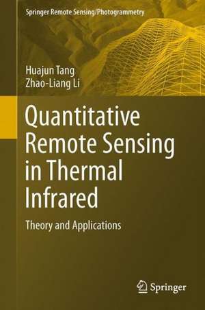
Quantitative Remote Sensing in Thermal Infrared: Theory and Applications: Springer Remote Sensing/Photogrammetry
Autor Huajun Tang, Zhao-Liang Lien Limba Engleză Hardback – 15 ian 2014
Both Prof. Huajun Tang and Prof. Zhao-Liang Li work at the Chinese Academy of Agricultural Sciences (CAAS), China.
| Toate formatele și edițiile | Preț | Express |
|---|---|---|
| Paperback (1) | 727.00 lei 6-8 săpt. | |
| Springer Berlin, Heidelberg – 23 aug 2016 | 727.00 lei 6-8 săpt. | |
| Hardback (1) | 694.68 lei 38-44 zile | |
| Springer Berlin, Heidelberg – 15 ian 2014 | 694.68 lei 38-44 zile |
Din seria Springer Remote Sensing/Photogrammetry
- 15%
 Preț: 653.98 lei
 - 24%
 Preț: 847.78 lei
 - 24%
 Preț: 911.54 lei
 - 15%
 Preț: 644.18 lei
 - 18%
 Preț: 785.11 lei
 - 18%
 Preț: 950.52 lei
 - 18%
 Preț: 895.58 lei
 - 18%
 Preț: 1112.60 lei
 - 18%
 Preț: 946.87 lei
 - 18%
 Preț: 1244.71 lei
 - 18%
 Preț: 1114.02 lei
 - 24%
 Preț: 728.29 lei
 - 24%
 Preț: 895.51 lei
 - 18%
 Preț: 1105.83 lei
 - 20%
 Preț: 560.05 lei
 - 18%
 Preț: 1043.14 lei
 - 18%
 Preț: 944.34 lei
 - 18%
 Preț: 888.18 lei
 - 18%
 Preț: 892.46 lei
 - 18%
 Preț: 1005.61 lei
 - 24%
 Preț: 844.06 lei
Preț: 694.68 lei
Preț vechi: 914.06 lei
-24% Nou
Puncte Express: 1042
Preț estimativ în valută:
132.92€ • 139.16$ • 109.99£
132.92€ • 139.16$ • 109.99£
Carte tipărită la comandă
Livrare economică 01-07 aprilie
Preluare comenzi: 021 569.72.76
Specificații
ISBN-13: 9783642420269
ISBN-10: 3642420265
Pagini: 304
Ilustrații: XXI, 281 p. 82 illus., 39 illus. in color.
Dimensiuni: 155 x 235 x 17 mm
Greutate: 0.6 kg
Ediția:2014
Editura: Springer Berlin, Heidelberg
Colecția Springer
Seria Springer Remote Sensing/Photogrammetry
Locul publicării:Berlin, Heidelberg, Germany
ISBN-10: 3642420265
Pagini: 304
Ilustrații: XXI, 281 p. 82 illus., 39 illus. in color.
Dimensiuni: 155 x 235 x 17 mm
Greutate: 0.6 kg
Ediția:2014
Editura: Springer Berlin, Heidelberg
Colecția Springer
Seria Springer Remote Sensing/Photogrammetry
Locul publicării:Berlin, Heidelberg, Germany
Public țintă
ResearchCuprins
Basic theory of quantitative remote sensing.- Radiometric calibration.- Emissivity retrieval.- LST retrieval.- Estimation of evapotranspiration.- Applications.- Future development and perspectives.
Notă biografică
Dr. Huajun Tang is a research professor and vice president of the Chinese Academy of Agricultural Sciences (CAAS), Beijing. He received his B.S. (1982) in agronomy from South-west Agricultural University, China, and M.S. (1987), Ph.D. (1993) with greatest distinction in Physical Land Resources from University of Ghent, Belgium. His research areas include remote sensing and GIS applications, land use and crop modeling. Over the last decades, he has served as a consultant to a number of governmental agencies, nonprofit organizations and companies including World Bank, FAO, UNESCAP. He has published more than 100 papers in international and Chinese scientific journals and has received a number of scien-tech innovation awards and honors including the corresponding member of Belgian Royal Academy of Overseas Science, President of the Chinese Society of Agricultural Resources and Regional Planning.
Dr. Zhao-Liang Li received the Ph.D. degree in physics of terrestrial environment-remote sensing from University of Strasbourg, France, in 1990. Since 1992, he has been a research scientist (Directeur de Recherche from 2011) at CNRS, France. He joined the Institute of Agricultural Resources and Regional Planning, Chinese Academy of Agricultural Sciences in 2013. He has participated in many national and international projects such as NASA-funded MODIS, EC-funded program EAGLE, and ESA funded programs SPECTRA, etc. His main expertise fields are in thermal infrared radiometry, parameterization of land surface processes at large scale, scaling change, as well as in the assimilation of satellite data to land surface models. He has published more than 100 papers in international refereed journals.
Dr. Zhao-Liang Li received the Ph.D. degree in physics of terrestrial environment-remote sensing from University of Strasbourg, France, in 1990. Since 1992, he has been a research scientist (Directeur de Recherche from 2011) at CNRS, France. He joined the Institute of Agricultural Resources and Regional Planning, Chinese Academy of Agricultural Sciences in 2013. He has participated in many national and international projects such as NASA-funded MODIS, EC-funded program EAGLE, and ESA funded programs SPECTRA, etc. His main expertise fields are in thermal infrared radiometry, parameterization of land surface processes at large scale, scaling change, as well as in the assimilation of satellite data to land surface models. He has published more than 100 papers in international refereed journals.
Textul de pe ultima copertă
This book provides a comprehensive and advanced overview of the basic theory of thermal remote sensing and its application in hydrology, agriculture, and forestry. Specifically, the book highlights the main theory, assumptions, advantages, drawbacks, and perspectives of these methods for the retrieval and validation of surface temperature/emissivity and evapotranspiration from thermal infrared remote sensing. It will be an especially valuable resource for students, researchers, experts, and decision-makers whose interest focuses on the retrieval and validation of surface temperature/emissivity, the estimation and validation of evapotranspiration at satellite pixel scale, and the application of thermal remote sensing.
Both Prof. Huajun Tang and Prof. Zhao-Liang Li work at the Chinese Academy of Agricultural Sciences (CAAS), China.
Both Prof. Huajun Tang and Prof. Zhao-Liang Li work at the Chinese Academy of Agricultural Sciences (CAAS), China.
Caracteristici
Provides the most comprehensive and advanced overview of the terminology, radiative transfer theory, methods for surface temperature/emissivity retrieval, and methods for evapotranspiration estimation in thermal infrared remote sensing Includes abundant and colorful examples of the validation of surface temperature/emissivity retrieval and evapotranspiration estimation, and of the application of thermal remote sensing in geography, agriculture, and forestry Offers in-depth perspectives on the future trends of thermal remote sensing
