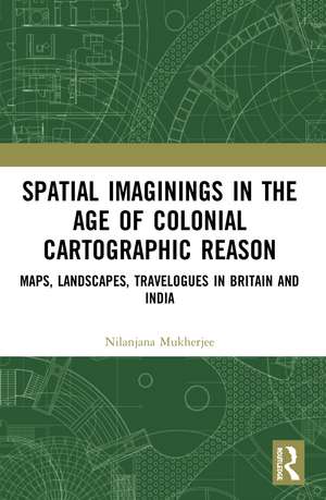
Spatial Imaginings in the Age of Colonial Cartographic Reason: Maps, Landscapes, Travelogues in Britain and India
Autor Nilanjana Mukherjeeen Limba Engleză Paperback – 25 sep 2023
This book:
- Addresses the concept of "production of space" to study the formulation of a colonial geography which resulted in the birth of a new place, later a nation;
- Investigates a generative period in the formation of British India c. 1750–1850 as a colonial territory vis-à-vis its representation and reiteration in British maps, landscape paintings and travel writings;
- Brings Great Britain and British India together on one plane not only in terms of the physical geo-spaces but also in the excavation of critical domains by alluding to critics from both spaces;
- Seeks to understand the pictorial grammar that legitimised the expansive British imperial cartographic gaze as the dominant narrative which marginalised all other existing local ideas of space and inhabitation.
| Toate formatele și edițiile | Preț | Express |
|---|---|---|
| Paperback (1) | 259.98 lei 6-8 săpt. | |
| Taylor & Francis – 25 sep 2023 | 259.98 lei 6-8 săpt. | |
| Hardback (1) | 1000.27 lei 6-8 săpt. | |
| Taylor & Francis – 17 iul 2020 | 1000.27 lei 6-8 săpt. |
Preț: 259.98 lei
Preț vechi: 326.49 lei
-20% Nou
Puncte Express: 390
Preț estimativ în valută:
49.75€ • 51.63$ • 41.58£
49.75€ • 51.63$ • 41.58£
Carte tipărită la comandă
Livrare economică 17-31 martie
Preluare comenzi: 021 569.72.76
Specificații
ISBN-13: 9780367505745
ISBN-10: 0367505746
Pagini: 314
Ilustrații: 23 Halftones, black and white; 23 Illustrations, black and white
Dimensiuni: 156 x 234 x 22 mm
Greutate: 0.45 kg
Ediția:1
Editura: Taylor & Francis
Colecția Routledge India
Locul publicării:Oxford, United Kingdom
ISBN-10: 0367505746
Pagini: 314
Ilustrații: 23 Halftones, black and white; 23 Illustrations, black and white
Dimensiuni: 156 x 234 x 22 mm
Greutate: 0.45 kg
Ediția:1
Editura: Taylor & Francis
Colecția Routledge India
Locul publicării:Oxford, United Kingdom
Public țintă
PostgraduateCuprins
Introduction: maps, landscapes, travelogues: spatial articulation and the imperial eyes PART I Cartographic imagination 1 Maps: the onset and dominance of cartographic reason 2 Mapping India: Rennell and Lambton PART II Landscapes of control 3 Estates, gardens and enclosures: aesthetic framing of British landscapes 4 Framing India: Chinnery and D’Oyly PART III Narrativising travel 5 Place and identity: travel narratives in the making of Britain 6 Narrating India: Hodges, Heber, Fraser and Hooker Postscript Bibliography
Notă biografică
Nilanjana Mukherjee is Assistant Professor at the Department of English, Shaheed Bhagat Singh College, University of Delhi. Her earlier publications include Mapping India: Transitions and Transformations 18th–19th Centuries (co-edited with Sutapa Dutta, 2019). She has also received the Meenakshi Mukherjee Memorial Prize for the year 2014 from the Indian Association of Commonwealth Languages and Literature for her article titled "Drawing Roads/Building Empire: Space and Circulation in Charles D'Oyly's Indian Landscapes" published in South Asia: Journal of South Asian Studies, Vol. 37. She is also a former Charles Wallace India Trust Visiting Fellow at the Institute of Advanced Studies in the Humanities and Centre for South Asian Studies, University of Edinburgh, UK.
Descriere
This volume explores how India as a geographical space was constructed by the British colonial regime in visual and material terms. It sheds light on the primary dominance of cartographic reason in the age of European Enlightenment which framed aesthetic and scientific modes of representations and imaginations.
