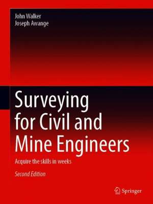
Surveying for Civil and Mine Engineers: Acquire the Skills in Weeks
Autor John Walker, Joseph Awangeen Limba Engleză Hardback – 7 iun 2020
It also covers new topics, such as the global navigation satellite system’s (Real Time Kinematic-RTK), which are increasingly used in a wide range of everyday engineering applications.
| Toate formatele și edițiile | Preț | Express |
|---|---|---|
| Paperback (1) | 749.66 lei 6-8 săpt. | |
| Springer International Publishing – 8 iun 2021 | 749.66 lei 6-8 săpt. | |
| Hardback (1) | 878.55 lei 38-44 zile | |
| Springer International Publishing – 7 iun 2020 | 878.55 lei 38-44 zile |
Preț: 878.55 lei
Preț vechi: 1140.96 lei
-23% Nou
Puncte Express: 1318
Preț estimativ în valută:
168.13€ • 174.53$ • 140.19£
168.13€ • 174.53$ • 140.19£
Carte tipărită la comandă
Livrare economică 18-24 martie
Preluare comenzi: 021 569.72.76
Specificații
ISBN-13: 9783030458027
ISBN-10: 3030458024
Pagini: 411
Ilustrații: XXV, 411 p. 2 illus., 1 illus. in color.
Dimensiuni: 210 x 279 mm
Greutate: 1.32 kg
Ediția:2nd ed. 2020
Editura: Springer International Publishing
Colecția Springer
Locul publicării:Cham, Switzerland
ISBN-10: 3030458024
Pagini: 411
Ilustrații: XXV, 411 p. 2 illus., 1 illus. in color.
Dimensiuni: 210 x 279 mm
Greutate: 1.32 kg
Ediția:2nd ed. 2020
Editura: Springer International Publishing
Colecția Springer
Locul publicării:Cham, Switzerland
Cuprins
Fundamental Surveying.- Levelling.- Relief and vertical Sections.- Total Station: Measurements and Computations.- Traversing.- Total Station differential Levelling.- Strike and Dip to an embedded Plane.- Circular Curves.- Vertical Curves.- Global Navigation Satellite System.- Setting out of Engineering Structures.- Coordinate Transformation.
Notă biografică
Professor Joseph Awange joined the Department of Spatial Sciences (Curtin University, Australia) in 2006 under a Curtin Research Fellowship and concurrently undertook the prestigious Alexander von Humboldt (AvH) Fellowship at the Geodetic Institute (Karlsruhe Institute of Technology, Germany) having been awarded the Australian 2008-2011 Ludwig Leichhardt Memorial Fellowship for experienced researchers. In 2015, he won all the three major Fellowship Awards: Alexander von Humboldt (Germany), Japan Society of Promotion of Science (Japan) and Brazil Frontier of Science (Brazil) to carry out research in those countries. At Curtin University, he is currently engaged in teaching and research having attracted more than $1.5M worth of research grants. He obtained his BSc and MSc degrees in Surveying from the University of Nairobi (Kenya), and was also awarded a merit scholarship by the German Academic Exchange Program (DAAD), which facilitated his obtaining a second MSc degree and PhD in Geodesy at Stuttgart University (Germany). In 2002-2004, he was awarded the prestigious Japan Society for Promotion of Science (JSPS) Fellowship to pursue postdoctoral research at Kyoto University (Japan). Prof Awange attained International Editorial role in Springer Earth Science Books and has authored 11 scholarly books with the prestigious Springer publishers and more than 130 peer-reviewed high impact journal publications (in e,g., Remote Sensing of Environment, Journal of Climate, Climatic Change, Advances in Water Resources, International Journal of Climatology, and Journal of Hydrology among others).
John Walker was awarded a B.App.Sc (Surveying and Mapping) in 1988, and a Post-Grad Dip. (Surveying and Mapping) in 1989 by Curtin University.
John had been a casual lecturer and tutor at Curtin since 1998, working in the areas of Aviation (Navigation, Flight Planning,Navigation Aids, and Flight Management); Surveying (Survey Computations, Survey
ing methods, GNSS) and Cartography (Computer Aided Mapping). He is the continuing author of a first semester course manual in Survey Computations.
He has worked closely with Dr Joseph Awange on the practical portion of a Surveying unit for Civil and Mining Engineers and has collaborated as co-author and editor of this book.
John has extensive experience as an Engineering Surveyor. He is also a commercial pilot in light aircraft and was formerly an Air Traffic Controller with leadership in Operational Control and Aviation Search and Rescue.
Textul de pe ultima copertă
This updated and expanded edition of the book includes four additional chapters on earthwork on sloping sites; transitional curves and super elevation; calculations of super elevations on composite curves; and underground mine surveying. Richly illustrated with diagrams, equations and tables as well as examples of every day survey tasks.
It also covers new topics, such as the global navigation satellite system’s (Real Time Kinematic-RTK), which are increasingly used in a wide range of everyday engineering applications.
It also covers new topics, such as the global navigation satellite system’s (Real Time Kinematic-RTK), which are increasingly used in a wide range of everyday engineering applications.
Caracteristici
Written for civil and mine engineers rather than surveyors Presents surveying technologies relevant for civil and mine engineers Includes numerous worked examples and solutions
