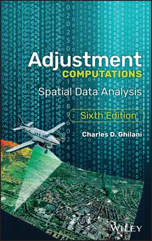
Adjustment Computations – Spatial Data Analysis, Sixth Edition
Autor CD Ghilanien Limba Engleză Hardback – 7 dec 2017
The definitive guide to bringing accuracy to measurement, updated and supplemented Adjustment Computations is the classic textbook for spatial information analysis and adjustment computations, providing clear, easy-to-understand instruction backed by real-world practicality. From the basic terms and fundamentals of errors to specific adjustment computations and spatial information analysis, this book covers the methodologies and tools that bring accuracy to surveying, GNSS, GIS, and other spatial technologies. Broad in scope yet rich in detail, the discussion avoids overly-complex theory in favor of practical techniques for students and professionals.
This new sixth edition has been updated to align with the latest developments in this rapidly expanding field, and includes new video lessons and updated problems, including worked problems in STATS, MATRIX, ADJUST, and MathCAD. All measurement produces some amount of error; whether from human mistakes, instrumentation inaccuracy, or environmental features, these errors must be accounted and adjusted for when accuracy is critical. This book describes how errors are identified, analyzed, measured, and corrected, with a focus on least squares adjustment the most rigorous methodology available.
Apply industry-standard methodologies to error analysis and adjustmentTranslate your skills to the real-world with instruction focused on the practicalMaster the fundamentals as well as specific computations and analysisStrengthen your understanding of critical topics on the Fundamentals in Surveying Licensing Exam As spatial technologies expand in both use and capability, so does our need for professionals who understand how to check and adjust for errors in spatial data. Conceptual knowledge is one thing, but practical skills are what counts when accuracy is at stake; Adjustment Computations provides the real-world training you need to identify, analyze, and correct for potentially crucial errors.
Preț: 1131.30 lei
Preț vechi: 1243.19 lei
-9% Nou
216.47€ • 226.01$ • 179.16£
Carte tipărită la comandă
Livrare economică 05-19 aprilie
Specificații
ISBN-10: 1119385989
Pagini: 720
Dimensiuni: 162 x 230 x 38 mm
Greutate: 1.08 kg
Ediția:6th Edition
Editura: Wiley
Locul publicării:Hoboken, United States
Public țintă
Students of surveying, photogrammetry, GIS and GPS. Students preparing for licensing exams. Professional surveyors, photogrammetrists, and practitioners who use GNSS and GIS for data collection and analysis, including oceanographers, urban planners, foresters, geographers, and transportation planners, etc.Cuprins
Notă biografică
DR. CHARLES D. GHILANI is a Professor Emeritus of Engineering. He taught in the B.S. Surveying Engineering and A.S. Surveying Technology programs at Pennsylvania State University. He holds a Ph.D. and M.S. in Civil and Environmental Engineering from the University of Wisconsin-Madison, and a B.S. degree in mathematics and education from the University of Wisconsin-Milwaukee. He is an honorary member of the Pennsylvania Society of Land Surveyors (P.S.L.S.), the president of the American Association for Geodetic Surveying, and the editor of Surveying and Land Information Science. He has received the Milton S. Eisenhower Distinguished Teaching Award in 2013, and the 2017 Surveying and Geomatics Educator's Society Educator Award.
