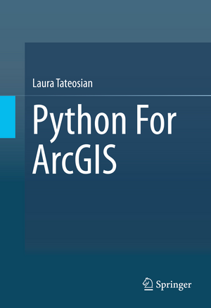
Python For ArcGIS
Autor Laura Tateosianen Limba Engleză Hardback – 16 ian 2016
| Toate formatele și edițiile | Preț | Express |
|---|---|---|
| Paperback (1) | 540.24 lei 6-8 săpt. | |
| Springer International Publishing – 30 mar 2018 | 540.24 lei 6-8 săpt. | |
| Hardback (1) | 715.96 lei 6-8 săpt. | |
| Springer International Publishing – 16 ian 2016 | 715.96 lei 6-8 săpt. |
Preț: 715.96 lei
Preț vechi: 842.31 lei
-15% Nou
Puncte Express: 1074
Preț estimativ în valută:
136.100€ • 143.04$ • 113.38£
136.100€ • 143.04$ • 113.38£
Carte tipărită la comandă
Livrare economică 04-18 aprilie
Preluare comenzi: 021 569.72.76
Specificații
ISBN-13: 9783319183978
ISBN-10: 3319183974
Pagini: 538
Ilustrații: XVI, 538 p. 167 illus., 148 illus. in color.
Dimensiuni: 155 x 235 x 30 mm
Greutate: 0.95 kg
Ediția:1st ed. 2015
Editura: Springer International Publishing
Colecția Springer
Locul publicării:Cham, Switzerland
ISBN-10: 3319183974
Pagini: 538
Ilustrații: XVI, 538 p. 167 illus., 148 illus. in color.
Dimensiuni: 155 x 235 x 30 mm
Greutate: 0.95 kg
Ediția:1st ed. 2015
Editura: Springer International Publishing
Colecția Springer
Locul publicării:Cham, Switzerland
Public țintă
ResearchCuprins
Introduction.- Beginning Python.- Basic data types: numbers and strings.- Basic data types: lists and tuples.- Preparing for Python in ArcGIS.- Calling tools with arcpy.- Getting user input.- Controlling flow.- Decision-making and describing data.- Repetition: Looping for geoprocessing.- Batch geoprocessing.- Additional looping functions.- Debugging.- Error handling.- User-defined functions.- User-defined modules.- Reading and Writing with Cursors.- Dictionaries.- Reading & writing text files.- Working with HTML & KML.- Classes.- User interfaces for file and folder selection.- ArcGIS Python GUIs.- Mapping module.
Notă biografică
Laura G. Tateosian is a professor at the Center for Geospatial Analytics at North Carolina State University. She earned her B.A. in Mathematics from Towson University, her M.S. in Mathematics from the University of Oklahoma, and her Ph.D. in computer science from North Carolina State University. She has more than 8 years of experience teaching Python programming for GIS and receives outstanding teaching evaluations. In 2014, she received an award for her teaching at North Carolina State University. Her research involves geospatial data analysis, aesthetic geovisualization, eye-tracking for map and visualization design, and automatic narrative mapping with Python and ArcGIS. Her research has published in refereed conferences and journals, such as, Information Visualization, International Journal for Uncertainty Quantification, Transactions in GIS, ACM Transactions on Graphics, IEEE Transactions on Visualization and Computer Graphics, the proceedings of the International Symposium on Non-Photorealistic Animation and Rendering, the International Symposium on Applied Perception in Graphics and Visualization, and IEEE Computer Graphics & Applications (Visualization Viewpoints).
Caracteristici
Illustrates concepts with examples that solve real geoprocessing problems Emphasizes batch processing for streamlining workflows Provides over 200 sample Python scripts and 175 exercises Offers exercises, key terms, and access to a solutions manual to enhance classroom usage Includes supplementary material: sn.pub/extras Request lecturer material: sn.pub/lecturer-material
