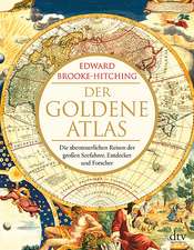
The Phantom Atlas: The Greatest Myths, Lies and Blunders on Maps
Autor Edward Brooke-Hitchingen Limba Engleză Hardback – 3 noi 2016
A
STUNNINGLY
ILLUSTRATED
BOOK
REVEALING
THE
GREATEST
MYTHS,
LIES
AND
BLUNDERS
ON
MAPS
'Highly recommended' - Andrew Marr
'A spectacular, enjoyable and eye-opening read' - Jonathan Ross
The Phantom Atlasisan atlas of the worldnot as it ever existed, butas it was thought to be. These marvellous and mysterious phantoms - non-existent islands, invented mountain ranges, mythical civilisations and other fictitious geography - were all at various times presented as facts on maps and atlases. This book is a collection of striking antique maps that display the most erroneous cartography, with each illustration accompanied by the story behind it.
Exploration, map-making and mythology are all brought together to createa colourful tapestry of monsters, heroes and volcanoes; swindlers, mirages and murderers. Sometimes the stories are almost impossible to believe, and remarkably, some of the errors were still on display in maps published in the 21st century. Throughout much of the 19th century more than 40 different mapmakers included the Mountains of Kong, a huge range of peaks stretching across the entire continent of Africa, in their maps - but it was only in 1889 when Louis Gustave Binger revealed the whole thing to be a fake. For centuries, explorers who headed to Patagonia returned with tales of the giants they had met who lived there, some nine feet tall. Then there was Gregor MacGregor, a Scottish explorer who returned to London to sell shares in a land he had discovered in South America. He had been appointed the Cazique of Poyais, and bestowed with many honours by the local king of this unspoiled paradise. Now he was offering others the chance to join him and make their fortune there, too - once they had paid him a bargain fee for their passage...
The Phantom Atlasis abeautifully produced volume, packed withstunning maps and drawingsof places and people that never existed. Theremarkable storiesbehind them all are brilliantly told by Edward Brooke-Hitching in a book that will appeal to cartophiles everywhere.
| Toate formatele și edițiile | Preț | Express |
|---|---|---|
| Hardback (2) | 135.80 lei 25-37 zile | +81.57 lei 4-10 zile |
| Simon&Schuster – 3 noi 2016 | 135.80 lei 25-37 zile | +81.57 lei 4-10 zile |
| Chronicle Books – 3 apr 2018 | 223.31 lei 3-5 săpt. |
Preț: 135.80 lei
Preț vechi: 174.58 lei
-22% Nou
Puncte Express: 204
Preț estimativ în valută:
25.99€ • 27.03$ • 21.46£
25.99€ • 27.03$ • 21.46£
Carte disponibilă
Livrare economică 28 martie-09 aprilie
Livrare express 07-13 martie pentru 91.56 lei
Preluare comenzi: 021 569.72.76
Specificații
ISBN-13: 9781471159459
ISBN-10: 1471159450
Pagini: 256
Ilustrații: Full Colour Throughout
Dimensiuni: 189 x 246 x 29 mm
Greutate: 0.97 kg
Editura: Simon&Schuster
Colecția Simon & Schuster UK
ISBN-10: 1471159450
Pagini: 256
Ilustrații: Full Colour Throughout
Dimensiuni: 189 x 246 x 29 mm
Greutate: 0.97 kg
Editura: Simon&Schuster
Colecția Simon & Schuster UK
Recenzii
'The
Phantom
Atlasdescribes
some
50
"myths,
lies
and
blunders"
and
illustrates
them
indelightfuldetail...deserve[s]
a
place
on
the
coffee
table,
but
only
after
it's
been
read:
there
is
as
much
to
absorb
as
to
see.'
‘A spectacular, enjoyable and eye-opening read... A wonderful book, with beautiful illustrations throughout’
‘Beautifully illustrated…brain-boggling…an excursion into the minds of men imagining an as yet uncharted world’
‘This intriguing book…shows how places that aren’t there can endure, sometimes for centuries, once a map-maker has inked them in’
‘Beautiful… Brooke-Hitching [has] an eye for a good story and his book is gloriously illustrated with ancient mistaken maps, each accompanied by a thoroughly researched tale of the men whose errors led to them.’
‘Extraordinary’
‘Excellent... Arranged alphabetically in fifty-eight short chapters, with lavish deployment of illustrations, the book provides a captivating chronicle of our battle with ignorance’
‘Unreservedly recommended’
‘From the magnetic mountain at the north pole to Australia’s inland sea, Edward Brooke-Hitching charts five centuries of misrepresentative maps.’
‘A rich selection… [that] shows how lively minds made use of limited knowledge, but also how rumour, guesswork and downright lies can persist in the scholarly imagination.’
‘One of the most beautiful books I’ve ever seen in my life…full of fascinating quirky things.’
‘The fascination and beauty of maps both emerge clearly in this well-written, witty and thoughtful book…this is a spirited and enjoyable study’
‘Exquisitely produced… Gorgeous illustrations of countries and islands that were once thought to exist...For any fans of maps this is a must’
'Fascinating ... and beautifully illustrated'
Descriere
A STUNNINGLY ILLUSTRATED BOOK REVEALING THE GREATEST MYTHS, LIES AND BLUNDERS ON MAPS
'Highly recommended' - Andrew Marr
'A spectacular, enjoyable and eye-opening read' - Jonathan Ross
The Phantom Atlas is an atlas of the world not as it ever existed, but as it was thought to be. These marvellous and mysterious phantoms - non-existent islands, invented mountain ranges, mythical civilisations and other fictitious geography - were all at various times presented as facts on maps and atlases. This book is a collection of striking antique maps that display the most erroneous cartography, with each illustration accompanied by the story behind it.
Exploration, map-making and mythology are all brought together to create a colourful tapestry of monsters, heroes and volcanoes; swindlers, mirages and murderers. Sometimes the stories are almost impossible to believe, and remarkably, some of the errors were still on display in maps published in the 21st century. Throughout much of the 19th century more than 40 different mapmakers included the Mountains of Kong, a huge range of peaks stretching across the entire continent of Africa, in their maps - but it was only in 1889 when Louis Gustave Binger revealed the whole thing to be a fake. For centuries, explorers who headed to Patagonia returned with tales of the giants they had met who lived there, some nine feet tall. Then there was Gregor MacGregor, a Scottish explorer who returned to London to sell shares in a land he had discovered in South America. He had been appointed the Cazique of Poyais, and bestowed with many honours by the local king of this unspoiled paradise. Now he was offering others the chance to join him and make their fortune there, too - once they had paid him a bargain fee for their passage...
The Phantom Atlas is a beautifully produced volume, packed with stunning maps and drawingsof places and people that never existed. The remarkable stories behind them all are brilliantly told by Edward Brooke-Hitching in a book that will appeal to cartophiles everywhere.

