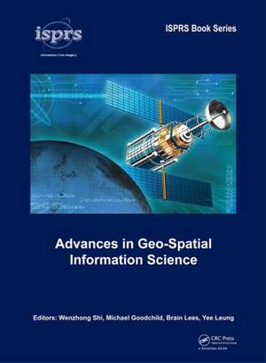
Advances in Geo-Spatial Information Science: ISPRS Book Series
Editat de Wenzhong Shi, Michael Goodchild, Brian Lees, Yee Leungen Limba Engleză Hardback – 12 iun 2012
Advances in Geo-Spatial Information Science will be of interest for academics and professionals interested in spatial information science, spatial data handling, and modeling of geographic systems.
| Toate formatele și edițiile | Preț | Express |
|---|---|---|
| Paperback (1) | 315.92 lei 6-8 săpt. | |
| CRC Press – 14 oct 2024 | 315.92 lei 6-8 săpt. | |
| Hardback (1) | 336.66 lei 6-8 săpt. | |
| CRC Press – 12 iun 2012 | 336.66 lei 6-8 săpt. |
Preț: 336.66 lei
Preț vechi: 435.83 lei
-23% Nou
Puncte Express: 505
Preț estimativ în valută:
64.44€ • 70.02$ • 54.16£
64.44€ • 70.02$ • 54.16£
Carte tipărită la comandă
Livrare economică 21 aprilie-05 mai
Preluare comenzi: 021 569.72.76
Specificații
ISBN-13: 9780415620932
ISBN-10: 0415620937
Pagini: 336
Dimensiuni: 174 x 246 mm
Greutate: 0.82 kg
Ediția:1
Editura: CRC Press
Colecția CRC Press
Seria ISPRS Book Series
Locul publicării:Boca Raton, United States
ISBN-10: 0415620937
Pagini: 336
Dimensiuni: 174 x 246 mm
Greutate: 0.82 kg
Ediția:1
Editura: CRC Press
Colecția CRC Press
Seria ISPRS Book Series
Locul publicării:Boca Raton, United States
Public țintă
Academic, Postgraduate, and ProfessionalCuprins
Foreword; Introduction; GIScience in the 21st century; Modeling space and time: A unified spatial model for GIS; Space-time kernels; Generalization of tiled models with curved surfaces using typification; Spatio-temporal trajectory analysis of mobile objects following the same itinerary; Modelling the land allocation process in time and space; Spatial analysis and data mining: Automatically and accurately matching objects in geospatial datasets; The estimation of MOEs change based on CBR; Multi-view augmented concept to improve semantic interoperability of geospatial data; Influence Power-based Hierarchy Tree Neighbor Function Clustering Algorithm; Cooperative information augmentation in a geosensor network; Implementation of the marked Strauss point process model to the epicenters of earthquake aftershocks; Uncertainty modelling; Accuracy assessment of extensional uncertainty modelled by random sets; Hierarchical approach for an accuracy-based conflation of multi-topographic databases; Mobile data modelling: Enhancing travel time forecasting with traffic condition detection; An indexing method for supporting spatial queries in P2P systems; A multi-modal route planning approach with an improved genetic algorithm; Geo-visualization: Using digital globes to visualize climate change impact; An online geographical visualisation portal for communicating and sharing natural resource information; Multi-resolution representation of digital terrain and building models; Location-based computing and service; Individual differences in the tourist wayfinding decision-making process: A case study of Phillip Island, Victoria, Australia; Routing with minimum number of landmarks; Location based context awareness through tag-cloud visualizations; An epilogue
Notă biografică
Wenzhong Shi, The Hong Kong Polytechnic University, Hong Kong SAR, China. Michael F. Goodchild, University of California, Santa Barbara, USA Brian Lees, The University of New South Wales at the Australian Defence Force Academy, Australia. Yee Leung, The Chinese University of Hong Kong, Hong Kong SAR, China.
Recenzii
In summary, this edited book provides an excellent coverage of the history, current state, and potential future of GIScience as an academic discipline. A variety of audiences will find the book to be a useful source of ideas and state-ofthe-art research.
Shivanand Balram. In: Geomatica, Vol. 66, No. 4, 2012, pp 337-338.
Shivanand Balram. In: Geomatica, Vol. 66, No. 4, 2012, pp 337-338.
Descriere
Covering recent advances regarding fundamental issues of geo-spatial information science (space and time, spatial analysis, uncertainty modeling and geo-visualization), and new scientific and technological research initiatives for geo-spatial information science (such as spatial data mining, mobile data modeling and location-based services), Advances in Geo-Spatial Information Science will be of interest for academics and professionals interested in spatial information science, spatial data handing and modeling of geographic systems.
