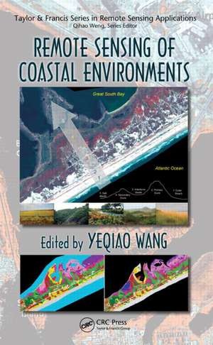
Remote Sensing of Coastal Environments: Remote Sensing Applications Series
Editat de Yeqiao Wangen Limba Engleză Hardback – 9 dec 2009
Edited by a recipient of the prestigious PECASE award, this book provides unrivaled coverage of the issues unique to coastal environments. It presents the best available data for measuring and monitoring coastal zones and explains how decision makers and resource managers can use this data to address contemporary issues in coastal zone management. The text illustrates the latest developments in active remote sensing, hyperspectral remote sensing, high spatial resolution remote sensing, the integration of remote sensing and in situ data, and covers the effects of land-cover and land-use change on coastal environments.
Complete with representative case studies, this authoritative resource provides a timely snapshot of the wide range of remote sensing applications in coastal issues to enhance the understanding of how increasing disturbances to our coastal regions are affecting the ecological dynamics, biological diversity, and ecosystem health of our coastal environments.
| Toate formatele și edițiile | Preț | Express |
|---|---|---|
| Paperback (1) | 574.85 lei 6-8 săpt. | |
| CRC Press – 31 mai 2017 | 574.85 lei 6-8 săpt. | |
| Hardback (1) | 1393.29 lei 6-8 săpt. | |
| CRC Press – 9 dec 2009 | 1393.29 lei 6-8 săpt. |
Din seria Remote Sensing Applications Series
- 8%
 Preț: 506.11 lei
 - 9%
 Preț: 614.37 lei
 - 15%
 Preț: 501.05 lei
 - 16%
 Preț: 337.84 lei
 - 21%
 Preț: 381.74 lei
 - 28%
 Preț: 992.21 lei
 - 25%
 Preț: 1058.86 lei
 - 26%
 Preț: 434.61 lei
 - 12%
 Preț: 314.66 lei
 - 15%
 Preț: 489.26 lei
 - 14%
 Preț: 310.54 lei
 - 13%
 Preț: 336.54 lei
 - 25%
 Preț: 485.78 lei
 - 26%
 Preț: 368.57 lei
 -
 Preț: 446.17 lei
 - 15%
 Preț: 574.85 lei
 - 15%
 Preț: 641.32 lei
 - 15%
 Preț: 494.99 lei
 - 31%
 Preț: 928.98 lei
Preț: 1393.29 lei
Preț vechi: 1699.13 lei
-18% Nou
Puncte Express: 2090
Preț estimativ în valută:
266.62€ • 285.09$ • 222.29£
266.62€ • 285.09$ • 222.29£
Carte tipărită la comandă
Livrare economică 18 aprilie-02 mai
Preluare comenzi: 021 569.72.76
Specificații
ISBN-13: 9781420094411
ISBN-10: 1420094416
Pagini: 442
Ilustrații: 147 b/w images, 57 tables and Less than 100
Dimensiuni: 156 x 234 x 25 mm
Greutate: 0.79 kg
Ediția:1
Editura: CRC Press
Colecția CRC Press
Seria Remote Sensing Applications Series
Locul publicării:Boca Raton, United States
ISBN-10: 1420094416
Pagini: 442
Ilustrații: 147 b/w images, 57 tables and Less than 100
Dimensiuni: 156 x 234 x 25 mm
Greutate: 0.79 kg
Ediția:1
Editura: CRC Press
Colecția CRC Press
Seria Remote Sensing Applications Series
Locul publicării:Boca Raton, United States
Public țintă
ProfessionalCuprins
LiDAR/Radar Remote Sensing. Hyperspectral Remote Sensing. High Spatial Resolution Remote Sensing. Remote Sensing and In Situ Measurements for Habitat Mapping. Effects of Land-Use/Land-Cover Change in Coastal Areas.
Recenzii
... certainly fills a critical niche in remote sensing applications, since not many remote sensing textbooks deal with the dynamics of complex coastal environments. This book is edited by Professor Yeqiao Wang, an internationally known expert in the field of coastal remote sensing. Most of the contributing authors are well-respected researchers. The book is suitable for use by advanced undergraduate students, graduate students, and practitioners in the field.
—Yang Shoo, PhD, Research Associate, National Research Counsel, United States Environmental Protection Agency, in Photogrammetric, December 2010
All in all, this publication covers many remote sensing techniques and their various current applications. ... it is no doubt an extremely useful and informative body of work for those already familiar with the subject matter covered. One suspects that the evolution of remote sensing techniques will be more rapid than the coastal changes that they are now being used to detect and monitor. For this reason, it is highly probable that we shall see more on this theme in the future. ... this publication represents an excellent snapshot of the current situation.
—Nick Bray, Terra et Aqua, 2010
Descriere
Edited by a PECASE award recipient, this book provides unrivaled coverage of the issues unique to coastal environments. It presents the best available data for measuring and monitoring coastal zones and explains how to use this data to address current issues in coastal zone management. The text illustrates recent developments in active remote sensing, hyperspectral remote sensing, high spatial resolution remote sensing, the integration of remote sensing, and in situ data. Covering the effects of land-cover and land-use change on coastal environments, the book includes case studies that illustrate remote sensing applications in coastal issues.
