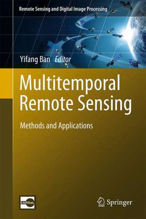
Multitemporal Remote Sensing: Methods and Applications: Remote Sensing and Digital Image Processing, cartea 20
Editat de Yifang Banen Limba Engleză Hardback – 15 dec 2016
Written by world renowned scientists, this book provides an excellent overview of a wide array of methods and techniques for the processing and analysis of multitemporal remotely sensed images. These methods and techniques include change detection, multitemporal data fusion, coarse-resolution time series processing, and interferometric SAR multitemporal processing, among others. A broad range of multitemporal datasets are used in their methodology demonstrations and application examples, including multispectral, hyperspectral, SAR and passive microwave data.
This book features a varietyof application examples covering both land and aquatic environments. Land applications include urban, agriculture, habitat disturbance, vegetation dynamics, soil moisture, land surface albedo, land surface temperature, glacier and disaster recovery. Aquatic applications include monitoring water quality, water surface areas and water fluctuation in wetland areas, spatial distribution patterns and temporal fluctuation trends of global land surface water, as well as evaluation of water quality in several coastal and marine environments.
This book will help scientists, practitioners, students gain a greater understanding of how multitemporal remote sensing could be effectively used to monitor our changing planetat local, regional, and global scales.
| Toate formatele și edițiile | Preț | Express |
|---|---|---|
| Paperback (1) | 1452.09 lei 38-44 zile | |
| Springer International Publishing – 5 iul 2018 | 1452.09 lei 38-44 zile | |
| Hardback (1) | 1476.65 lei 38-44 zile | |
| Springer International Publishing – 15 dec 2016 | 1476.65 lei 38-44 zile |
Din seria Remote Sensing and Digital Image Processing
- 18%
 Preț: 1020.74 lei
 - 18%
 Preț: 1231.47 lei
 - 18%
 Preț: 944.82 lei
 - 15%
 Preț: 530.42 lei
 - 24%
 Preț: 1613.59 lei
 - 18%
 Preț: 1385.19 lei
 - 24%
 Preț: 793.38 lei
 - 15%
 Preț: 640.37 lei
 - 18%
 Preț: 1112.15 lei
 - 18%
 Preț: 1408.08 lei
 - 15%
 Preț: 662.95 lei
 - 18%
 Preț: 954.45 lei
 - 18%
 Preț: 1389.78 lei
 - 18%
 Preț: 1122.10 lei
 - 18%
 Preț: 1407.64 lei
 - 20%
 Preț: 988.28 lei
 - 18%
 Preț: 945.76 lei
 - 24%
 Preț: 802.76 lei
 - 15%
 Preț: 650.86 lei
 - 15%
 Preț: 650.37 lei
 - 15%
 Preț: 642.51 lei
 - 15%
 Preț: 653.46 lei
Preț: 1476.65 lei
Preț vechi: 1942.96 lei
-24% Nou
Puncte Express: 2215
Preț estimativ în valută:
282.59€ • 293.94$ • 233.30£
282.59€ • 293.94$ • 233.30£
Carte tipărită la comandă
Livrare economică 10-16 aprilie
Preluare comenzi: 021 569.72.76
Specificații
ISBN-13: 9783319470351
ISBN-10: 3319470353
Pagini: 290
Ilustrații: XII, 445 p. 188 illus., 145 illus. in color.
Dimensiuni: 155 x 235 x 28 mm
Greutate: 1.04 kg
Ediția:1st ed. 2016
Editura: Springer International Publishing
Colecția Springer
Seria Remote Sensing and Digital Image Processing
Locul publicării:Cham, Switzerland
Cuprins
Multitemporal remote sensing: Current status, trends and challenges.- Change detection techniques: A review.- Change detection in urban areas: Spatial and temporal scales.- Change detection in multitemporal hyperspectral images.- Object-based change detection in urban areas using multitemporal high resolution SAR images with unsupervised thresholding algorithms.- Fusion of multitemporal spaceborne SAR and optical data for urban mapping and urbanization monitoring.- Post-classification change detection in Arctic glaciers by multi-polarization SAR.- Interferometric SAR multitemporal processing: Techniques and applications.- TIMESAT for processing time-series data from satellite sensors for land surface monitoring.- PhenoSat – A tool for remote sensing based analysis of vegetation dynamics.- Temporal techniques in remote sensing of global vegetation.- Soil moisture dynamics estimated from MODIS time series images.- Temporal analysis of remotely sensed land surface shortwave Albedo.- Observing the response of terrestrial vegetation to climate variability across a range of time scales by time series analysis of land surface temperature.- A review of multitemporal synthetic aperture radar (SAR) for crop monitoring.- An approach for determining relationships between disturbance and habitat selection using bi-weekly synthetic images and telemetry data.- Multitemporal remote sensing for inland water bodies and wetland monitoring.- Global land surface water mapping and analysis at 30m spatial resolution for years 2000 and 2010.- Multitemporal remote sensing of coastal waters.- Monitoring long-term disaster recovery – Space and ground views.
Textul de pe ultima copertă
Written by world renowned scientists, this book provides an excellent overview of a wide array of methods and techniques for the processing and analysis of multitemporal remotely sensed images. These methods and techniques include change detection, multitemporal data fusion, coarse-resolution time series processing, and interferometric SAR multitemporal processing, among others. A broad range of multitemporal datasets are used in their methodology demonstrations and application examples, including multispectral, hyperspectral, SAR and passive microwave data.
This book features a variety of application examples covering both land and aquatic environments. Land applications include urban, agriculture, habitat disturbance, vegetation dynamics, soil moisture, land surface albedo, land surface temperature, glacier and disaster recovery. Aquatic applications include monitoring water quality, water surface areas and water fluctuation in wetland areas, spatial distribution patterns and temporal fluctuation trends of global land surface water, as well as evaluation of water quality in several coastal and marine environments.
This book will help scientists, practitioners, students gain a greater understanding of how multitemporal remote sensing could be effectively used to monitor our changing planet at local, regional, and global scales.
Caracteristici
Examines the processing and analysis of multitemporal remotely sensed images Features a variety of application examples covering both land and aquatic environments Contains contributions from world renowned scientists


