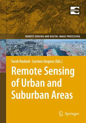
Remote Sensing of Urban and Suburban Areas: Remote Sensing and Digital Image Processing, cartea 10
Editat de Tarek Rashed, Carsten Jürgensen Limba Engleză Paperback – 5 sep 2012
| Toate formatele și edițiile | Preț | Express |
|---|---|---|
| Paperback (1) | 530.42 lei 43-57 zile | |
| SPRINGER NETHERLANDS – 5 sep 2012 | 530.42 lei 43-57 zile | |
| Hardback (1) | 592.61 lei 43-57 zile | |
| SPRINGER NETHERLANDS – 16 iun 2010 | 592.61 lei 43-57 zile |
Din seria Remote Sensing and Digital Image Processing
- 18%
 Preț: 1020.74 lei
 - 18%
 Preț: 1231.47 lei
 - 18%
 Preț: 944.82 lei
 - 24%
 Preț: 1613.59 lei
 - 18%
 Preț: 1385.19 lei
 - 24%
 Preț: 793.38 lei
 - 15%
 Preț: 640.37 lei
 - 18%
 Preț: 1112.15 lei
 - 18%
 Preț: 1408.08 lei
 - 15%
 Preț: 662.95 lei
 - 18%
 Preț: 954.45 lei
 - 18%
 Preț: 1389.78 lei
 - 24%
 Preț: 1476.65 lei
 - 18%
 Preț: 1122.10 lei
 - 18%
 Preț: 1407.64 lei
 - 20%
 Preț: 988.28 lei
 - 18%
 Preț: 945.76 lei
 - 24%
 Preț: 802.76 lei
 - 15%
 Preț: 650.86 lei
 - 15%
 Preț: 650.37 lei
 - 15%
 Preț: 642.51 lei
 - 15%
 Preț: 653.46 lei
Preț: 530.42 lei
Preț vechi: 624.03 lei
-15% Nou
Puncte Express: 796
Preț estimativ în valută:
101.53€ • 110.32$ • 85.34£
101.53€ • 110.32$ • 85.34£
Carte tipărită la comandă
Livrare economică 21 aprilie-05 mai
Preluare comenzi: 021 569.72.76
Specificații
ISBN-13: 9789400732407
ISBN-10: 9400732406
Pagini: 364
Ilustrații: XII, 352 p.
Dimensiuni: 155 x 235 x 19 mm
Greutate: 0.5 kg
Ediția:2010
Editura: SPRINGER NETHERLANDS
Colecția Springer
Seria Remote Sensing and Digital Image Processing
Locul publicării:Dordrecht, Netherlands
ISBN-10: 9400732406
Pagini: 364
Ilustrații: XII, 352 p.
Dimensiuni: 155 x 235 x 19 mm
Greutate: 0.5 kg
Ediția:2010
Editura: SPRINGER NETHERLANDS
Colecția Springer
Seria Remote Sensing and Digital Image Processing
Locul publicării:Dordrecht, Netherlands
Public țintă
ResearchCuprins
Urban and Suburban Areas as a Research Topic for Remote Sensing.- Urban and Suburban Areas as a Research Topic for Remote Sensing.- Theoretical Aspects.- The Structure and Form of Urban Settlements.- Defining Urban Areas.- The Spectral Dimension in Urban Remote Sensing.- The Spatial and Temporal Nature of Urban Objects.- The V-I-S Model: Quantifying the Urban Environment.- Techniques and Applications.- A Survey of the Evolution of Remote Sensing Imaging Systems and Urban Remote Sensing Applications.- Classification of Urban Areas: Inferring Land Use from the Interpretation of Land Cover.- Processing Techniques for Hyperspectral Data.- Segmentation and Object-Based Image Analysis.- Data Fusion in Remote Sensing of Urban and Suburban Areas.- Characterization and Monitoring of Urban/Peri-urban Ecological Function and Landscape Structure Using Satellite Data.- Remote Sensing of Desert Cities in Developing Countries.- Remote Sensing of Urban Environmental Conditions.- Remote Sensing of Urban Land Use Change in Developing Countries: An Example from Büyükçekmece, Istanbul, Turkey.- Using Satellite Images in Policing Urban Environments.- Using DMSP OLS Imagery to Characterize Urban Populations in Developed and Developing Countries.
Recenzii
From the reviews:
“The book presents theoretical issues and worthwhile practical applications of remote sensing of urban and suburban environments. … book provides dedicated contributions to several topics of fundamental importance, especially for undergraduate and graduate students as well as researchers and practitioners. … a valuable contribution to the current discussions regarding remote sensing of urban settlements.” (Tobias Matusch and Nima Ahmadian, Erde, Vol. 143 (3), 2012)
“The book presents theoretical issues and worthwhile practical applications of remote sensing of urban and suburban environments. … book provides dedicated contributions to several topics of fundamental importance, especially for undergraduate and graduate students as well as researchers and practitioners. … a valuable contribution to the current discussions regarding remote sensing of urban settlements.” (Tobias Matusch and Nima Ahmadian, Erde, Vol. 143 (3), 2012)
Textul de pe ultima copertă
"Remote Sensing of Urban and Suburban Areas" provides instructors with a text reference that has a logical and easy-to-follow flow of topics around which they can structure the syllabi of their urban remote sensing courses. Topics have been chosen to bridge the gap between remote sensing and urban studies through a better understanding of the science that underlies both fields. In so doing, the book includes 17 chapters written by leading international experts in respected fields to provide a balanced coverage of fundamental issues in both remote sensing and urban studies. Emphasis is placed on: theoretical and practical issues in contemporary urban studies and remote sensing; the spectral, spatial and temporal requirements of remotely sensed data in relation to various urban phenomena; methods and techniques for analyzing and integrating remotely sensed data and image processing with geographic information systems to address urban problems; and examples of applications in which applying remote sensing to tackle urban problems is deemed useful and important.This book will be of interest to university instructors, advanced undergraduate students, graduate students, and researchers in the fields of geography, architecture, engineering and urban planning.- Logical and easy-to-follow flow of topics around which university instructors can structure the syllabuses of their urban remote sensing courses- Set-up of chapters contains educational aids such as learning objectives, summarizing text boxes, exercises and learning activities at the end of each chapter.
Caracteristici
Logical and easy to follow flow of topics Contains educational aids such as: learning objectives, summarizing text boxes, exercises and learning activities at the end of each chapter Includes supplementary material: sn.pub/extras
