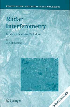
Radar Interferometry: Persistent Scatterer Technique: Remote Sensing and Digital Image Processing, cartea 12
Autor Bert M. Kampesen Limba Engleză Hardback – 4 aug 2006
| Toate formatele și edițiile | Preț | Express |
|---|---|---|
| Paperback (1) | 1377.15 lei 6-8 săpt. | |
| SPRINGER NETHERLANDS – 3 dec 2014 | 1377.15 lei 6-8 săpt. | |
| Hardback (1) | 1385.19 lei 6-8 săpt. | |
| SPRINGER NETHERLANDS – 4 aug 2006 | 1385.19 lei 6-8 săpt. |
Din seria Remote Sensing and Digital Image Processing
- 18%
 Preț: 1020.74 lei
 - 18%
 Preț: 1231.47 lei
 - 18%
 Preț: 944.82 lei
 - 15%
 Preț: 530.42 lei
 - 24%
 Preț: 1613.59 lei
 - 24%
 Preț: 793.38 lei
 - 15%
 Preț: 640.37 lei
 - 18%
 Preț: 1112.15 lei
 - 18%
 Preț: 1408.08 lei
 - 15%
 Preț: 662.95 lei
 - 18%
 Preț: 954.45 lei
 - 18%
 Preț: 1389.78 lei
 - 24%
 Preț: 1476.65 lei
 - 18%
 Preț: 1122.10 lei
 - 18%
 Preț: 1407.64 lei
 - 20%
 Preț: 988.28 lei
 - 18%
 Preț: 945.76 lei
 - 24%
 Preț: 802.76 lei
 - 15%
 Preț: 650.86 lei
 - 15%
 Preț: 650.37 lei
 - 15%
 Preț: 642.51 lei
 - 15%
 Preț: 653.46 lei
Preț: 1385.19 lei
Preț vechi: 1689.26 lei
-18% Nou
Puncte Express: 2078
Preț estimativ în valută:
265.07€ • 283.44$ • 220.100£
265.07€ • 283.44$ • 220.100£
Carte tipărită la comandă
Livrare economică 18 aprilie-02 mai
Preluare comenzi: 021 569.72.76
Specificații
ISBN-13: 9781402045769
ISBN-10: 140204576X
Pagini: 232
Ilustrații: XXI, 211 p.
Dimensiuni: 155 x 235 x 18 mm
Greutate: 0.56 kg
Ediția:2006
Editura: SPRINGER NETHERLANDS
Colecția Springer
Seria Remote Sensing and Digital Image Processing
Locul publicării:Dordrecht, Netherlands
ISBN-10: 140204576X
Pagini: 232
Ilustrații: XXI, 211 p.
Dimensiuni: 155 x 235 x 18 mm
Greutate: 0.56 kg
Ediția:2006
Editura: SPRINGER NETHERLANDS
Colecția Springer
Seria Remote Sensing and Digital Image Processing
Locul publicării:Dordrecht, Netherlands
Public țintă
Professional/practitionerCuprins
The Permanent Scatterer Technique.- The Integer Least-Squares Estimator.- The STUN Algorithm.- Synthetic Data Experiments.- Real Data Processing.- Conclusions and Recommendations.
Textul de pe ultima copertă
This volume is devoted to the Persistent Scatterer Technique, the latest development in radar interferometric data processing. Using this technique, millimetric displacements can be observed at hundreds of thousands of targets that are affected only slightly from temporal and geometric decorrelation, such as the walls and the roofs of houses, lamp posts, grates, window ledges, etc. All acquired data can be used by this technique, which enables the analysis of displacements since 1992 in any area world-wide, using the archived historical data of the ERS-1 and ERS-2 satellites. Data of other current and future sensors can also be processed using this technique. The original PS algorithm is revisited based on the main literature, and possible weak points are identified. The STUN (spatio-temporal unwrapping network) algorithm, developed to cope with these issues in a robust way, is presented and applied to two test sites. For the Berlin area, two data stacks of adjacent tracks are analyzed to assess the quality description provided by the STUN algorithm. For the Las Vegas test site, a combination of ERS and ENVISAT data is performed to estimate significant linear and seasonal displacements.
Audience
This book is of interest to scientists and professionals in geodesy and geophysics working with Radar Interferometry, studying urban displacements, earthquakes, or volcanoes.
Audience
This book is of interest to scientists and professionals in geodesy and geophysics working with Radar Interferometry, studying urban displacements, earthquakes, or volcanoes.
Caracteristici
Only book on Permanent Scatterer technique of radar interferometry Explains the Permanent Scatterer technique in detail, possible pitfalls, and details a newly developed stochastic model and estimator algorithm to cope with possible problems for the application of the PS technique The use of Permanent Scatterer allows very precise measurements of the displacement of hundreds of points per square kilometer Describes the only technique currently able to perform displacement measurements in the past, utilizing the ERS satellite data archive using data acquired from 1992-present Shows how to interpret results obtained by radar interferometry
