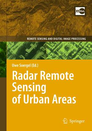
Radar Remote Sensing of Urban Areas: Remote Sensing and Digital Image Processing, cartea 15
Editat de Uwe Soergelen Limba Engleză Paperback – 5 mai 2012
| Toate formatele și edițiile | Preț | Express |
|---|---|---|
| Paperback (1) | 640.37 lei 6-8 săpt. | |
| SPRINGER NETHERLANDS – 5 mai 2012 | 640.37 lei 6-8 săpt. | |
| Hardback (1) | 645.47 lei 6-8 săpt. | |
| SPRINGER NETHERLANDS – 18 mar 2010 | 645.47 lei 6-8 săpt. |
Din seria Remote Sensing and Digital Image Processing
- 18%
 Preț: 1020.74 lei
 - 18%
 Preț: 1231.47 lei
 - 18%
 Preț: 944.82 lei
 - 15%
 Preț: 530.42 lei
 - 24%
 Preț: 1613.55 lei
 - 18%
 Preț: 1385.19 lei
 - 24%
 Preț: 793.36 lei
 - 18%
 Preț: 1112.15 lei
 - 18%
 Preț: 1408.08 lei
 - 15%
 Preț: 662.95 lei
 - 18%
 Preț: 954.45 lei
 - 18%
 Preț: 1389.78 lei
 - 24%
 Preț: 1476.62 lei
 - 18%
 Preț: 1122.10 lei
 - 18%
 Preț: 1407.64 lei
 - 20%
 Preț: 988.27 lei
 - 18%
 Preț: 945.76 lei
 - 24%
 Preț: 802.74 lei
 - 15%
 Preț: 650.86 lei
 - 15%
 Preț: 650.37 lei
 - 15%
 Preț: 642.51 lei
 - 15%
 Preț: 653.46 lei
Preț: 640.37 lei
Preț vechi: 753.39 lei
-15% Nou
Puncte Express: 961
Preț estimativ în valută:
122.54€ • 128.26$ • 101.99£
122.54€ • 128.26$ • 101.99£
Carte tipărită la comandă
Livrare economică 29 martie-12 aprilie
Preluare comenzi: 021 569.72.76
Specificații
ISBN-13: 9789400731721
ISBN-10: 9400731728
Pagini: 296
Ilustrații: XVI, 278 p. 120 illus.
Dimensiuni: 155 x 235 x 16 mm
Greutate: 0.42 kg
Ediția:2010
Editura: SPRINGER NETHERLANDS
Colecția Springer
Seria Remote Sensing and Digital Image Processing
Locul publicării:Dordrecht, Netherlands
ISBN-10: 9400731728
Pagini: 296
Ilustrații: XVI, 278 p. 120 illus.
Dimensiuni: 155 x 235 x 16 mm
Greutate: 0.42 kg
Ediția:2010
Editura: SPRINGER NETHERLANDS
Colecția Springer
Seria Remote Sensing and Digital Image Processing
Locul publicării:Dordrecht, Netherlands
Public țintă
Professional/practitionerCuprins
Review of Radar Remote Sensing on Urban Areas.- Rapid Mapping Using Airborne and Satellite SAR Images.- Feature Fusion Based on Bayesian Network Theory for Automatic Road Extraction.- Traffic Data Collection with TerraSAR-X and Performance Evaluation.- Object Recognition from Polarimetric SAR Images.- Fusion of Optical and SAR Images.- Estimation of Urban DSM from Mono-aspect InSAR Images.- Building Reconstruction from Multi-aspect InSAR Data.- SAR Simulation of Urban Areas: Techniques and Applications.- Urban Applications of Persistent Scatterer Interferometry.- Airborne Remote Sensing at Millimeter Wave Frequencies.
Textul de pe ultima copertă
This book presents a unique collection of state-of-the-art contributions by international remote sensing experts focussing on methodologies to extract information about urban areas from Synthetic Aperture Radar (SAR) data. SAR is an active remote sensing technique capable to gather data independently from sun light and weather conditions. Emphasizing technical and geometrical issues the potential and limits of SAR are addressed in focussed case studies, for example, the detection of buildings and roads, traffic monitoring, surface deformation monitoring, and urban change. These studies can be sorted into two groups: the mapping of the current urban state and the monitoring of change. The former covers, for instance, methodologies for the detection and reconstruction of individual buildings and road networks; the latter, for example, surface deformation monitoring and urban change. This includes also investigations related to the benefit of SAR Interferometry, which is useful to determine either digital elevation models and surface deformation or the radial velocity of objects (e.g. cars), and the Polarization of the signal that comprises valuable information about the type of soil and object geometry. Furthermore, the features of modern satellite and airborne sensor devices which provide high-spatial resolution of the urban scene are discussed.
Audience: This book will be of interest to scientists and professionals in geodesy, geography, architecture, engineering and urban planning.
Audience: This book will be of interest to scientists and professionals in geodesy, geography, architecture, engineering and urban planning.
Caracteristici
This book is a unique collection of state-of-the art contributions by international remote sensing experts focussing on methodologies to extract information about urban areas from Synthetic Aperture Radar data Very relevant questions related to mapping of urban areas are addressed in case studies, i.e., the detection of buildings and roads, traffic monitoring, surface deformation monitoring, and urban change SAR data of satellite and airborne sensors carriers are comprised Includes supplementary material: sn.pub/extras
