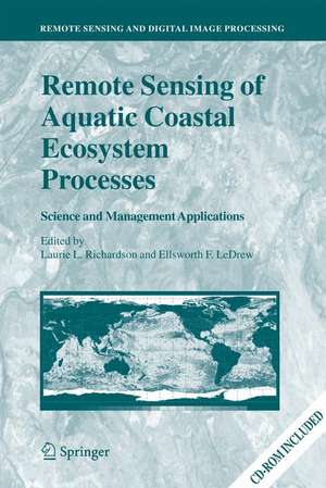
Remote Sensing of Aquatic Coastal Ecosystem Processes: Science and Management Applications: Remote Sensing and Digital Image Processing, cartea 9
Editat de Laurie L. Richardson, Ellsworth F. LeDrewen Limba Engleză Hardback – 2 feb 2006
Audience
This book is targeted for scientists and managers interested in using remote sensing in the study or management of aquatic coastal environments. With only limited discussion of optics and theory presented in the book, such researchers might benefit from the detailed presentations of aquatic spectral signatures, and to operational management issues. While not specifically written for remote sensing scientists, it will prove to be a useful reference for this community for the current status of aquatic coastal remote sensing.
| Toate formatele și edițiile | Preț | Express |
|---|---|---|
| Paperback (1) | 642.68 lei 6-8 săpt. | |
| SPRINGER NETHERLANDS – 23 noi 2014 | 642.68 lei 6-8 săpt. | |
| Hardback (1) | 653.46 lei 6-8 săpt. | |
| SPRINGER NETHERLANDS – 2 feb 2006 | 653.46 lei 6-8 săpt. |
Din seria Remote Sensing and Digital Image Processing
- 18%
 Preț: 1020.74 lei
 - 18%
 Preț: 1231.47 lei
 - 18%
 Preț: 944.82 lei
 - 15%
 Preț: 530.42 lei
 - 24%
 Preț: 1613.55 lei
 - 18%
 Preț: 1385.19 lei
 - 24%
 Preț: 793.36 lei
 - 15%
 Preț: 640.37 lei
 - 18%
 Preț: 1112.15 lei
 - 18%
 Preț: 1408.08 lei
 - 15%
 Preț: 662.95 lei
 - 18%
 Preț: 954.45 lei
 - 18%
 Preț: 1389.78 lei
 - 24%
 Preț: 1476.62 lei
 - 18%
 Preț: 1122.10 lei
 - 18%
 Preț: 1407.64 lei
 - 20%
 Preț: 988.27 lei
 - 18%
 Preț: 945.76 lei
 - 24%
 Preț: 802.74 lei
 - 15%
 Preț: 650.86 lei
 - 15%
 Preț: 650.37 lei
 - 15%
 Preț: 642.51 lei
Preț: 653.46 lei
Preț vechi: 768.78 lei
-15% Nou
Puncte Express: 980
Preț estimativ în valută:
125.04€ • 130.24$ • 104.24£
125.04€ • 130.24$ • 104.24£
Carte tipărită la comandă
Livrare economică 28 martie-11 aprilie
Preluare comenzi: 021 569.72.76
Specificații
ISBN-13: 9781402039676
ISBN-10: 1402039670
Pagini: 344
Ilustrații: XVII, 324 p. With online files/update.
Dimensiuni: 160 x 240 x 27 mm
Greutate: 0.78 kg
Ediția:2006
Editura: SPRINGER NETHERLANDS
Colecția Springer
Seria Remote Sensing and Digital Image Processing
Locul publicării:Dordrecht, Netherlands
ISBN-10: 1402039670
Pagini: 344
Ilustrații: XVII, 324 p. With online files/update.
Dimensiuni: 160 x 240 x 27 mm
Greutate: 0.78 kg
Ediția:2006
Editura: SPRINGER NETHERLANDS
Colecția Springer
Seria Remote Sensing and Digital Image Processing
Locul publicării:Dordrecht, Netherlands
Public țintă
ResearchCuprins
Section I - Science Applications.- REMOTE SENSING AND THE SCIENCE, MONITORING, AND MANAGEMENT OF AQUATIC COASTAL ECOSYSTEMS.- EXTREME EVENTS AND PERTURBATIONS OF COASTAL ECOSYSTEMS.- OPTICAL REMOTE SENSING TECHNIQUES TO ESTIMATE PHYTOPLANKTON CHLOROPHYLL a CONCENTRATIONS IN COASTAL.- A TOOL FOR INVERSE MODELING OF SPECTRAL MEASUREMENTS IN DEEP AND SHALLOW WATERS.- INTEGRATION OF CORAL REEF ECOSYSTEM PROCESS STUDIES AND REMOTE SENSING.- Section II - Monitoring Applications.- INFRASTRUCTURE AND CAPABILITIES OF A NEAR REAL-TIME METEOROLOGICAL AND OCEANOGRAPHIC IN SITU INSTRUM.- AIRBORNE LASER ALTIMETRY FOR PREDICTIVE MODELING OF COASTAL STORM-SURGE FLOODING.- INTEGRATION OF NEW DATA TYPES WITH HISTORICAL ARCHIVES TO PROVIDE INSIGHT INTO COASTAL ECOSYSTEM CHA.- Section III - Management Applications.- OBSERVING COASTAL WATERS WITH SPACEBORNE SENSORS.- THE ROLE OF INTEGRATED INFORMATION ACQUISITION AND MANAGEMENT IN THE ANALYSIS OF COASTAL ECOSYSTEM C.- MAPPING OF CORAL REEFS FOR MANAGEMENT OF MARINE PROTECTED AREAS IN DEVELOPING NATIONS USING REMOTE S.- DATA SYNTHESIS FOR COASTAL AND CORAL REEF ECOSYSTEM MANAGEMENT AT REGIONAL AND GLOBAL SCALES.- RECOMMENDATIONS FOR SCIENTISTS AND MANAGERS FOR APPLICATION OF REMOTE SENSING TO COASTAL WATERS.
Recenzii
From the reviews:
"The objective is to introduce aquatic scientists and managers of coastal aquatic ecosystems to the possibilities of remote sensing techniques. … The book is one of the rare collective works, in which the subject matter is so well integrated and presented by the editors. When this reviewer read in the introduction that the editors suggest the book can be used as a resource manual, he did not believe the assumption at first. However, he now believes this to be quiet true." (Geomatica, Vol. 61 (3), 2007)
"The objective is to introduce aquatic scientists and managers of coastal aquatic ecosystems to the possibilities of remote sensing techniques. … The book is one of the rare collective works, in which the subject matter is so well integrated and presented by the editors. When this reviewer read in the introduction that the editors suggest the book can be used as a resource manual, he did not believe the assumption at first. However, he now believes this to be quiet true." (Geomatica, Vol. 61 (3), 2007)
Caracteristici
Emphasis on real use of remote sensing to support current science and management Case studies and overview of the use of remote sensing in coastal management Includes supplementary material: sn.pub/extras
