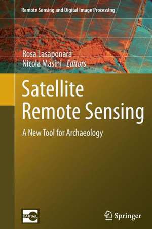
Satellite Remote Sensing: A New Tool for Archaeology: Remote Sensing and Digital Image Processing, cartea 16
Editat de Rosa Lasaponara, Nicola Masinien Limba Engleză Paperback – 22 feb 2014
The recent increasing development of EO techniques and the tremendous advances in Information and Communication Technologies (ICT) have resulted primarily in Cultural Heritage applications. The book focuses on new challenging prospects for the use of EO in archaeology not only for probing the subsurface to unveil sites and artifacts, but also for the management and valorization as well as for the monitoring and preservation of cultural resources. The book provides a first-class understanding of this revolutionary scenario which was unthinkable several years ago.
The book offers: (i) an excellent collection of outstanding articles focusing on satellite data processing, analysis and interpretation for archaeological applications, (ii) impressive case studies, (iii) striking examples of the high potential of the integration of multi-temporal, multi-scale, multi-sensors techniques.
Each chapter is composed as an authoritative contribution to help the reader grasp the value of its content. The authors are renowned experts from the international scientific community.
Audience: This book will be of interest to scientists in remote sensing applied to archeology, geoarcheology, paleo-environment, paleo-climate and cultural heritage.
| Toate formatele și edițiile | Preț | Express |
|---|---|---|
| Paperback (1) | 1112.15 lei 6-8 săpt. | |
| SPRINGER NETHERLANDS – 22 feb 2014 | 1112.15 lei 6-8 săpt. | |
| Hardback (1) | 1116.26 lei 6-8 săpt. | |
| SPRINGER NETHERLANDS – 18 ian 2012 | 1116.26 lei 6-8 săpt. |
Din seria Remote Sensing and Digital Image Processing
- 18%
 Preț: 1020.74 lei
 - 18%
 Preț: 1231.47 lei
 - 18%
 Preț: 944.82 lei
 - 15%
 Preț: 530.42 lei
 - 24%
 Preț: 1613.59 lei
 - 18%
 Preț: 1385.19 lei
 - 24%
 Preț: 793.38 lei
 - 15%
 Preț: 640.37 lei
 - 18%
 Preț: 1408.08 lei
 - 15%
 Preț: 662.95 lei
 - 18%
 Preț: 954.45 lei
 - 18%
 Preț: 1389.78 lei
 - 24%
 Preț: 1476.65 lei
 - 18%
 Preț: 1122.10 lei
 - 18%
 Preț: 1407.64 lei
 - 20%
 Preț: 988.28 lei
 - 18%
 Preț: 945.76 lei
 - 24%
 Preț: 802.76 lei
 - 15%
 Preț: 650.86 lei
 - 15%
 Preț: 650.37 lei
 - 15%
 Preț: 642.51 lei
 - 15%
 Preț: 653.46 lei
Preț: 1112.15 lei
Preț vechi: 1356.29 lei
-18% Nou
Puncte Express: 1668
Preț estimativ în valută:
212.84€ • 221.38$ • 175.71£
212.84€ • 221.38$ • 175.71£
Carte tipărită la comandă
Livrare economică 14-28 aprilie
Preluare comenzi: 021 569.72.76
Specificații
ISBN-13: 9789400796157
ISBN-10: 9400796153
Pagini: 384
Ilustrații: XVIII, 366 p.
Dimensiuni: 155 x 235 x 28 mm
Greutate: 0.54 kg
Ediția:2012
Editura: SPRINGER NETHERLANDS
Colecția Springer
Seria Remote Sensing and Digital Image Processing
Locul publicării:Dordrecht, Netherlands
ISBN-10: 9400796153
Pagini: 384
Ilustrații: XVIII, 366 p.
Dimensiuni: 155 x 235 x 28 mm
Greutate: 0.54 kg
Ediția:2012
Editura: SPRINGER NETHERLANDS
Colecția Springer
Seria Remote Sensing and Digital Image Processing
Locul publicării:Dordrecht, Netherlands
Public țintă
ResearchCuprins
Foreword by Volker Liebig.- Foreword by Tom G. Farr.- Acknowledgements.- Introduction.- Part I Optical Satellite Remote Sensing in Archaeology: An Overview.- 1 Remote Sensing in Archaeology: From Visual Data Interpretation to Digital Data Manipulation; Rosa Lasaponara and Nicola Masini.- 2 Image Enhancement, Feature Extraction and Geospatial Analysis in an Archaeological Perspective; Rosa Lasaponara and Nicola Masini .- 3 Pattern Recognition and Classification Using VHR Data for Archaeological Research; Rosa Lasaponara and Nicola Masini.- 4 Pan-Sharpening Techniques to Enhance Archaeological Marks: An Overview; Rosa Lasaponara and Nicola Masini.- Part II Satellite Remote Sensing for Cultural Heritage Documentation and Management.- 5 Remote Sensing and Integration with Other Geomatic Techniques in Archaeology; Gabriele Bitelli.- 6 Integrated Methodologies for the Archaeological Map of an Ancient City and Its Territory: The Case of Hierapolis in Phrygia; Giuseppe Scardozzi.-
7 NASA Remote Sensing and Archaeology; Marco J. Giardino.- 8 Satellite-Based Monitoring of Archaeological Looting in Peru; Rosa Lasaponara, Maria Danese, and Nicola Masini.- Part III Palaeoenvironment and Archaeology: The Contribution of Satellite Observation.- 9 Uncovering Angkor: Integrated Remote Sensing Applications in the Archaeology of Early Cambodia; Damian Evans and Arianna Traviglia.- 10 Remote Sensing Study of the Ancient Jabali Silver Mines (Yemen): From Past to Present; Jean-Paul Deroin, Florian Téreygeol, and Jűrgen Heckes.- 11 Irrigation Is Forever: A Study of the Post-destruction Movement of Water Across the Ancient Site of Sri Ksetra, Central Burma; Janice Stargardt, Gabriel Amable, and Bernard Devereux.- 12 Following the Ancient Nasca Puquios from Space; Rosa Lasaponara and Nicola Masini.- 13 High-Resolution Satellite Imagery and the Detection ofBuried Archaeological Features in Ploughed Landscapes; Ioana A. Oltean and Lauren L. Abell.- 14 Integrated Remote Sensing Approach in Cahuachi (Peru): Studies and Results of the ITACA Mission (2007–2010); Nicola Masini, Rosa Lasaponara, Enzo Rizzo, and Giuseppe Orefici.- Index.
7 NASA Remote Sensing and Archaeology; Marco J. Giardino.- 8 Satellite-Based Monitoring of Archaeological Looting in Peru; Rosa Lasaponara, Maria Danese, and Nicola Masini.- Part III Palaeoenvironment and Archaeology: The Contribution of Satellite Observation.- 9 Uncovering Angkor: Integrated Remote Sensing Applications in the Archaeology of Early Cambodia; Damian Evans and Arianna Traviglia.- 10 Remote Sensing Study of the Ancient Jabali Silver Mines (Yemen): From Past to Present; Jean-Paul Deroin, Florian Téreygeol, and Jűrgen Heckes.- 11 Irrigation Is Forever: A Study of the Post-destruction Movement of Water Across the Ancient Site of Sri Ksetra, Central Burma; Janice Stargardt, Gabriel Amable, and Bernard Devereux.- 12 Following the Ancient Nasca Puquios from Space; Rosa Lasaponara and Nicola Masini.- 13 High-Resolution Satellite Imagery and the Detection ofBuried Archaeological Features in Ploughed Landscapes; Ioana A. Oltean and Lauren L. Abell.- 14 Integrated Remote Sensing Approach in Cahuachi (Peru): Studies and Results of the ITACA Mission (2007–2010); Nicola Masini, Rosa Lasaponara, Enzo Rizzo, and Giuseppe Orefici.- Index.
Recenzii
From the reviews:
“It provides both a good basis for analysis as well as several test cases illustrating the use of remote sensing techniques for archaeology. The book begins with an excellent introduction to remote sensing techniques suitable for undergraduate or graduate instruction. … The book is well written and organized. The illustrations, important for a book on remote sensing, are of high quality and many are in color. … provides a blueprint for future archaeologists seeking to make the most of remote sensing.” (Tom G. Farr, IEEE Geoscience and Remote Sensing Newsletter, Issue 164, September, 2012)
“This book is divided into three sections and has a mix of chapters split between methodology and case studies … . The case studies are generally interesting with examples of the combination of techniques together with various issues caused by data availability, sensor variability, etc. … Overall, it is a useful volume … of more value to those interested in the technical aspects of processing and using the data … .” (Simon Crutchley, International Journal of Remote Sensing, Vol. 34 (2), January, 2013)
“I found this book very practical and it has significant advantages over other archaeological remote sensing books in that it provides methodological details … that I think many students of archaeological remote sensing would appreciate. … there are not many books like this in archaeology, as I found the details covered on the analytical methods valuable, particularly for students. I do highly recommend this volume for those interested in learning about how satellite remote sensing data and techniques can be applied to archaeological problems.” (Mark Altaweel, International Journal of Applied Earth Observation and Geoinformation, 2012)
Textul de pe ultima copertă
This book provides a state-of-the-art overview of satellite archaeology and it is an invaluable volume for archaeologists, scientists, and managers interested in using satellite Earth Observation (EO) to improve the traditional approach for archaeological investigation, protection and management of Cultural Heritage.
The recent increasing development of EO techniques and the tremendous advances in Information and Communication Technologies (ICT) have resulted primarily in Cultural Heritage applications. The book focuses on new challenging prospects for the use of EO in archaeology not only for probing the subsurface to unveil sites and artifacts, but also for the management and valorization as well as for the monitoring and preservation of cultural resources. The book provides a first-class understanding of this revolutionary scenario which was unthinkable several years ago.
The book offers: (i) an excellent collection of outstanding articles focusing on satellite data processing, analysis and interpretation for archaeological applications, (ii) impressive case studies, (iii) striking examples of the high potential of the integration of multi-temporal, multi-scale, multi-sensors techniques.
Each chapter is composed as an authoritative contribution to help the reader grasp the value of its content. The authors are renowned experts from the international scientific community.
Audience: This book will be of interest to scientists in remote sensing applied to archeology, geoarcheology, paleo-environment, paleo-climate and cultural heritage.
Caracteristici
Excellent collection of outstanding articles focused on: advanced satellite data processing, analysis and interpretation for archaeological applications Excellent examples of the high potentiality of the Integration of EO multitemporal, multiscale, multisensors techniques Significant examples of the integration of EO techniques with other traditional archaeological data source, such as aerial photos, field survey, trials, excavations and historical documentation
