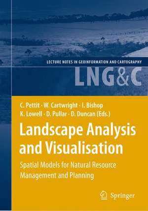
Landscape Analysis and Visualisation: Spatial Models for Natural Resource Management and Planning: Lecture Notes in Geoinformation and Cartography
Editat de Christopher Pettit, William Cartwright, Ian Bishop, Kim Lowell, David Pullar, David Duncanen Limba Engleză Hardback – 24 iun 2008
| Toate formatele și edițiile | Preț | Express |
|---|---|---|
| Paperback (1) | 1233.37 lei 6-8 săpt. | |
| Springer Berlin, Heidelberg – 21 noi 2014 | 1233.37 lei 6-8 săpt. | |
| Hardback (1) | 1245.34 lei 6-8 săpt. | |
| Springer Berlin, Heidelberg – 24 iun 2008 | 1245.34 lei 6-8 săpt. |
Din seria Lecture Notes in Geoinformation and Cartography
- 18%
 Preț: 1420.09 lei
 - 20%
 Preț: 569.73 lei
 - 18%
 Preț: 951.29 lei
 - 18%
 Preț: 963.15 lei
 - 18%
 Preț: 948.16 lei
 - 18%
 Preț: 951.47 lei
 - 18%
 Preț: 1228.47 lei
 - 18%
 Preț: 956.33 lei
 - 18%
 Preț: 1251.82 lei
 - 18%
 Preț: 956.03 lei
 - 18%
 Preț: 1235.43 lei
 - 18%
 Preț: 940.87 lei
 - 18%
 Preț: 1845.48 lei
 - 15%
 Preț: 644.95 lei
 - 18%
 Preț: 945.79 lei
 - 18%
 Preț: 948.16 lei
 - 18%
 Preț: 961.23 lei
 - 18%
 Preț: 1239.49 lei
 - 18%
 Preț: 947.35 lei
 - 18%
 Preț: 957.62 lei
 - 5%
 Preț: 1104.48 lei
 - 18%
 Preț: 1232.26 lei
 - 18%
 Preț: 1420.09 lei
 - 18%
 Preț: 952.57 lei
 - 18%
 Preț: 959.36 lei
 - 18%
 Preț: 953.82 lei
 - 18%
 Preț: 953.20 lei
 - 18%
 Preț: 1233.06 lei
 - 18%
 Preț: 950.52 lei
 - 18%
 Preț: 947.35 lei
 - 18%
 Preț: 1234.62 lei
 - 20%
 Preț: 558.62 lei
 - 18%
 Preț: 957.62 lei
 - 18%
 Preț: 1226.73 lei
 - 18%
 Preț: 1233.69 lei
 - 18%
 Preț: 947.85 lei
 - 18%
 Preț: 952.09 lei
 - 18%
 Preț: 1242.03 lei
 - 18%
 Preț: 1550.30 lei
 - 18%
 Preț: 953.65 lei
Preț: 1245.34 lei
Preț vechi: 1518.71 lei
-18% Nou
Puncte Express: 1868
Preț estimativ în valută:
238.30€ • 249.94$ • 198.38£
238.30€ • 249.94$ • 198.38£
Carte tipărită la comandă
Livrare economică 01-15 aprilie
Preluare comenzi: 021 569.72.76
Specificații
ISBN-13: 9783540691679
ISBN-10: 3540691677
Pagini: 646
Ilustrații: XXXII, 614 p.
Dimensiuni: 155 x 235 x 46 mm
Greutate: 1.24 kg
Ediția:2008
Editura: Springer Berlin, Heidelberg
Colecția Springer
Seria Lecture Notes in Geoinformation and Cartography
Locul publicării:Berlin, Heidelberg, Germany
ISBN-10: 3540691677
Pagini: 646
Ilustrații: XXXII, 614 p.
Dimensiuni: 155 x 235 x 46 mm
Greutate: 1.24 kg
Ediția:2008
Editura: Springer Berlin, Heidelberg
Colecția Springer
Seria Lecture Notes in Geoinformation and Cartography
Locul publicării:Berlin, Heidelberg, Germany
Public țintă
ResearchCuprins
Understanding Landscapes through Knowledge Management Frameworks, Spatial Models, Decision Support Tools and Visualisation.- Natural Resource Knowledge Management Frameworks and Tools.- Reading between the Lines: Knowledge for Natural Resource Management.- Improving the Use of Science in Evidencebased Policy: Some Victorian Experiences in Natural Resource Management.- The Catchment Analysis Tool: Demonstrating the Benefits of Interconnected Biophysical Models.- The Application of a Simple Spatial Multi-Criteria Analysis Shell to Natural Resource Management Decision Making.- Platform for Environmental Modelling Support: a Grid Cell Data Infrastructure for Modellers.- Integrating the Ecology of Landscapes into Landscape Analysis and Visualisation.- Looking at Landscapes for Biodiversity: Whose View Will Do?.- Native Vegetation Condition: Site to Regional Assessments.- Towards Adaptive Management of Native Vegetation in Regional Landscapes.- Revegetation and the Significance of Timelags in Provision of Habitat Resources for Birds.- The Application of Genetic Markers to Landscape Management.- Scenario Analysis with Performance Indicators: a Case Study for Forest Linkage Restoration.- Socioeconomic Dimensions to Landscapes.- Strategic Spatial Governance: Deriving Social–Ecological Frameworks for Managing Landscapes and Regions.- Placing People at the Centre of Landscape Assessment.- The Social Landscapes of Rural Victoria.- A Decision Aiding System for Predicting People‘s Scenario Preferences.- Land Use Change and Scenario Modelling.- Mapping and Modelling Land Use Change: an Application of the SLEUTH Model.- Uncertainty in Landscape Models: Sources, Impacts and Decision Making.- Assessing Water Quality Impacts of Community Defined Land Use Change Scenarios for theDouglas Shire, Far North Queensland.- Analysing Landscape Futures for Dryland Agricultural Areas: a Case Study in the Lower Murray Region of Southern Australia.- Applying the What If? Planning Support System for Better Understanding Urban Fringe Growth.- Landscape Visualisation.- Understanding Place and Agreeing Purpose: the Role of Virtual Worlds.- Geographic Landscape Visualisation in Planning Adaptation to Climate Change in Victoria, Australia.- Visualising Alternative Futures.- Virtual Globes: the Next GIS?.- A Virtual Knowledge World for Natural Resource Management.- Computer Games for Interacting with a Rural Landscape.- Automated Generation of Enhanced Virtual Environments for Collaborative Decision Making Via a Live Link to GIS.- Land Use Decision Making in a Virtual Environment.
Caracteristici
Offers buyers comprehensive detail of a broad spectrum of new technologies and approaches in understanding and visualising landscape change through the combination of GIS, 3D visualisation and knowledge management frameworks and tools Includes supplementary material: sn.pub/extras
