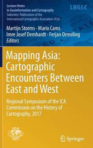
Mapping Asia: Cartographic Encounters Between East and West: Regional Symposium of the ICA Commission on the History of Cartography, 2017: Lecture Notes in Geoinformation and Cartography
Editat de Martijn Storms, Mario Cams, Imre Josef Demhardt, Ferjan Ormelingen Limba Engleză Hardback – 28 iun 2018
| Toate formatele și edițiile | Preț | Express |
|---|---|---|
| Paperback (1) | 1544.32 lei 6-8 săpt. | |
| Springer International Publishing – feb 2019 | 1544.32 lei 6-8 săpt. | |
| Hardback (1) | 1550.30 lei 6-8 săpt. | |
| Springer International Publishing – 28 iun 2018 | 1550.30 lei 6-8 săpt. |
Din seria Lecture Notes in Geoinformation and Cartography
- 18%
 Preț: 1420.09 lei
 - 20%
 Preț: 569.73 lei
 - 18%
 Preț: 951.29 lei
 - 18%
 Preț: 963.15 lei
 - 18%
 Preț: 948.16 lei
 - 18%
 Preț: 951.47 lei
 - 18%
 Preț: 1228.47 lei
 - 18%
 Preț: 956.33 lei
 - 18%
 Preț: 1251.82 lei
 - 18%
 Preț: 956.03 lei
 - 18%
 Preț: 1235.43 lei
 - 18%
 Preț: 940.87 lei
 - 18%
 Preț: 1845.48 lei
 - 15%
 Preț: 644.95 lei
 - 18%
 Preț: 945.79 lei
 - 18%
 Preț: 948.16 lei
 - 18%
 Preț: 1245.34 lei
 - 18%
 Preț: 961.23 lei
 - 18%
 Preț: 1239.49 lei
 - 18%
 Preț: 947.35 lei
 - 18%
 Preț: 957.62 lei
 - 5%
 Preț: 1104.48 lei
 - 18%
 Preț: 1232.26 lei
 - 18%
 Preț: 1420.09 lei
 - 18%
 Preț: 952.57 lei
 - 18%
 Preț: 959.36 lei
 - 18%
 Preț: 953.82 lei
 - 18%
 Preț: 953.20 lei
 - 18%
 Preț: 1233.06 lei
 - 18%
 Preț: 950.52 lei
 - 18%
 Preț: 947.35 lei
 - 18%
 Preț: 1234.62 lei
 - 20%
 Preț: 558.62 lei
 - 18%
 Preț: 957.62 lei
 - 18%
 Preț: 1226.73 lei
 - 18%
 Preț: 1233.69 lei
 - 18%
 Preț: 947.85 lei
 - 18%
 Preț: 952.09 lei
 - 18%
 Preț: 1242.03 lei
 - 18%
 Preț: 953.65 lei
Preț: 1550.30 lei
Preț vechi: 1890.61 lei
-18% Nou
Puncte Express: 2325
Preț estimativ în valută:
296.64€ • 310.56$ • 245.46£
296.64€ • 310.56$ • 245.46£
Carte tipărită la comandă
Livrare economică 05-19 aprilie
Preluare comenzi: 021 569.72.76
Specificații
ISBN-13: 9783319904054
ISBN-10: 3319904051
Pagini: 252
Ilustrații: X, 299 p. 88 illus., 77 illus. in color.
Dimensiuni: 155 x 235 mm
Greutate: 0.61 kg
Ediția:1st ed. 2019
Editura: Springer International Publishing
Colecția Springer
Seriile Lecture Notes in Geoinformation and Cartography, Publications of the International Cartographic Association (ICA)
Locul publicării:Cham, Switzerland
Cuprins
Will be updated upon the receipt of the manuscript
Recenzii
“The essays are academic articles intended for academic use by university professors, researchers, or students. That said, for those academicians with an interest in Eastern and Western cartographic history, this book is an invaluable resource.” (Jasmin Khangura, Cartographic Perspectives, November 19, 2019)
Notă biografică
Martijn Storms (Arnhem, 1978) studied human geography and planning at Utrecht University, where he specialised in GIS and cartography. He is the curator of maps and atlases at Leiden University Libraries and project coordinator for Koeman’s Atlantes Neerlandici at Brill publishers. Besides, he is a member of the editing board of Caert-Thresoor, the Dutch journal on the history of cartography and national representative of the Netherlands for Imago Mundi. He was symposium director of the Mapping Asia symposium, reflected in this volume.
Mario Cams obtained his PhD from the University of Leuven in 2015 and is currently Assistant Professor at the University of Macau’s Department of History. He is the author of Companions in Geography: East-West Collaboration in the Mapping of Qing China (c. 1685–1735) (Leiden/Boston: Brill, 2017), in which he revisits the early 18th century surveying and mapping of Qing China, one of the largest cartographic endeavors of the early modern world. His current research continues to focus on Qing cartography, as well as on exchanges in maps and geographies between Europe and East Asia before the 20th century.
Imre Josef Demhardt is interested in post-enlightenment cartography, colonialism, and regional studies with a focus on Central Europe, Sub-Saharan Africa, and North America. Besides numerous articles and several books on these subjects, he is involved as coeditor of Vol. 5 (Nineteenth Century) in the encyclopedia project on the History of Cartography. He holds the Garrett Chair in the History of Cartography at the University of Texas at Arlington and currently serves as Chair of the ICA Commission on the History of Cartography.
Ferjan Ormeling held the chair of cartography at Utrecht University 1985–2010 and since then is part of the Explokart research group at the University of Amsterdam. His research focuses on atlas cartography, toponymyand the cartographic history of the Indonesian archipelago, either separately or in combination. He was one of the editors of the national atlases of the Netherlands and contributed to the Comprehensive Atlas of the Dutch East India Company. From 2007–2017 he was vice-chair of the United Nations Group of Experts on Geographical Names.
Textul de pe ultima copertă
This proceedings book presents the first-ever cross-disciplinary analysis of 16th–20th century South, East, and Southeast Asian cartography. The central theme of the conference was the mutual influence of Western and Asian cartographic traditions, and the focus was on points of contact between Western and Asian cartographic history. Geographically, the topics were limited to South Asia, East Asia and Southeast Asia, with special attention to India, China, Japan, Korea and Indonesia. Topics addressed included Asia’s place in the world, the Dutch East India Company, toponymy, Philipp Franz von Siebold, maritime cartography, missionary mapping and cadastral mapping.
Caracteristici
Presents the first-ever cross-disciplinary analysis of 16th–20th century South, East, and Southeast Asian cartography Pursues an interdisciplinary approach, bringing together leading and talented experts in their fields The only proceedings of their kind on the market
