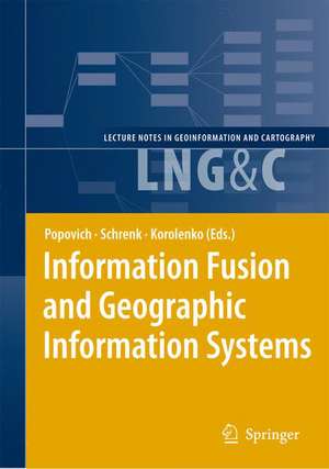
Information Fusion and Geographic Information Systems: Proceedings of the Third International Workshop: Lecture Notes in Geoinformation and Cartography
Editat de Vasily V. Popovich, Manfred Schrenk, Kyrill V. Korolenkoen Limba Engleză Hardback – 25 iun 2007
| Toate formatele și edițiile | Preț | Express |
|---|---|---|
| Paperback (1) | 947.18 lei 6-8 săpt. | |
| Springer Berlin, Heidelberg – 30 noi 2010 | 947.18 lei 6-8 săpt. | |
| Hardback (1) | 953.20 lei 6-8 săpt. | |
| Springer Berlin, Heidelberg – 25 iun 2007 | 953.20 lei 6-8 săpt. |
Din seria Lecture Notes in Geoinformation and Cartography
- 18%
 Preț: 1420.09 lei
 - 20%
 Preț: 569.74 lei
 - 18%
 Preț: 951.29 lei
 - 18%
 Preț: 963.15 lei
 - 18%
 Preț: 948.16 lei
 - 18%
 Preț: 951.47 lei
 - 18%
 Preț: 1228.47 lei
 - 18%
 Preț: 956.33 lei
 - 18%
 Preț: 1251.82 lei
 - 18%
 Preț: 956.03 lei
 - 18%
 Preț: 1235.43 lei
 - 18%
 Preț: 940.87 lei
 - 18%
 Preț: 1845.48 lei
 - 15%
 Preț: 644.95 lei
 - 18%
 Preț: 945.79 lei
 - 18%
 Preț: 948.16 lei
 - 18%
 Preț: 1245.34 lei
 - 18%
 Preț: 961.23 lei
 - 18%
 Preț: 1239.49 lei
 - 18%
 Preț: 947.35 lei
 - 18%
 Preț: 957.62 lei
 - 5%
 Preț: 1104.48 lei
 - 18%
 Preț: 1232.26 lei
 - 18%
 Preț: 1420.09 lei
 - 18%
 Preț: 952.57 lei
 - 18%
 Preț: 959.36 lei
 - 18%
 Preț: 953.82 lei
 - 18%
 Preț: 1233.06 lei
 - 18%
 Preț: 950.52 lei
 - 18%
 Preț: 947.35 lei
 - 18%
 Preț: 1234.62 lei
 - 20%
 Preț: 558.63 lei
 - 18%
 Preț: 957.62 lei
 - 18%
 Preț: 1226.73 lei
 - 18%
 Preț: 1233.69 lei
 - 18%
 Preț: 947.85 lei
 - 18%
 Preț: 952.09 lei
 - 18%
 Preț: 1242.03 lei
 - 18%
 Preț: 1550.30 lei
 - 18%
 Preț: 953.65 lei
Preț: 953.20 lei
Preț vechi: 1162.43 lei
-18% Nou
Puncte Express: 1430
Preț estimativ în valută:
182.42€ • 198.08$ • 153.23£
182.42€ • 198.08$ • 153.23£
Carte tipărită la comandă
Livrare economică 22 aprilie-06 mai
Preluare comenzi: 021 569.72.76
Specificații
ISBN-13: 9783540376286
ISBN-10: 3540376283
Pagini: 600
Ilustrații: XIII, 335 p.
Dimensiuni: 155 x 235 x 27 mm
Greutate: 0.67 kg
Ediția:2007
Editura: Springer Berlin, Heidelberg
Colecția Springer
Seria Lecture Notes in Geoinformation and Cartography
Locul publicării:Berlin, Heidelberg, Germany
ISBN-10: 3540376283
Pagini: 600
Ilustrații: XIII, 335 p.
Dimensiuni: 155 x 235 x 27 mm
Greutate: 0.67 kg
Ediția:2007
Editura: Springer Berlin, Heidelberg
Colecția Springer
Seria Lecture Notes in Geoinformation and Cartography
Locul publicării:Berlin, Heidelberg, Germany
Public țintă
Academic/professional/technical: Research and professionalCuprins
Invited Papers.- New Challenges for Defining Information Fusion Requirements.- Situation Management: Basic Concepts and Approaches.- Maritime GIS: From Monitoring to Simulation Systems.- Data, Information and Knowledge Harmonization, Integration and Fusion in GIS.- Intelligent Images Analysis in GIS.- Context-Driven Information Fusion for Operational Decision Making in Humanitarian Logistics.- From Battle Management Language (BML) to Automatic Information Fusion.- Centrope MAP: Combining X-Border Information from Multiple Sources for Planning Purposes.- Information Assurance and Protection in GIS.- Software Environment for Simulation and Evaluation of a Security Operation Center.- Security Policy Verification Tool for Geographical Information Systems.- Architecture Types of the Bit Permutation Instruction for General Purpose Processors.- New Public Key Cryptosystems Based on Difficulty of Factorization and Discrete Logarithm Problems.- GIS as a Basis for Monitoring Systems.- Application of a Dynamic Recurrent Neural Network in Spatio-Temporal Forecasting.- System of Traffic Control on the Basis of Cartographic Databases and Geoinformation Technologies.- Information Fusion of Land Laser Scanning for Geographic Information Systems.- Using GIS to Analyze Acute Myocardial Infarction in Turkey.- Ontologies and Programming Technologies for GIS and GIS Applications.- Obtaining Semantic Descriptions Based on Conceptual Schemas Embedded into a Geographic Context.- Representing the Semantic Content of Topological Relations into Spatial Databases.- Some Remarks on Topological Abstraction in Multi Representation Databases.- Intelligent Simulation of Hydrophysical Fields by Immunocomputing.- Visual Modeling of Spatial Processes.- Universal Data Model for Intelligent GIS.- 3D Graphics Applied to Maritime Safety.- Operations Research and TSMO for GIS Applications.- Northern Shield US-Russia Maritime Energy Security Cooperation.- Space-Extensive Targets Radar Search in the Presence of Noise.- Empirical Bayes Trajectory Estimation Based on Bearings from Moving Observer.
Caracteristici
Introduces research results received in the areas of information integration, development of GIS and GIS-applications for a wide spectrum of information systems
