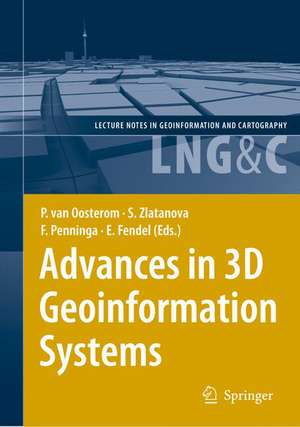
Advances in 3D Geoinformation Systems: Lecture Notes in Geoinformation and Cartography
Editat de Peter van Oosterom, Sisi Zlatanova, Friso Penninga, Elfriede Fendelen Limba Engleză Hardback – 22 noi 2007
| Toate formatele și edițiile | Preț | Express |
|---|---|---|
| Paperback (1) | 1224.85 lei 6-8 săpt. | |
| Springer Berlin, Heidelberg – 5 dec 2014 | 1224.85 lei 6-8 săpt. | |
| Hardback (1) | 1233.69 lei 6-8 săpt. | |
| Springer Berlin, Heidelberg – 22 noi 2007 | 1233.69 lei 6-8 săpt. |
Din seria Lecture Notes in Geoinformation and Cartography
- 18%
 Preț: 1420.09 lei
 - 20%
 Preț: 569.73 lei
 - 18%
 Preț: 951.29 lei
 - 18%
 Preț: 963.15 lei
 - 18%
 Preț: 948.16 lei
 - 18%
 Preț: 951.47 lei
 - 18%
 Preț: 1228.47 lei
 - 18%
 Preț: 956.33 lei
 - 18%
 Preț: 1251.82 lei
 - 18%
 Preț: 956.03 lei
 - 18%
 Preț: 1235.43 lei
 - 18%
 Preț: 940.87 lei
 - 18%
 Preț: 1845.48 lei
 - 15%
 Preț: 644.95 lei
 - 18%
 Preț: 945.79 lei
 - 18%
 Preț: 948.16 lei
 - 18%
 Preț: 1245.34 lei
 - 18%
 Preț: 961.23 lei
 - 18%
 Preț: 1239.49 lei
 - 18%
 Preț: 947.35 lei
 - 18%
 Preț: 957.62 lei
 - 5%
 Preț: 1104.48 lei
 - 18%
 Preț: 1232.26 lei
 - 18%
 Preț: 1420.09 lei
 - 18%
 Preț: 952.57 lei
 - 18%
 Preț: 959.36 lei
 - 18%
 Preț: 953.82 lei
 - 18%
 Preț: 953.20 lei
 - 18%
 Preț: 1233.06 lei
 - 18%
 Preț: 950.52 lei
 - 18%
 Preț: 947.35 lei
 - 18%
 Preț: 1234.62 lei
 - 20%
 Preț: 558.62 lei
 - 18%
 Preț: 957.62 lei
 - 18%
 Preț: 1226.73 lei
 - 18%
 Preț: 947.85 lei
 - 18%
 Preț: 952.09 lei
 - 18%
 Preț: 1242.03 lei
 - 18%
 Preț: 1550.30 lei
 - 18%
 Preț: 953.65 lei
Preț: 1233.69 lei
Preț vechi: 1504.49 lei
-18% Nou
Puncte Express: 1851
Preț estimativ în valută:
236.07€ • 247.61$ • 196.52£
236.07€ • 247.61$ • 196.52£
Carte tipărită la comandă
Livrare economică 01-15 aprilie
Preluare comenzi: 021 569.72.76
Specificații
ISBN-13: 9783540721345
ISBN-10: 3540721347
Pagini: 470
Ilustrații: XIX, 444 p.
Dimensiuni: 155 x 235 x 32 mm
Greutate: 0.9 kg
Ediția:2008
Editura: Springer Berlin, Heidelberg
Colecția Springer
Seria Lecture Notes in Geoinformation and Cartography
Locul publicării:Berlin, Heidelberg, Germany
ISBN-10: 3540721347
Pagini: 470
Ilustrații: XIX, 444 p.
Dimensiuni: 155 x 235 x 32 mm
Greutate: 0.9 kg
Ediția:2008
Editura: Springer Berlin, Heidelberg
Colecția Springer
Seria Lecture Notes in Geoinformation and Cartography
Locul publicării:Berlin, Heidelberg, Germany
Public țintă
ResearchCuprins
Keynotes.- Maps Get Real: Digital Maps evolving from mathematical line graphs to virtual reality models.- On Valid and Invalid Three-Dimensional Geometries.- Papers.- Navigable Space in 3D City Models for Pedestrians.- Towards 3D Spatial Data Infrastructures (3D-SDI) based on open standards — experiences, results and future issues.- Re-using laser scanner data in applications for 3D topography.- Using Raster DTM for Dike Modelling.- Development of a Web Geological Feature Server (WGFS) for sharing and querying of 3D objects.- Using 3D-Laser-Scanners and Image-Recognition for Volume-Based Single-Tree-Delineation and -Parameterization for 3D-GIS-Applications.- Automatic building modeling from terrestrial laser scanning.- 3D City Modelling from LIDAR Data.- First implementation results and open issues on the Poincaré-TEN data structure.- Drainage reality in terrains with higher-order Delaunay triangulations.- Surface Reconstruction from Contour Lines or LIDAR elevations by Least Squared-error Approximation using Tensor-Product Cubic B-splines.- Modelling and Managing Topology in 3D Geoinformation Systems.- Mathematically provable correct implementation of integrated 2D and 3D representations.- 3D Solids and Their Management In DBMS.- Implementation alternatives for an integrated 3D Information Model.- Serving CityGML via Web Feature Services in the OGC Web Services - Phase 4 Testbed.- Towards 3D environmental impact studies: example of noise.- The Kinetic 3D Voronoi Diagram: A Tool for Simulating Environmental Processes.- Techniques for Generalizing Building Geometry of Complex Virtual 3D City Models.- Automatic Generation of Residential Areas using Geo-Demographics.- Position papers.- Working Group I — Requirements and Applications — Position Paper: Requirementsfor 3D in Geographic Information Systems Applications.- Working Group II — Acquisition — Position Paper: Data collection and 3D reconstruction.- Working Group III — Modelling — Position Paper: Modelling 3D Geo-Information.- Working Group IV — Analysis — Position Paper: Spatial Data Analysis in 3D GIS.- Working Group V — Visualization — Position Paper: 3D Geo-Visualization.
Recenzii
From the reviews:
"Clearly written and definitively presented, the individual papers represent a valuable collection of information on the current state-of-the-art research in the field of 3D geoinformation. Papers are well documented with references. … Overall, a significant, highly interesting, and - to repeat - timely volume. … There is much to commend in this book and I would suggest that all libraries of scientists and researchers in GIS, photogrammetry and remote sensing acquire and stock at least one copy." (Current Engineering Practice, 2008)
“Collection of papers from the 2007 3D GeoInfo workshop held in Delft Holland, and covers a range of these challenges, collected under the themes of Applications, Acquisition, Modelling, Analysis and Visualisation. The main strength of the collection concerns the data modelling and DBMS implementation issues with 3D GIS. … this is a good collection of recent research in 3D GIS, particularly for those interested in data models and city modelling. The volume is well presented with a high number of useful black and white figures.” (Duncan Smith, Applied Spatial Analysis and Policy, Vol. 3 (1), 2010)
Caracteristici
Covers the international state-of-the-art research in the field of 3D geo-information modelling
