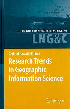
Research Trends in Geographic Information Science: Lecture Notes in Geoinformation and Cartography
Editat de Gerhard Navratilen Limba Engleză Hardback – 19 iun 2009
| Toate formatele și edițiile | Preț | Express |
|---|---|---|
| Paperback (1) | 944.51 lei 6-8 săpt. | |
| Springer Berlin, Heidelberg – 28 oct 2010 | 944.51 lei 6-8 săpt. | |
| Hardback (1) | 951.47 lei 6-8 săpt. | |
| Springer Berlin, Heidelberg – 19 iun 2009 | 951.47 lei 6-8 săpt. |
Din seria Lecture Notes in Geoinformation and Cartography
- 18%
 Preț: 1420.09 lei
 - 20%
 Preț: 569.74 lei
 - 18%
 Preț: 951.29 lei
 - 18%
 Preț: 963.15 lei
 - 18%
 Preț: 948.16 lei
 - 18%
 Preț: 1228.47 lei
 - 18%
 Preț: 956.33 lei
 - 18%
 Preț: 1251.82 lei
 - 18%
 Preț: 956.03 lei
 - 18%
 Preț: 1235.43 lei
 - 18%
 Preț: 940.87 lei
 - 18%
 Preț: 1845.48 lei
 - 15%
 Preț: 644.95 lei
 - 18%
 Preț: 945.79 lei
 - 18%
 Preț: 948.16 lei
 - 18%
 Preț: 1245.34 lei
 - 18%
 Preț: 961.23 lei
 - 18%
 Preț: 1239.49 lei
 - 18%
 Preț: 947.35 lei
 - 18%
 Preț: 957.62 lei
 - 5%
 Preț: 1104.48 lei
 - 18%
 Preț: 1232.26 lei
 - 18%
 Preț: 1420.09 lei
 - 18%
 Preț: 952.57 lei
 - 18%
 Preț: 959.36 lei
 - 18%
 Preț: 953.82 lei
 - 18%
 Preț: 953.20 lei
 - 18%
 Preț: 1233.06 lei
 - 18%
 Preț: 950.52 lei
 - 18%
 Preț: 947.35 lei
 - 18%
 Preț: 1234.62 lei
 - 20%
 Preț: 558.63 lei
 - 18%
 Preț: 957.62 lei
 - 18%
 Preț: 1226.73 lei
 - 18%
 Preț: 1233.69 lei
 - 18%
 Preț: 947.85 lei
 - 18%
 Preț: 952.09 lei
 - 18%
 Preț: 1242.03 lei
 - 18%
 Preț: 1550.30 lei
 - 18%
 Preț: 953.65 lei
Preț: 951.47 lei
Preț vechi: 1160.32 lei
-18% Nou
Puncte Express: 1427
Preț estimativ în valută:
182.09€ • 189.40$ • 150.32£
182.09€ • 189.40$ • 150.32£
Carte tipărită la comandă
Livrare economică 14-28 aprilie
Preluare comenzi: 021 569.72.76
Specificații
ISBN-13: 9783540882435
ISBN-10: 354088243X
Pagini: 296
Ilustrații: XII, 283 p.
Greutate: 0.62 kg
Ediția:2009
Editura: Springer Berlin, Heidelberg
Colecția Springer
Seria Lecture Notes in Geoinformation and Cartography
Locul publicării:Berlin, Heidelberg, Germany
ISBN-10: 354088243X
Pagini: 296
Ilustrații: XII, 283 p.
Greutate: 0.62 kg
Ediția:2009
Editura: Springer Berlin, Heidelberg
Colecția Springer
Seria Lecture Notes in Geoinformation and Cartography
Locul publicării:Berlin, Heidelberg, Germany
Public țintă
ResearchCuprins
Section I: Philosophical background and Semantics.- Ontology, Epistemology, Teleology: Triangulating Geographic Information Science.- Geonoemata Elicited: Concepts, Objects, and Other Uncertain Geographic Things.- Virtue Ethics for GIS Professionals.- Why Is Scale an Effective Descriptor for Data Quality? The Physical and Ontological Rationale for Imprecision and Level of Detail.- Semantic Engineering.- Section II: Mathematical Methods.- A Common Spatial Model for GIS.- Computation with Imprecise Probabilities.- Spatial Data Quality: Problems and Prospects.- Latent Analysis as a Potential Method for Integrating Spatial Data Concepts.- Stereology for Multitemporal Images with an Application to Flooding.- Modeling Spatiotemporal Paths for Single Moving Objects.- Moving Objects in Databases and GIS: State-of-the-Art and Open Problems.- The Degree Distribution of Random Planar Graphs.- Section III: Tools and Applications.- Geographical Information Engineering in the 21 Century.- Towards Visual Summaries of Geographic Databases Based on Chorems.- Intelligent Spatial Communication.- Training Games and GIS.- Cadastre and Economic Development.
Caracteristici
Gives an overview of the research topics in the fields of GIS and Applied Geosciences Includes supplementary material: sn.pub/extras
