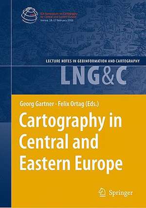
Cartography in Central and Eastern Europe: Selected Papers of the 1st ICA Symposium on Cartography for Central and Eastern Europe: Lecture Notes in Geoinformation and Cartography
Editat de Georg Gartner, Felix Ortagen Limba Engleză Hardback – 25 noi 2009
| Toate formatele și edițiile | Preț | Express |
|---|---|---|
| Paperback (1) | 1230.66 lei 6-8 săpt. | |
| Springer Berlin, Heidelberg – 14 mar 2012 | 1230.66 lei 6-8 săpt. | |
| Hardback (1) | 1235.43 lei 6-8 săpt. | |
| Springer Berlin, Heidelberg – 25 noi 2009 | 1235.43 lei 6-8 săpt. |
Din seria Lecture Notes in Geoinformation and Cartography
- 18%
 Preț: 1420.09 lei
 - 20%
 Preț: 569.74 lei
 - 18%
 Preț: 951.29 lei
 - 18%
 Preț: 963.15 lei
 - 18%
 Preț: 948.16 lei
 - 18%
 Preț: 951.47 lei
 - 18%
 Preț: 1228.47 lei
 - 18%
 Preț: 956.33 lei
 - 18%
 Preț: 1251.82 lei
 - 18%
 Preț: 956.03 lei
 - 18%
 Preț: 940.87 lei
 - 18%
 Preț: 1845.48 lei
 - 15%
 Preț: 644.95 lei
 - 18%
 Preț: 945.79 lei
 - 18%
 Preț: 948.16 lei
 - 18%
 Preț: 1245.34 lei
 - 18%
 Preț: 961.23 lei
 - 18%
 Preț: 1239.49 lei
 - 18%
 Preț: 947.35 lei
 - 18%
 Preț: 957.62 lei
 - 5%
 Preț: 1104.48 lei
 - 18%
 Preț: 1232.26 lei
 - 18%
 Preț: 1420.09 lei
 - 18%
 Preț: 952.57 lei
 - 18%
 Preț: 959.36 lei
 - 18%
 Preț: 953.82 lei
 - 18%
 Preț: 953.20 lei
 - 18%
 Preț: 1233.06 lei
 - 18%
 Preț: 950.52 lei
 - 18%
 Preț: 947.35 lei
 - 18%
 Preț: 1234.62 lei
 - 20%
 Preț: 558.63 lei
 - 18%
 Preț: 957.62 lei
 - 18%
 Preț: 1226.73 lei
 - 18%
 Preț: 1233.69 lei
 - 18%
 Preț: 947.85 lei
 - 18%
 Preț: 952.09 lei
 - 18%
 Preț: 1242.03 lei
 - 18%
 Preț: 1550.30 lei
 - 18%
 Preț: 953.65 lei
Preț: 1235.43 lei
Preț vechi: 1506.62 lei
-18% Nou
Puncte Express: 1853
Preț estimativ în valută:
236.43€ • 256.73$ • 198.60£
236.43€ • 256.73$ • 198.60£
Carte tipărită la comandă
Livrare economică 22 aprilie-06 mai
Preluare comenzi: 021 569.72.76
Specificații
ISBN-13: 9783642032936
ISBN-10: 3642032931
Pagini: 400
Ilustrații: XIX, 570 p. 236 illus.
Dimensiuni: 155 x 235 x 41 mm
Greutate: 0.95 kg
Ediția:2009
Editura: Springer Berlin, Heidelberg
Colecția Springer
Seria Lecture Notes in Geoinformation and Cartography
Locul publicării:Berlin, Heidelberg, Germany
ISBN-10: 3642032931
Pagini: 400
Ilustrații: XIX, 570 p. 236 illus.
Dimensiuni: 155 x 235 x 41 mm
Greutate: 0.95 kg
Ediția:2009
Editura: Springer Berlin, Heidelberg
Colecția Springer
Seria Lecture Notes in Geoinformation and Cartography
Locul publicării:Berlin, Heidelberg, Germany
Public țintă
ResearchCuprins
From Ortelius to OpenStreetMap #x2013; Transformation of the Map into a Multifunctional Signpost.- Topographic Mapping.- EuroRegionalMap #x2013; How to Succeed in Overcoming National Borders.- Methods of Portraying Spatial Data Used in Official Geoinformation Services in Poland #x2013; A Comparative Study.- Compilation of Digital Elevation Model for Turkey in 3-Arc-Second Resolution by Using SRTM Data Supported with Local Elevation Data.- Mapping Land Cover with Commercial and Freeware Image Classification Software #x2013; An Example from Bavaria, Germany.- New Approach to Multi Scale Cartographic Modelling of Reference and Thematic Databases in Poland.- Implementation of the INSPIRE-Directive in Germany and Poland #x2013; Legal Point of View.- Cartographic Modelling.- Automated Building Simplification Using a Recursive Approach.- Constraint-Based Evaluation of Automated and Manual Generalised Topographic Maps.- Cross-Border Mapping: Geodata, Geonames, Multilinguality and More.- XSLT Templates for Thematic Maps.- Geoinformational Methods in Ecodiagnostical Studies for the Losiny Ostrov National Park Territory.- Cartography and Graphic Design.- Various Ways of Assessment of Cartographic Works.- Multimedia Cartography.- Exploring Space: Applying Interactive Integrated Media for Visualising Geography.- The Art of Autostereoscopic Relief Representation in Cartography.- Approaches to Image Abstraction for Photorealistic Depictions of Virtual 3D Models.- Globes on the Web #x2013; Technical Background and First Items of the Virtual Globes Museum.- Mapping Crime Using Geovirtual Urban Environments.- A Survey of Mobile Indoor Navigation Systems.- Atlas Cartography.- Mapping Space-Related Transformation Processes in Eastern Europe. Examples from the Atlas of Eastern and Southeastern Europe.- The Demographic Atlas of Croatia #x2013; A Web-Based Atlas Information System.- Mapping and Analysing the Local Language Areas for Slovenian Linguistic Atlas.- Interactive and Multimedia Atlas Information Systems as a Cartographic Geo-Communication Platform.- Cartographic Applications.- Integration of Hightech Components for Operating Ragweed Mapping and Control System in Hungary Using Remote Sensing and GIS.- Detailed Mapping of Landslide Susceptibility for Urban Planning Purposes in Carpathian and Subcarpathian Towns of Romania.- Dynamic Cartographic Methods for Visualisation of Health Statistics.- A Multiresolution, Reference and Thematic Database as the NSDI Component in Poland #x2013; The Concept and Management Systems.- The Remote Sensing Based Hungarian Crop Production Forecast Program (Cropmon) and its Other Applications.- The Blind Mouse #x2013; A Game for Developing and Popularizing Cartographical Skills.- Historical Cartography.- Orientation of the Map of Lazarus (1528) of Hungary #x2013; Result of the Ptolemian Projection?.- History of the Hungarian Geological Maps #x2013; An Overview from the 18 Century to Nowadays.- Cartometric Analysis of Old Maps on the Example of Vogt#x2019;s Map.- Structural Lineaments Derived from Planforms of Watercourses in the Second Military Survey of the Habsburg Empire.- The Austro-Hungarian Triangulations in the Balkan Peninsula (1855#x2013;1875).- Maps of Czech Lands in the Period 1518#x2013;1720 from the Map Collection of Charles University in Prague.- The Dilemma for the History of Modern Maps Based on Neo-Cartographic Technologies.
Caracteristici
The rich and leading role of the region of Central and Eastern Europe in the domain of cartography is proven by contributions of various countries and background Includes supplementary material: sn.pub/extras
