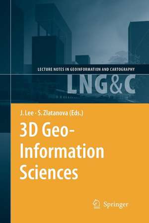
3D Geo-Information Sciences: Lecture Notes in Geoinformation and Cartography
Editat de Jiyeong Lee, Siyka Zlatanovaen Limba Engleză Paperback – 30 noi 2010
| Toate formatele și edițiile | Preț | Express |
|---|---|---|
| Paperback (1) | 952.09 lei 6-8 săpt. | |
| Springer Berlin, Heidelberg – 30 noi 2010 | 952.09 lei 6-8 săpt. | |
| Hardback (1) | 960.78 lei 6-8 săpt. | |
| Springer Berlin, Heidelberg – 4 noi 2008 | 960.78 lei 6-8 săpt. |
Din seria Lecture Notes in Geoinformation and Cartography
- 18%
 Preț: 1420.09 lei
 - 20%
 Preț: 569.73 lei
 - 18%
 Preț: 951.29 lei
 - 18%
 Preț: 963.15 lei
 - 18%
 Preț: 948.16 lei
 - 18%
 Preț: 951.47 lei
 - 18%
 Preț: 1228.47 lei
 - 18%
 Preț: 956.33 lei
 - 18%
 Preț: 1251.82 lei
 - 18%
 Preț: 956.03 lei
 - 18%
 Preț: 1235.43 lei
 - 18%
 Preț: 940.87 lei
 - 18%
 Preț: 1845.48 lei
 - 15%
 Preț: 644.95 lei
 - 18%
 Preț: 945.79 lei
 - 18%
 Preț: 948.16 lei
 - 18%
 Preț: 1245.34 lei
 - 18%
 Preț: 961.23 lei
 - 18%
 Preț: 1239.49 lei
 - 18%
 Preț: 947.35 lei
 - 18%
 Preț: 957.62 lei
 - 5%
 Preț: 1104.48 lei
 - 18%
 Preț: 1232.26 lei
 - 18%
 Preț: 1420.09 lei
 - 18%
 Preț: 952.57 lei
 - 18%
 Preț: 959.36 lei
 - 18%
 Preț: 953.82 lei
 - 18%
 Preț: 953.20 lei
 - 18%
 Preț: 1233.06 lei
 - 18%
 Preț: 950.52 lei
 - 18%
 Preț: 947.35 lei
 - 18%
 Preț: 1234.62 lei
 - 20%
 Preț: 558.62 lei
 - 18%
 Preț: 957.62 lei
 - 18%
 Preț: 1226.73 lei
 - 18%
 Preț: 1233.69 lei
 - 18%
 Preț: 947.85 lei
 - 18%
 Preț: 1242.03 lei
 - 18%
 Preț: 1550.30 lei
 - 18%
 Preț: 953.65 lei
Preț: 952.09 lei
Preț vechi: 1161.08 lei
-18% Nou
Puncte Express: 1428
Preț estimativ în valută:
182.19€ • 191.09$ • 151.66£
182.19€ • 191.09$ • 151.66£
Carte tipărită la comandă
Livrare economică 01-15 aprilie
Preluare comenzi: 021 569.72.76
Specificații
ISBN-13: 9783642099519
ISBN-10: 3642099513
Pagini: 456
Ilustrații: XVII, 435 p.
Dimensiuni: 155 x 235 x 24 mm
Greutate: 0.64 kg
Ediția:Softcover reprint of hardcover 1st ed. 2009
Editura: Springer Berlin, Heidelberg
Colecția Springer
Seria Lecture Notes in Geoinformation and Cartography
Locul publicării:Berlin, Heidelberg, Germany
Public țintă
ResearchCuprins
Keynotes.- A Virtual Geographic Environment for a Simulation of Air Pollution Dispersion in the Pearl River Delta (PRD) Region.- Representing and Exchanging 3D City Models with CityGML.- Research and Development Program for the Third National Geographic Information System Project in Korea: Korean Land Spatialization Program.- Papers.- Construction Operators for Modelling 3D Objects and Dual Navigation Structures.- A Multilayered Space-Event Model for Navigation in Indoor Spaces.- Towards Defining a Framework for Automatic Generation of Buildings in CityGML Using Building Information Models.- Managed Objects for Infrastructure Data.- Integrating Terrain Surface and Street Network for 3D Routing.- Using a B-Rep Structure to Query 9-Intersection Topological Relationships in 3D GIS – Reviewing the Approach and Improving Performance.- Query Processing in 3D Spatial Databases: Experiences with Oracle Spatial 11g.- Making Interoperability Persistent: A 3D Geo Database Based on CityGML.- Use of Finite Arithmetic in 3D Spatial Databases.- Automatic Digital Aerial Image Resection Controlled by LIDAR Data.- Automatic Surface Patch Generation from a Video Image Sequence.- Indoor 3D Modeling and Visualization with a 3D Terrestrial Laser Scanner.- Automatic Image Mosaic-Building Algorithm for Generating Facade Textures.- 3D Continuous K-NN Query for a Landmark-based Wayfinding Location-based Service.- 3D Geo-Network for Agent-based Building Evacuation Simulation.- Hierarchical Modelling of Multi-Geospatial Databases as Basis for Geo-Oriented 3D Analysis Capabilities.- Solar Radiation over the Urban Texture: LIDAR Data and Image Processing Techniques for Environmental Analysis at City Scale.- Creation and Error Analysis of High Resolution DEM Based on Source Data Sets of VariousAccuracy.- A Topological Analysis Method for 3D Geo-Entities Structured as Hexahedron Tessellations.- Constraint-based Generation and Visualization of 3D City Models.- GeoVEs as Tools to Communicate in Urban Projects: Requirements for Functionality and Visualization.- Producing 3D Applications for Urban Planning by Integrating 3D Scanned Building Data with Geo-spatial Data.- 3D Dynamic Simulation and Visualization for GIS-based Infiltration Excess Overland Flow Modelling.
Caracteristici
State-of-the-art methods, algorithms, models and systems with regard to the Third Dimension Includes supplementary material: sn.pub/extras
