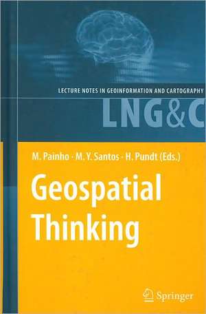
Geospatial Thinking: Lecture Notes in Geoinformation and Cartography
Editat de Marco Painho, Maribel Yasmina Santos, Hardy Pundten Limba Engleză Hardback – 15 apr 2010
| Toate formatele și edițiile | Preț | Express |
|---|---|---|
| Paperback (1) | 951.29 lei 6-8 săpt. | |
| Springer Berlin, Heidelberg – 28 mai 2012 | 951.29 lei 6-8 săpt. | |
| Hardback (1) | 956.33 lei 6-8 săpt. | |
| Springer Berlin, Heidelberg – 15 apr 2010 | 956.33 lei 6-8 săpt. |
Din seria Lecture Notes in Geoinformation and Cartography
- 18%
 Preț: 1420.09 lei
 - 20%
 Preț: 569.73 lei
 - 18%
 Preț: 951.29 lei
 - 18%
 Preț: 963.15 lei
 - 18%
 Preț: 948.16 lei
 - 18%
 Preț: 951.47 lei
 - 18%
 Preț: 1228.47 lei
 - 18%
 Preț: 1251.82 lei
 - 18%
 Preț: 956.03 lei
 - 18%
 Preț: 1235.43 lei
 - 18%
 Preț: 940.87 lei
 - 18%
 Preț: 1845.48 lei
 - 15%
 Preț: 644.95 lei
 - 18%
 Preț: 945.79 lei
 - 18%
 Preț: 948.16 lei
 - 18%
 Preț: 1245.34 lei
 - 18%
 Preț: 961.23 lei
 - 18%
 Preț: 1239.49 lei
 - 18%
 Preț: 947.35 lei
 - 18%
 Preț: 957.62 lei
 - 5%
 Preț: 1104.48 lei
 - 18%
 Preț: 1232.26 lei
 - 18%
 Preț: 1420.09 lei
 - 18%
 Preț: 952.57 lei
 - 18%
 Preț: 959.36 lei
 - 18%
 Preț: 953.82 lei
 - 18%
 Preț: 953.20 lei
 - 18%
 Preț: 1233.06 lei
 - 18%
 Preț: 950.52 lei
 - 18%
 Preț: 947.35 lei
 - 18%
 Preț: 1234.62 lei
 - 20%
 Preț: 558.62 lei
 - 18%
 Preț: 957.62 lei
 - 18%
 Preț: 1226.73 lei
 - 18%
 Preț: 1233.69 lei
 - 18%
 Preț: 947.85 lei
 - 18%
 Preț: 952.09 lei
 - 18%
 Preț: 1242.03 lei
 - 18%
 Preț: 1550.30 lei
 - 18%
 Preț: 953.65 lei
Preț: 956.33 lei
Preț vechi: 1166.26 lei
-18% Nou
Puncte Express: 1434
Preț estimativ în valută:
182.100€ • 191.94$ • 152.34£
182.100€ • 191.94$ • 152.34£
Carte tipărită la comandă
Livrare economică 01-15 aprilie
Preluare comenzi: 021 569.72.76
Specificații
ISBN-13: 9783642123252
ISBN-10: 3642123252
Pagini: 438
Ilustrații: XVIII, 418 p. 243 illus.
Dimensiuni: 155 x 235 x 28 mm
Greutate: 0.76 kg
Ediția:2010
Editura: Springer Berlin, Heidelberg
Colecția Springer
Seria Lecture Notes in Geoinformation and Cartography
Locul publicării:Berlin, Heidelberg, Germany
ISBN-10: 3642123252
Pagini: 438
Ilustrații: XVIII, 418 p. 243 illus.
Dimensiuni: 155 x 235 x 28 mm
Greutate: 0.76 kg
Ediția:2010
Editura: Springer Berlin, Heidelberg
Colecția Springer
Seria Lecture Notes in Geoinformation and Cartography
Locul publicării:Berlin, Heidelberg, Germany
Public țintă
ResearchCuprins
Intersection of Nonconvex Polygons Using the Alternate Hierarchical Decomposition.- Visual Analytics of Urban Environments using High-Resolution Geographic Data.- A Visual Query Language for Spatial Data Warehouses.- The Impact of Data Quality in the Context of Pedestrian Movement Analysis.- Visit Potential: A Common Vocabulary for the Analysis of Entity-Location Interactions in Mobility Applications.- Pre-School Facilities and Catchment Area Profiling: a Planning Support Method.- A Geo-business Classification for London.- Suggestive Geo-Tagging Assistance for Geo-Collaboration Tools.- A Novel Approach to Mining Travel Sequences Using Collections of Geotagged Photos.- Exposing CSW Catalogues as Linked Data.- Applying Semantic Linkage in the Geospatial Web.- A Machine Learning Approach for Resolving Place References in Text.- Towards a Spatial Semantics to Analyze the Visual Dynamics of the Pedestrian Mobility in the Urban Fabric.- Managing Collapsed Surfaces in Spatial Constraints Validation.- A Spatio-Temporal Model Towards Ad-Hoc Collaborative Decision-Making.- iNav: An Indoor Navigation Model Supporting Length-Dependent Optimal Routing.- MIMEXT: a KML Extension for Georeferencing and Easy Share MIME Type Resources.- Schema Mapping in INSPIRE - Extensible Components for Translating Geospatial Data.- Automated Image-Based Abstraction of Aerial Images.- Geospatial Annotations for 3D Environments and their WFS-based Implementation.- Towards Spatial Data Infrastructures in the Clouds.
Caracteristici
A state-of-the-art overview of ongoing GIScience research Brings together insights and ideas in the field of GIS Covers a variety of research topics such as geospatial modelling and analysis, quality and semantics of geoinformation, spatial data infrastructures, and spatial decision support systems Includes supplementary material: sn.pub/extras
