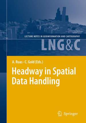
Headway in Spatial Data Handling: 13th International Symposium on Spatial Data Handling: Lecture Notes in Geoinformation and Cartography
Editat de Anne Ruas, Christopher Golden Limba Engleză Hardback – 16 iun 2008
| Toate formatele și edițiile | Preț | Express |
|---|---|---|
| Paperback (1) | 1833.33 lei 6-8 săpt. | |
| Springer Berlin, Heidelberg – 25 noi 2010 | 1833.33 lei 6-8 săpt. | |
| Hardback (1) | 1845.48 lei 6-8 săpt. | |
| Springer Berlin, Heidelberg – 16 iun 2008 | 1845.48 lei 6-8 săpt. |
Din seria Lecture Notes in Geoinformation and Cartography
- 18%
 Preț: 1420.09 lei
 - 20%
 Preț: 569.74 lei
 - 18%
 Preț: 951.29 lei
 - 18%
 Preț: 963.15 lei
 - 18%
 Preț: 948.16 lei
 - 18%
 Preț: 951.47 lei
 - 18%
 Preț: 1228.47 lei
 - 18%
 Preț: 956.33 lei
 - 18%
 Preț: 1251.82 lei
 - 18%
 Preț: 956.03 lei
 - 18%
 Preț: 1235.43 lei
 - 18%
 Preț: 940.87 lei
 - 15%
 Preț: 644.95 lei
 - 18%
 Preț: 945.79 lei
 - 18%
 Preț: 948.16 lei
 - 18%
 Preț: 1245.34 lei
 - 18%
 Preț: 961.23 lei
 - 18%
 Preț: 1239.49 lei
 - 18%
 Preț: 947.35 lei
 - 18%
 Preț: 957.62 lei
 - 5%
 Preț: 1104.48 lei
 - 18%
 Preț: 1232.26 lei
 - 18%
 Preț: 1420.09 lei
 - 18%
 Preț: 952.57 lei
 - 18%
 Preț: 959.36 lei
 - 18%
 Preț: 953.82 lei
 - 18%
 Preț: 953.20 lei
 - 18%
 Preț: 1233.06 lei
 - 18%
 Preț: 950.52 lei
 - 18%
 Preț: 947.35 lei
 - 18%
 Preț: 1234.62 lei
 - 20%
 Preț: 558.63 lei
 - 18%
 Preț: 957.62 lei
 - 18%
 Preț: 1226.73 lei
 - 18%
 Preț: 1233.69 lei
 - 18%
 Preț: 947.85 lei
 - 18%
 Preț: 952.09 lei
 - 18%
 Preț: 1242.03 lei
 - 18%
 Preț: 1550.30 lei
 - 18%
 Preț: 953.65 lei
Preț: 1845.48 lei
Preț vechi: 2250.58 lei
-18% Nou
Puncte Express: 2768
Preț estimativ în valută:
353.17€ • 383.50$ • 296.67£
353.17€ • 383.50$ • 296.67£
Carte tipărită la comandă
Livrare economică 22 aprilie-06 mai
Preluare comenzi: 021 569.72.76
Specificații
ISBN-13: 9783540685654
ISBN-10: 3540685650
Pagini: 668
Ilustrații: XV, 650 p.
Dimensiuni: 155 x 235 x 41 mm
Greutate: 1.27 kg
Ediția:2008
Editura: Springer Berlin, Heidelberg
Colecția Springer
Seria Lecture Notes in Geoinformation and Cartography
Locul publicării:Berlin, Heidelberg, Germany
ISBN-10: 3540685650
Pagini: 668
Ilustrații: XV, 650 p.
Dimensiuni: 155 x 235 x 41 mm
Greutate: 1.27 kg
Ediția:2008
Editura: Springer Berlin, Heidelberg
Colecția Springer
Seria Lecture Notes in Geoinformation and Cartography
Locul publicării:Berlin, Heidelberg, Germany
Public țintă
ResearchCuprins
A Study on how Humans Describe Relative Positions of Image Objects.- Perceptual Sketch Interpretation.- The Shape Cognition and Query Supported by Fourier Transform.- Classification of Landslide Susceptibility in the Development of Early Warning Systems.- Clusters in Aggregated Health Data.- Spatial Simulation of Agricultural Practices using a Robust Extension of Randomized Classification Tree Algorithms.- Impact of a Change of Support on the Assessment of Biodiversity with Shannon Entropy.- Implicit Spatial Information Extraction from Remote Sensing Images.- The Application of the Concept of Indicative Neighbourhood on Landsat ETM + Images and Orthophotos Using Circular and Annulus Kernels.- Sensitivity of the C-band SRTM DEM Vertical Accuracy to Terrain Characteristics and Spatial Resolution.- Improving the Reusability of Spatiotemporal Simulation Models: Using MDE to Implement Cellular Automata.- Support Vector Machines for Spatiotemporal Analysis in Geosensor Networks.- Toward a Method to Generally Describe Physical Spatial Processes.- A Data Model for Multi-scale Topographical Data.- An Interoperable Web Service Architecture to Provide Base Maps Empowered by Automated Generalisation.- Combining Three Multi-agent Based Generalisation Models: AGENT, CartACom and GAEL.- Implementation of Building Reconstruction Algorithm Using Real World LIDAR Data.- A New Approach for Mountain Areas Cartography.- Slope Accuracy and Path Planning on Compressed Terrain.- Processing 3D Geo-Information for Augmenting Georeferenced and Oriented Photographs with Text Labels.- Interactive Geovisualization and Geometric Modelling of 3D Data - A Case Study from the Åknes Rockslide Site, Norway.- FieldGML: An Alternative Representation For Fields.- Marine GIS: Progress in 3D Visualization forDynamic GIS.- The IGN-E Case: Integrating Through a Hidden Ontology.- All Roads Lead to Rome – Geospatial Modeling of Hungarian Street Names with Destination Reference.- Where is the Terraced House? On the Use of Ontologies for Recognition of Urban Concepts in Cartographic Databases.- Information Processes Produce Imperfections in Data—The Information Infrastructure Compensates for Them.- Moving from Pixels to Parcels: the Use of Possibility Theory to Explore the Uncertainty Associated object Oriented Remote Sensing.- Data Matching – a Matter of Belief.- Deriving Topological Relationships Between Simple Regions with Holes.- Spatial Rules Generate Urban Patterns: Emergence of the Small-World Network.- Conceptual Neighborhoods of Topological Relations Between Lines.- Spatial Support and Spatial Confidence for Spatial Association Rules.- A Primer of Picture-Aided Navigation in Mobile Systems.- Road Network Model for Vehicle Navigation using Traffic Direction Approach.- Clustering Algorithm for Network Constraint Trajectories.
Caracteristici
High level and current research work in GIS Includes supplementary material: sn.pub/extras
