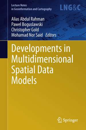
Developments in Multidimensional Spatial Data Models: Lecture Notes in Geoinformation and Cartography
Editat de Alias Abdul Rahman, Pawel Boguslawski, Christopher Gold, Mohamad Nor Saiden Limba Engleză Hardback – 8 mai 2013
| Toate formatele și edițiile | Preț | Express |
|---|---|---|
| Paperback (1) | 638.57 lei 6-8 săpt. | |
| Springer Berlin, Heidelberg – 23 aug 2016 | 638.57 lei 6-8 săpt. | |
| Hardback (1) | 644.82 lei 6-8 săpt. | |
| Springer Berlin, Heidelberg – 8 mai 2013 | 644.82 lei 6-8 săpt. |
Din seria Lecture Notes in Geoinformation and Cartography
- 18%
 Preț: 1420.09 lei
 - 20%
 Preț: 569.74 lei
 - 18%
 Preț: 951.29 lei
 - 18%
 Preț: 963.15 lei
 - 18%
 Preț: 948.16 lei
 - 18%
 Preț: 951.47 lei
 - 18%
 Preț: 1228.47 lei
 - 18%
 Preț: 956.33 lei
 - 18%
 Preț: 1251.82 lei
 - 18%
 Preț: 956.03 lei
 - 18%
 Preț: 1235.43 lei
 - 18%
 Preț: 940.87 lei
 - 18%
 Preț: 1845.48 lei
 - 15%
 Preț: 644.95 lei
 - 18%
 Preț: 945.79 lei
 - 18%
 Preț: 948.16 lei
 - 18%
 Preț: 1245.34 lei
 - 18%
 Preț: 961.23 lei
 - 18%
 Preț: 1239.49 lei
 - 18%
 Preț: 947.35 lei
 - 18%
 Preț: 957.62 lei
 - 5%
 Preț: 1104.48 lei
 - 18%
 Preț: 1232.26 lei
 - 18%
 Preț: 1420.09 lei
 - 18%
 Preț: 952.57 lei
 - 18%
 Preț: 959.36 lei
 - 18%
 Preț: 953.82 lei
 - 18%
 Preț: 953.20 lei
 - 18%
 Preț: 1233.06 lei
 - 18%
 Preț: 950.52 lei
 - 18%
 Preț: 947.35 lei
 - 18%
 Preț: 1234.62 lei
 - 20%
 Preț: 558.63 lei
 - 18%
 Preț: 957.62 lei
 - 18%
 Preț: 1226.73 lei
 - 18%
 Preț: 1233.69 lei
 - 18%
 Preț: 947.85 lei
 - 18%
 Preț: 952.09 lei
 - 18%
 Preț: 1242.03 lei
 - 18%
 Preț: 1550.30 lei
 - 18%
 Preț: 953.65 lei
Preț: 644.82 lei
Preț vechi: 758.60 lei
-15% Nou
Puncte Express: 967
Preț estimativ în valută:
123.39€ • 131.94$ • 102.88£
123.39€ • 131.94$ • 102.88£
Carte tipărită la comandă
Livrare economică 18 aprilie-02 mai
Preluare comenzi: 021 569.72.76
Specificații
ISBN-13: 9783642363788
ISBN-10: 3642363784
Pagini: 260
Ilustrații: X, 249 p. 161 illus., 132 illus. in color.
Dimensiuni: 155 x 235 x 20 mm
Greutate: 0.54 kg
Ediția:2013
Editura: Springer Berlin, Heidelberg
Colecția Springer
Seria Lecture Notes in Geoinformation and Cartography
Locul publicării:Berlin, Heidelberg, Germany
Public țintă
ResearchCuprins
From the Contents: Medial Axis Approximation of River Networks for Catchment Area Delineation.- Representing the Dual of Objects in a Four‐Dimensional GIS.- Calibration and Accuracy Assessment of Leica ScanStation C10 Terrestrial Laser Scanner.- A Methodology for Processing Raw LIDAR Data to Support Urban Flood Modelling Frameworks.- Potential of Multiscale Texture Polarization Ratio of C‐band SAR for Forest Biomass Estimation.- Reliability of a High Accuracy Image‐Based System for 3D Modelling of the Medial Longitudinal Arch During Gait.
Textul de pe ultima copertă
This book presents the latest research developments in geoinformation science, which includes all the sub-disciplines of the subject, such as: geomatic engineering, GIS, remote sensing, digital photogrammetry, digital cartography, etc.
Caracteristici
Multidisciplinary approach Cutting-edge research results on the subject The research covered is a valuable springboard for new ideas Includes supplementary material: sn.pub/extras
