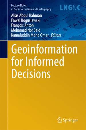
Geoinformation for Informed Decisions: Lecture Notes in Geoinformation and Cartography
Editat de Alias Abdul Rahman, Pawel Boguslawski, François Anton, Mohamad Nor Said, Kamaludin Mohd Omaren Limba Engleză Hardback – 24 mar 2014
| Toate formatele și edițiile | Preț | Express |
|---|---|---|
| Paperback (1) | 638.43 lei 43-57 zile | |
| Springer International Publishing – 23 aug 2016 | 638.43 lei 43-57 zile | |
| Hardback (1) | 565.64 lei 38-44 zile | |
| Springer International Publishing – 24 mar 2014 | 565.64 lei 38-44 zile |
Din seria Lecture Notes in Geoinformation and Cartography
- 18%
 Preț: 1420.09 lei
 - 20%
 Preț: 569.74 lei
 - 18%
 Preț: 951.29 lei
 - 18%
 Preț: 963.15 lei
 - 18%
 Preț: 948.16 lei
 - 18%
 Preț: 951.47 lei
 - 18%
 Preț: 1228.47 lei
 - 18%
 Preț: 956.33 lei
 - 18%
 Preț: 1251.82 lei
 - 18%
 Preț: 956.03 lei
 - 18%
 Preț: 1235.43 lei
 - 18%
 Preț: 940.87 lei
 - 18%
 Preț: 1845.48 lei
 - 15%
 Preț: 644.95 lei
 - 18%
 Preț: 945.79 lei
 - 18%
 Preț: 948.16 lei
 - 18%
 Preț: 1245.34 lei
 - 18%
 Preț: 961.23 lei
 - 18%
 Preț: 1239.49 lei
 - 18%
 Preț: 947.35 lei
 - 18%
 Preț: 957.62 lei
 - 5%
 Preț: 1104.48 lei
 - 18%
 Preț: 1232.26 lei
 - 18%
 Preț: 1420.09 lei
 - 18%
 Preț: 952.57 lei
 - 18%
 Preț: 959.36 lei
 - 18%
 Preț: 953.82 lei
 - 18%
 Preț: 953.20 lei
 - 18%
 Preț: 1233.06 lei
 - 18%
 Preț: 950.52 lei
 - 18%
 Preț: 947.35 lei
 - 18%
 Preț: 1234.62 lei
 - 20%
 Preț: 558.63 lei
 - 18%
 Preț: 957.62 lei
 - 18%
 Preț: 1226.73 lei
 - 18%
 Preț: 1233.69 lei
 - 18%
 Preț: 947.85 lei
 - 18%
 Preț: 952.09 lei
 - 18%
 Preț: 1242.03 lei
 - 18%
 Preț: 1550.30 lei
 - 18%
 Preț: 953.65 lei
Preț: 565.64 lei
Preț vechi: 707.05 lei
-20% Nou
Puncte Express: 848
Preț estimativ în valută:
108.27€ • 117.64$ • 91.01£
108.27€ • 117.64$ • 91.01£
Carte tipărită la comandă
Livrare economică 16-22 aprilie
Preluare comenzi: 021 569.72.76
Specificații
ISBN-13: 9783319036434
ISBN-10: 3319036432
Pagini: 300
Ilustrații: XII, 242 p. 147 illus., 122 illus. in color.
Dimensiuni: 155 x 235 x 20 mm
Greutate: 0.5 kg
Ediția:2014
Editura: Springer International Publishing
Colecția Springer
Seria Lecture Notes in Geoinformation and Cartography
Locul publicării:Cham, Switzerland
ISBN-10: 3319036432
Pagini: 300
Ilustrații: XII, 242 p. 147 illus., 122 illus. in color.
Dimensiuni: 155 x 235 x 20 mm
Greutate: 0.5 kg
Ediția:2014
Editura: Springer International Publishing
Colecția Springer
Seria Lecture Notes in Geoinformation and Cartography
Locul publicării:Cham, Switzerland
Public țintă
ResearchCuprins
From the Contents: The interoperable Building Model of the European Union.- Object Oriented Multispectral Images Segmentation and Classification.- Reverse RTK Data Streaming for Low-Cost Landslide Monitoring.- An Alternative Technique for Landslide Inventory Modeling based on Spatial Pattern Characterization.- Development of A New D16 Algorithm for Single Flow Direction Model.
Textul de pe ultima copertă
This book presents the latest research developments in geoinformation science, which includes all the sub-disciplines of the field, such as: geomatic engineering, GIS, remote sensing, digital photogrammetry, digital cartography, etc.
Caracteristici
The recent findings presented in the book will benefit all researchers in the field Presents cutting-edge findings in different sub-fields Identifies potential new research directions Includes supplementary material: sn.pub/extras
