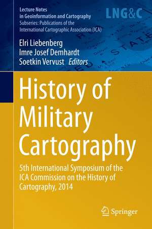
History of Military Cartography: 5th International Symposium of the ICA Commission on the History of Cartography, 2014: Lecture Notes in Geoinformation and Cartography
Editat de Elri Liebenberg, Imre Josef Demhardt, Soetkin Vervusten Limba Engleză Hardback – 29 ian 2016
| Toate formatele și edițiile | Preț | Express |
|---|---|---|
| Paperback (1) | 1656.71 lei 6-8 săpt. | |
| Springer International Publishing – 30 mar 2018 | 1656.71 lei 6-8 săpt. | |
| Hardback (1) | 1662.85 lei 6-8 săpt. | |
| Springer International Publishing – 29 ian 2016 | 1662.85 lei 6-8 săpt. |
Din seria Lecture Notes in Geoinformation and Cartography
- 18%
 Preț: 1420.09 lei
 - 20%
 Preț: 569.74 lei
 - 18%
 Preț: 951.29 lei
 - 18%
 Preț: 963.15 lei
 - 18%
 Preț: 948.16 lei
 - 18%
 Preț: 951.47 lei
 - 18%
 Preț: 1228.47 lei
 - 18%
 Preț: 956.33 lei
 - 18%
 Preț: 1251.82 lei
 - 18%
 Preț: 956.03 lei
 - 18%
 Preț: 1235.43 lei
 - 18%
 Preț: 940.87 lei
 - 18%
 Preț: 1845.48 lei
 - 15%
 Preț: 644.95 lei
 - 18%
 Preț: 945.79 lei
 - 18%
 Preț: 948.16 lei
 - 18%
 Preț: 1245.34 lei
 - 18%
 Preț: 961.23 lei
 - 18%
 Preț: 1239.49 lei
 - 18%
 Preț: 947.35 lei
 - 18%
 Preț: 957.62 lei
 - 5%
 Preț: 1104.48 lei
 - 18%
 Preț: 1232.26 lei
 - 18%
 Preț: 1420.09 lei
 - 18%
 Preț: 952.57 lei
 - 18%
 Preț: 959.36 lei
 - 18%
 Preț: 953.82 lei
 - 18%
 Preț: 953.20 lei
 - 18%
 Preț: 1233.06 lei
 - 18%
 Preț: 950.52 lei
 - 18%
 Preț: 947.35 lei
 - 18%
 Preț: 1234.62 lei
 - 20%
 Preț: 558.63 lei
 - 18%
 Preț: 957.62 lei
 - 18%
 Preț: 1226.73 lei
 - 18%
 Preț: 1233.69 lei
 - 18%
 Preț: 947.85 lei
 - 18%
 Preț: 952.09 lei
 - 18%
 Preț: 1242.03 lei
 - 18%
 Preț: 1550.30 lei
 - 18%
 Preț: 953.65 lei
Preț: 1662.85 lei
Preț vechi: 2027.88 lei
-18% Nou
Puncte Express: 2494
Preț estimativ în valută:
318.23€ • 331.01$ • 262.71£
318.23€ • 331.01$ • 262.71£
Carte tipărită la comandă
Livrare economică 12-26 aprilie
Preluare comenzi: 021 569.72.76
Specificații
ISBN-13: 9783319252421
ISBN-10: 3319252429
Pagini: 222
Ilustrații: XI, 375 p. 165 illus.
Dimensiuni: 155 x 235 x 22 mm
Greutate: 0.72 kg
Ediția:1st ed. 2016
Editura: Springer International Publishing
Colecția Springer
Seriile Lecture Notes in Geoinformation and Cartography, Publications of the International Cartographic Association (ICA)
Locul publicării:Cham, Switzerland
Public țintă
ResearchTextul de pe ultima copertă
This volume gathers 19 papers first presented at the 5th International Symposium of the ICA Commission on the History of Cartography, which took place at the University of Ghent, Belgium on 2-5 December 2014. The overall conference theme was 'Cartography in Times of War and Peace', but preference was given to papers dealing with the military cartography of the First World War (1914-1918). The papers are classified by period and regional sub-theme, i.e. Military Cartography from the 18th to the 20th century; WW I Cartography in Belgium, Central Europe, etc.
Caracteristici
Presenting information previously unavailable on military cartography from the 18th to the 20th century Reporting on research projects in the history of cartography at tertiary institutions worldwide An important aid to educationalists teaching the development of geographical information science Includes supplementary material: sn.pub/extras
